Thursday, June 9, 2011

Driving and Hiking the Columbia River Gorge: Lovely Latourell Falls

I’m a firm believer in Heaven on earth and that it’s unique for everyone. My version of Heaven varies, but today it’s the lush, verdant Columbia River Gorge just east of Portland, Oregon, and its many dramatic waterfalls. Take a hike there above Latourell Falls on a late spring/early summer day when Cascade snowmelt peaks and I bet you’d agree.

Probably it’s my slice of Heaven because I grew up on the Gorge’s western edge and roamed there frequently as a girl. But a drive along the Historic Columbia River Highway and a hike in this misty land of green forests, moss-covered basalt cliffs, and streaming water always leaves me refreshed. Call me Gorge Girl.

The Drive
Like a homing pigeon, on a recent weekend I drive south up the more narrow but still lush Sandy River Gorge from Troutdale, then angle northeast up along bucolic fields through Springdale and Corbett, and past Chanticleer Point (where everyone must stop for the magnificent view upriver) to catch the old highway east.

I always watch carefully for roadside deals at the small farms along the road up to Corbett. Today I grab an extravagant bouquet of plump purple lilacs for only $5, less than half the cost you’d pay at farmer’s markets in Seattle or Portland.

After driving cautiously down the first narrow switchbacks of the old highway around a few blind turns, I stop briefly at the Crown Point Vista House perched 733 feet above the Columbia on a massive basalt outcrop. This lovely, German-style Art Nouveau stone structure dates from the early days of the highway as a rest stop/viewpoint (it opened in 1918), and it still draws many visitors for the same reason.

The Hike
Sure, there are longer and more challenging hikes in the Gorge, but 224-foot Latourell Falls, the first waterfall along the highway east past Crown Point, is a beautiful introduction to the Gorge trails. At a little over 2 miles, with ups and downs totaling close to 1,000 feet in elevation gain/loss, it’s a decent workout.

I start out at the trailhead just east of the bridge over Latourell Creek in Guy W. Talbot Park. It’s a short hike up a paved trail to a nice viewpoint of the waterfall, but continue up the dirt trail to the left.


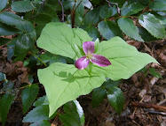
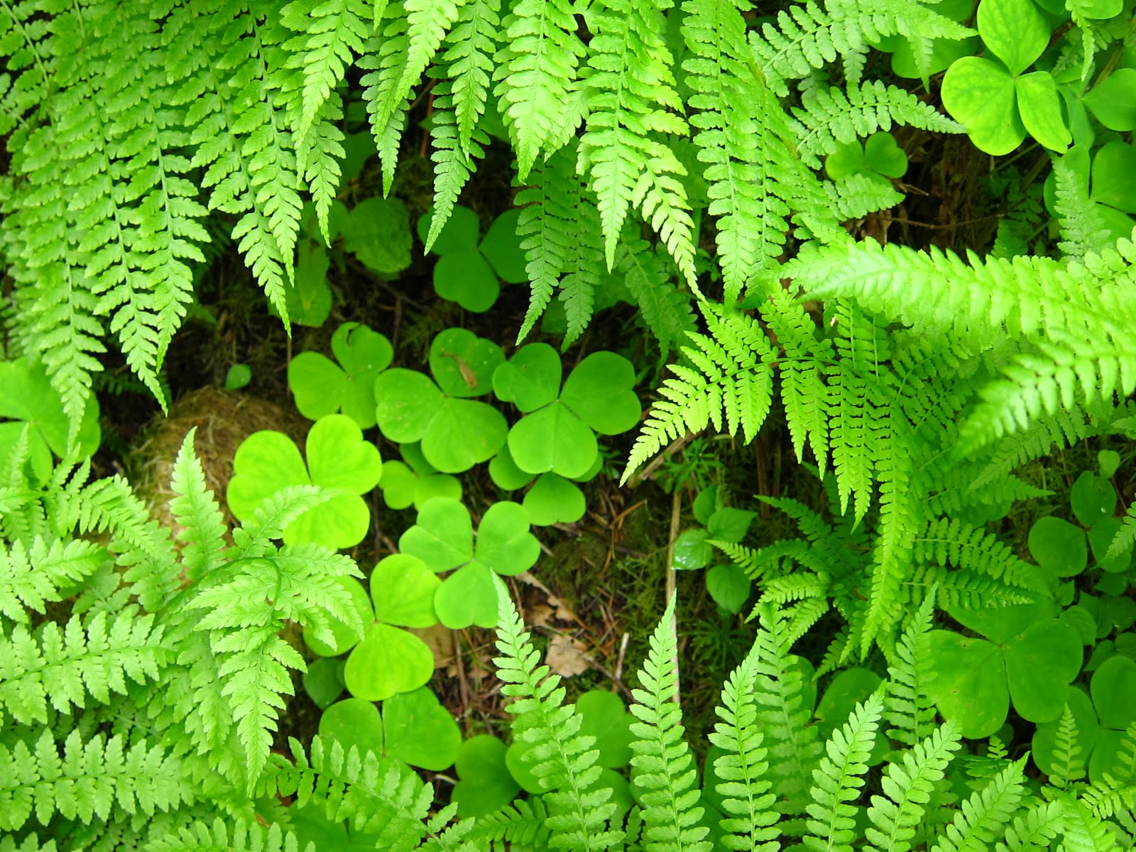
The trail rises gently and switchbacks up through the dense mixed deciduous-evergreen forest, passing a profusion of moisture-loving plants like maidenhair ferns, trilliums, wood sorrel, and bleeding hearts. Numerous species of native plants unique to the Gorge are not found anywhere else in the world.


Within a half mile or more the trail tops out and then drops down a bit to Latourell Creek above the falls. Today the falls and stream are rushing thick and fast with springtime abundance. I continue on, passing over a few small footbridges over side streams until I hear the roar and feel the mist of Upper Latourell Falls before I see it.


Upper Latourell Falls is almost as dramatic as the lower fall, and hikers can get closer to the base of the falls on another wooden bridge. The columnar basalt is strikingly visible here in angled vertical columns of dark wet rock. As a girl I strayed beyond the bridge closer to the base of the waterfalls, but with slick rocks, it’s not really a good idea.


Since I’m running late to meet friends, I need to pick up the pace on the way back. As I pass above the lower waterfall, in haste I miss a junction and end up at a narrow finger of rock that lies not far above where the waterfall plunges over 200 feet to the creek below. This spot is crossed by a cable to keep people away, but today the cable is lying on the ground and easy to miss. When I get close to the edge and realize where I am, vertigo hits and I have to step back. Be very careful up here! But the view is good up the Columbia River.


As the trail leaves the creek and waterfalls and travels west a bit before dropping back to the highway, the forest understory becomes a bit drier and has less of a rainforest feel. Here in the Gorge you pass through several microclimates, depending on how close you are to a waterfall.

I reach the highway and walk across the historic Latourell Creek bridge back to my car, although the trail continues down below the bridge along the creek far below. As usual after hiking in the Gorge I feel energized and especially alive despite the sweat-inducing exercise. There’s just something magical about the abundant and thriving plant life and coursing streams here. Like I said, it's heavenly.

When You Go
Right now is a great time to go drive, bicycle, or hike past the waterfalls since there’s so much water in our streams and rivers this year. Here’s a map of the western Gorge waterfalls. There isn’t a sign indicating the hike distance at the trailhead where I started, so I couldn’t remember if I would be hiking for a mile or two or more. I recommend sturdy trail shoes since the trail is pretty rocky and damp in places. You can also get to Latourell and the other waterfalls more quickly off Interstate 84 along the Columbia River.

Thursday, June 2, 2011

Hiking to Heather Lake: Early Season, Late Snow

Yes, I know that hiking to an alpine lake in late spring/early summer after a record-breaking snow season is a bit risky. But I’m ready to stray beyond lowland foothills hikes. I can’t resist.

“How about hiking to Heather Lake?” I suggest. “It’s at only 2,500 feet and the freezing level hasn’t gone below 4,000 feet in the last week.” This isn’t the best logic, but it works. My friend Julie is game.

So we drive up north on I-5 from Seattle to Marysville, then head east, taking the Mountain Loop Highway to the trailhead near the base of Mount Pilchuck. We’re not alone. Northwest hikers eager to get out in the mountains have jammed the small parking area and their vehicles spill over onto the roadside. (Heather Lake is a very popular hike, but with the road to the Pilchuck trailhead still closed due to snow, it's especially busy this early in the season.)

After throwing on light jackets and packs, we start on up the trail, immediately heading into thick second-growth forest. The grade isn’t too steep, but with our damp weather lately, the trail is pretty muddy and wet in places. In a few spots it’s literally just a stream crossing. But nothing too intense, and with waterproofed hiking boots our feet don’t get wet.


I’m glad I wore decent boots because the trail is also pretty rocky in some spots. I’m amazed (but not surprised) that I see hikers out in short shorts and flimsy sneakers, especially since I read that the trail is still snow-covered for the last half mile. But everyone happily treks away, regardless of insufficient gear and attire.

Along the trail and slopes are stumps of the behemoth old-growth cedar trees that once graced this area. A mile or so up the trail, we pass through a grove of some big trees that somehow managed to survive the rampant logging. I just have to give one a hug. (Yes, I'm a tree hugger.)


Sure enough, we start hitting snow about a quarter mile below the lake, and it gets pretty deep pretty quickly. Actually the compacted snow is easy to hike on (albeit a little slippery) and the trail is well marked with footprints. Although the real trail might not be exactly where the footprints go, they lead to the still mostly snow-covered lake.


Heather Lake lies tucked in a glacial cirque a couple thousand feet directly below the summit of Mount Pilchuck, stunning in its dramatic setting. Steep rocky cliffs rise abruptly above the lake, which of course today is not so much a lake as a snowfield with a few small openings.


We find a big rock and a snowless tree well beside the lake to sit and grab lunch. A few tree wells back we passed a group of guys cooking up a great smelling lunch. “Hey got any leftovers?” I tease them as we walk past.

I get chilled after sitting and munching lunch for about 15 minutes. Out come a shell, wool beanie, and gloves out of my fanny pack. I wonder how those who wore shorts and sneakers are faring.

We got a fairly late start (about 12:30) so I’m surprised by how many people we pass on the way down who are just making their way up the trail. But this time of year it doesn’t get dark until about 9 p.m. We’re back at the car a little before 4, after about 3 hours hiking this 4+-mile trip. But not before I snapped more shots of some of the lush, lovely native greenery along the trail.

When You Go
Here’s a map and directions to Heather Lake, which is about an hour drive from Seattle. Be sure and register and pay the $5 user fee at the station beside the bathroom. (We didn’t see it until we got back to the car.) You also need to have a Northwest Forest Pass in your vehicle.

Wednesday, May 25, 2011

Bicycling Portlandia: Looping around the Willamette River

"Don’t forget to bring your bicycle!” my friend Matt calls to remind me as I’m leaving Seattle for the drive to Portland.

Got it. Bicycle, helmet, and clothes are already stashed in my car.

Four hours later I’m bicycling through soft spring air along the Willamette River in Portland during the tail end of evening rush hour, grateful to be out of the car and moving my legs. After battling Friday afternoon traffic on I-5, this is the perfect way to end the day (or start the evening).

Portland, Oregon, was once again recently named the most bicycle-friendly city in the U.S.A., but this and other such kudos are no surprise to locals. Portland has been the most progressive city on the Left Coast since the 1970s, when it started converting old railroad beds and tearing up downtown streets for the first MAX light rail line.
Portland also boasts the highest percentage of bicycle commuters in the nation.

But I’m not thinking of all that on my early evening ride. On the first (first!) day of the year when the temperature rises above 70 ° F, I’m just thrilled to be pedaling sans jacket in my bicycle capris and a short-sleeved shirt (and, of course, a helmet).

From the Goose Hollow/Stadium District just above downtown Portland where I’m staying, it’s an easy ride about a dozen blocks down to the river. With the city criss-crossed by street car and light rail lines, vehicle traffic in downtown Portland is considerably lighter than in downtown Seattle and many other big cities.

It feels great to stretch my legs and cruise through the city streets down to the Vera Katz Esplanade. This wide trail loops over a few bridges and along the Willamette River for 1.5 miles in downtown Portland. It’s not a long ride, but getting to the esplanade and back adds distance and exercise. And who says you can’t loop around several times?

I wasn’t paying close attention to Matt’s directions to the trail, so I end up bicycling east across the Morrison Bridge instead of the Hawthorne Bridge. But look at that wide bicycle lane!


Just across the river I take the spiral bicycle off-ramp down to the esplanade along the riverfront. Then I bicycle north, sharing the trail with skaters, roller bladers, walkers, and other bicyclists. To my left, a few motorboats pass by on the river.


Despite traffic on the adjacent highway, it still feels peaceful and relaxed along the trail. Traveling by nonmotorized transportation on a designated trail has a way of dialing down the stress level, even if you’re pushing for a good workout. How often do you hear about bicycle rage versus road rage? I suppose it happens, but I’d bet not much. [Since I originally posted this, a friend sent me a link to a column about bicycle rage in Portland! So I stand corrected, it does happen more than you'd think! But not on bicycle trails so much.]

How many times have you bicycled on a floating trail? On the east side of the river, just north of the Morrison Bridge, the trail drops down for a stretch onto a floating dock, bringing me closer to the river.


At the northern edge of the esplanade, the trail crosses historic Steel Bridge, the world’s only double-layered drawbridge. Railroad tracks sit just about the trail on the lower level, and beyond the bridge I see the Broadway and Fremont Bridges to the north. Portland is, after all, a city of unique and historic bridges.


Along the west side of the river, skirting downtown, I slow down along the trail as it passes through Tom McCall Waterfront Park, where pedestrian traffic is heavier. (Sidebar: A solo Governor McCall approached me and shook my hand when I was a girl because he noticed me wearing a “Keep McCall” campaign button—courtesy of my father. He was a tall, friendly man!)

After wending my way along the waterfront park past interesting sculptures, fountains, and a museum, I double back and head uptown. Even though I’m heading back uphill, it’s not very steep and the going is easy. Try bicycling straight uphill from the waterfront in the middle of downtown Seattle, and you’ll appreciate the mellow grade of Portland’s rise to the base of the West Hills above the city.


So here’s where Portland’s bicycle love can get annoying: When I stop in the Pearl (District) to grab a quick bite to eat, the bicycle racks are full! I have to cruise several blocks to find a spot to lock my bike. At least I can take solace in that I’m burning calories and not gasoline searching for a place to park.

When You Go
Here’s a link to a bicycle map of downtown Portland. Of course there is a much larger network of bicycle trails throughout the city beyond downtown. And if you want some wilder and crazier bicycling, try the Sunday evening Zoobomb in Washington Park.

Tuesday, May 17, 2011

An Authentic Pacific Northwest Spring: Go Walk in the Woods

While colorful tulips and sunny daffodils signal Spring here in the Northwest, I feel the season most truly in the lowland forests of western Oregon and Washington. Instead of tidy beds of cheerful flowering bulbs, the springtime forest here is a messy, wild profusion of textures and shapes.
It’s splendid.

Spring is the burst of fresh, vivid green that engulfs the forest understory as vine maples and other native plants leaf out and blossom. I see Spring in unfurling sword fern fronds, standing erect like snakes entranced by a charmer, and in delicate pink bleeding hearts quivering in the breeze, spread over the forest floor.

My sense of the seasons no doubt started during many hours playing in the woods as a kid in east Multnomah County and at summer camp in the Cascade foothills. Back then there weren’t as many subdivisions, and suburban children roamed outside unsupervised, without fear of abduction or worse.

To us kids, stinging nettles were an annoyance and a weapon against neighborhood bullies, not the darling of foodies out foraging for wild edibles today. Clover-like wood sorrel growing beside our stream was a tart but refreshing snack. Huckleberries were awesome, salmonberries were sorta tasty, but thimbleberries were dry and yucky.


In the same way that muscle memory develops from repeated use, spending significant time in a place imprints us in ways we don’t realize until something seems amiss. When I slept under the stars in the Southern Hemisphere, I recognized that the night sky was….unrecognizable, different. I get the same intuitive reaction when I see plants growing in the forest that just aren’t right and shouldn’t be there. Sadly, I see more invasive and non-native plants in Northwest forests than I did as a kid. Can you pick the baddie out of the lineup below?


I’m concerned that kids today aren’t playing in the woods or elsewhere outside enough and hence not developing an intuitive sense of place within their local ecosystems. We need to grow and nurture knowledgeable little environmentalists through three-dimensional, direct experience, not primarily through book or Internet learning.

Fortunately there are some wonderful organizations focusing on environmental education for kids here in the Northwest, like the North Cascades Institute in the North Cascades, IslandWood on Bainbridge Island, and the Outdoor School program in Oregon’s Multnomah County.

So get on outside with your kids (or your leashed dog, friends, whomever) for a walk in some woods near where you live—wherever you live. With a late spring this year, there’s still time to see Oregon grape, salal, salmonberries, and more native plants in bloom west of the Cascades. (It's a little too late for my favorite, trillium.) Test yourself to see how many you can identify, or whether any look out of place. King County in Washington has a good online native plant guide. The Audubon Society has some good pocket guides.

Or simply revel in the freshness of a native Northwest springtime.

When You Go
The photos with this blog post were all taken in Carkeek Park near my home in north Seattle. Woodlands are abundant and easily accessible throughout the Northwest. In the Seattle area, try Seward Park (the only remaining remnant of old growth forest in the city), Schmitz Park in West Seattle, Discovery Park, or St. Edwards Park in Juanita. In Portland, try extensive Forest Park above downtown.

Anywhere else you suggest? Leave a comment below!

Wednesday, May 11, 2011

Bicycling Lopez Island: Tour de Lopez, Tour de Fun

Up north of Seattle, near a southward jog of the Canadian border, lies a group of magical islands kissed by fresh sea breezes and plenty of sunshine. The four San Juan Islands serviced by state ferries are free of major development, which makes for great bicycling. Pretty much every road is a back road in the San Juans.

Riding the annual Tour de Lopez on Lopez Island is a great way to start the bicycling season, so some friends and I dust off our bicycles, pull on tight padded shorts, strap on bicycle helmets, and head north from the Seattle area for this year’s ride. With little traffic on I-5 when we leave (earlier than my taste on a weekend morning), the drive to Anacortes to catch the 8:30 ferry is about an hour and 20 minutes.

Often on summer weekends lots of bicyclists ride onto the San Juan ferry, but today we’re an overwhelming mass of shiny black lycra and rain shells as we wait to board for the 30-minute boat ride.

After we disembark at the north end of Lopez at Humphrey Head, we warm up fast with an uphill stretch along the tree-lined, two-lane road. Hills are a great way to separate the real bicyclists from the rest of us. I break a sweat within about 5 minutes.

Lopez is a mellow, fairly flat island, without any killer hills, which makes it the most popular San Juan Island with bicyclists. Tour de Lopez riders have a choice of four distances (5, 10, 18, and 31 miles), and I opt for the 18 mile route because of a fussy Achilles tendon. Although several hundred ride today, we spread out pretty quickly after check-in at Odlin County Park.

This is not a competitive ride. It’s about getting good exercise, maybe seeing old friends, and enjoying this friendly island. How many places do you know where drivers routinely lift their fingers off the steering wheel (the “Lopez wave”) to greet oncoming traffic?

We start by breezing south past Shoal and Swifts Bays on the northeast side of the island. For much of the ride we’re inland, riding along mostly level roads past bucolic, forest-fringed pastures where happy cows loll in the fresh island air. So I’m anthropomorphizing, but how could a cow not be happy here? How could anyone not be happy here?


I’m especially happy to see a good friend and former college roommate at one of the stops along the way.

“Ride with me!” Carina tells me after a hug. Good plan since I won’t see the friend I came with (one of the real bicyclists) until the finish in Lopez Village.


About halfway through the ride, bright sunshine and blue skies finally break through. Can it really be spring at last? Could it be any more idyllic and pastoral? Everything shimmers a brilliant spring green in the clean island air.

“I used to be a Bobby, guarded the Queen for a while,” says Graham, a retired British ex-pat who lives in Anacortes and rides alongside us for a while. “Never saw her smile.” After a few minutes of entertaining conversation, he pulls away in a flash of bright yellow and red spandex.

Before it seems possible, we’re coasting down one of the few decent hills on the island toward Fisherman’s Bay and quaint Lopez Village, where the post-ride lunch/party is happening.


It’s the biggest party of the year in the village, and a few hundred of us hungry cyclists chow down on tasty pulled pork, bratwurst, barbeque chicken, veggie burgers, salads, and cookies courtesy of the Bay Café (or so I was told). With musicians playing and tables spread out on the village green, there’s lots of hugs and laughter along with good appetites.

"I’d like to catch the 1:30 ferry,” says Rich. I can stop relaxing because now we have to dash 4.5 miles to the ferry going as fast as we can to make it. And my foot hurts. (Personally I recommend taking your time and enjoying an afternoon on the island.)

About a mile from the ferry we see a stream of cars heading towards the village that have come off the ferry. Dang, that means they’re loading already! And there’s still a hill to climb ahead.

“Slow down!” yells the ferry worker at us as we speed onto the ferry just as the gate is closing. Whew, that was close. Now we can really relax and enjoy the beauty of a San Juan ferry cruise (designated a State Scenic Byway in 2008) back to the mainland.


When You Go
The Lopez Island Chamber of Commerce organizes the Tour de Lopez each April; check their website in a few months for next year’s date. Their website has a slideshow of this year’s ride. But regardless, get yourself up to Lopez with your bicycle any time of year!