Showing posts with label Sometimes I travel. Show all posts

Friday, September 17, 2021

Hiking Glacier National Park: Dawson Pass and Pitamakan Pass (Part 2)

 This is the second post about an early September backpacking trip in Glacier National Park. Read the first post here.

On this second day of our trek, we hiked through a stark, glacially carved landscape where mountains meet the sky. After a relatively easy first day, this second day was more challenging, but the payoff was absolutely worth it.

After packing up and leaving No Name Lake by mid-morning, my hiking buddies Mark and Andy and I hiked up switchbacks a couple miles to Dawson Pass (elevation 7,600 feet) on the Continental Divide. For this lowlander (I live about 300 feet above sea level), I actually didn't feel the elevation that much.

Along the way, we passed above timberline into a dramatic landscape of shale and scree (Mark, who has a geology degree, would describe the rocks/formations more precisely).

Approaching Dawson Pass, Two Medicine Lake behind and below.

Wildfire smoke blew in and tamped down the dramatic views, a minor downside on an otherwise spectacular day hiking. We'd been warned about the winds at the pass, and sure enough, as we crested the pass, wind raced across, prompting us to pull out windbreakers when we stopped for lunch.

Windy Dawson Pass. Mark Beaufait photo.

Smoke obscured the views on the other side of Dawson Pass


After lunch and hiking up a few hundred feet above the pass, the real drama of the day began. I'd read about the relatively narrow ledge portion of the trail that skirts beneath Flinsch Peak, but I didn't realize this narrow goat trail (or so it seemed) continued over 3 miles.

The trail continued past and around the backside of the second peak in the distance.
 

Let's be clear: The trail was pretty exposed in some places, where a misstep on the loose scree could lead to an unstoppable fall/slide down a 3,000 foot mountainside. Have I mentioned that although I like being in high places, I'm not a big fan of heights?

But onward we trekked because, of course, there was no going back. A couple times rock steps on the trail were so tall that it was a challenge to step up with a heavy backpack (once with an assist from Andy). And some wind gusts were so strong that I was pushed sideways and had to stop to steady myself.


We passed beneath the glacial horn of Flinsch Peak shown here. M. Beaufait photo.

One of the widest stretches of the ledge trail. M. Beaufait photo.

The trail at times. M. Beaufait photo.

Walking the ledge for that distance required complete focus with every step, at least for me. But the views, even with the smoke, wow! I felt a sense of expansive space, like being in an airplane and looking around and down at the world below. 

Starting the descent down to Oldman Lake, our destination for the night.


M. Beaufait photo.
 

As we neared Oldman Lake, we passed through big scarlet patches of low-lying huckleberry bushes heavy with sweet ripe berries. We also passed some very large piles of berry-infested bear scat; we'd heard from other hikers that grizzly bears had been spotted near the lake and even wandering through our upcoming campsite.

While black bears aren't that scary to see, grizzlies are another matter. Fortunately the bears decided to forage elsewhere that night. Perhaps they were scared off by our pack of hikers (nine of us) at the campsite, most of us from Seattle.

Oldman Lake  

A rustic gray-bearded, solo man (trail name, Stormwalker) showed up at camp later than the rest of us and told us he'd done many epic thru hikes since the 1970s (Pacific Crest Trail, Appalachian Trail, the Continental Divide Trail (CDT), Nepal, New Zealand...). On this outing, he was seeking CDT thru hikers to give them advice and $2 bills. In some parts, that's still good for a cuppa (not Seattle).

Evening light at Oldman Lake.

Fellow hikers we met at our two campsites were all fun, friendly, and engaging. Maybe that's partly why I'm drawn to the outdoorsy. We swapped stories and laughs in the designated cooking areas (away from our tents to deter bears) and then wandered off to our tents as it got dark.

Perhaps the grizzlies were hunkered down due to the persistent strong wind, with occasional big gusts. Who knows. But regardless of the bear factor, I slept well again. Being "good" tired makes for good sleep.

 Just too many more photos to share to cram them all into this post, so check back in a couple days for the third and last post of our backpack trip on the Dawson/Pitamakan Passes Loop.

Happy trails and thanks for visiting Pacific Northwest Seasons! In between blog posts, visit Pacific NW Seasons on FaceBookTwitter, and Instagram for more Northwest photos and outdoors news.


Sunday, September 12, 2021

Hiking Glacier National Park: Dawson Pass and Pitamakan Pass Loop (Part 1)


As I sit down to reflect and write about hiking the spectacular Dawson Pass/Pitamakan Pass Loop in Montana's Glacier National Park, I still feel a lingering sense of awe. This hike was different than my usual treks in the Cascades of Oregon and Washington. 

There were plenty of big mountains, big views, and big sky. The sense of space and chiseled (rather than Cascade craggy) mountains dominated. Despite a smudgy blanket of wildfire smoke that subdued the views somewhat, it was still all that and more.

With so many shots to share, this is the first of a few posts about this early September road trip/backpack. While many hikers do this 16- to 19-mile loop as a day hike now, some of us opt for a more leisurely trek, with a few days on the trail. Yes, I'm old school, but I don't want to rush through paradise.

Road Tripping

You don't want to hear much about the car troubles I had as I drove east from Seattle to meet friends north of Spokane. I'm grateful for AAA and managed to barely make it to a truck stop in George, Washington, where I charged up my dead smartphone to call for help since my clutch died. Enough about that.

After a good night sleep at the home of my friends' relatives north of Spokane, we took off mid-morning for the 5+ hour drive across northern Idaho and on to East Glacier. My friends Mark and Andy splurged on a big room for us at the historic Glacier Park Lodge, vintage 1913, before we started our 3-day backpack.

Glacier Park Lodge lobby

I love these big old lodges built for guests traveling by rail. This lodge was along the Great Northern Railway, and you can still arrive by train today.

We had dinner and breakfast in the lodge dining room, where the food was tasty and the portions were very generous. I gave half my breakfast to Andy, and it was plenty for two.

Day 1 on the Trail

We needed to be up and out early to pick up our two-night permit (pre-reserved) at the Two Medicine Lake ranger station when it opened at 8 a.m. It was fun to chat with some of the other hikers in line ahead of us at the ranger station. One middle-aged woman was thru-hiking the Continental Divide Trail (CDT) solo and down to her last 3 days. 

Two Medicine Lake    
 

We hopped on the historic shuttle boat that traverses the lake to the trailhead, and enjoyed the gorgeous morning as we cruised across the lake. (Some hikers start near the ranger station and hike an additional 3 miles along the lakeshore to the trailhead, but we opted for the scenic boat ride. See the short video below for a taste of the ride.) The boat is on the National Register of Historic Places and was originally built in 1926.


Historic Sinopah shuttle boat
 

All the other passengers dispersed pretty quickly up a few shorter trails as we slathered on sunscreen, shed layers, and threw on our backpacks. Our first night destination was No Name Lake, a short warm-up hike only about 2.2 miles away and 900 feet higher.

While hiking up a somewhat steep trail with a heavy-ish backpack can be a slog, I tend to do better on the uphills because they're easier on my aging feet and knees. We stopped once for a water/snack break and to enjoy the increasingly spectacular views.

Looking back down to Two Medicine Lake where we started.


Our best weather was this first day, with clear blue skies and mild temps. Since it was such a short hike, we arrived at the lake by early afternoon and had our pick of the three campsites.

And then we chilled all afternoon after setting up tents. Thankfully, this late in the season mosquitoes and other pesky bugs aren't a problem. 

No Name is a lovely alpine lake tucked close against the base of a steep cliff wall that juts upward abruptly a few thousand feet. Mark spotted a couple snowy white mountain goats lounging on some steep scree at the toe of the cliff, far above.

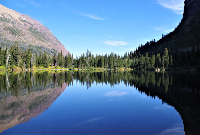
No Name Lake

We'd been warned to be on the lookout for grizzly bears and carried bear spray wherever we went. So when we heard a loud huff and something crashing through the brush coming our direction, I got a quick rush of adrenaline.

Soon two BIG moose came trotting toward us and then split around the three of us standing close together, passing within less than 10 feet on either side. These beasts can do serious harm if annoyed, so we (outwardly) kept calm.

After dinner when we were sitting on the beach at the lake, fellow campers Maggie and Rowan yelled to us that the moose were headed our way (four of them this time). I looked up to see a moose headed right toward me about 20 feet away, so we quickly scrambled sideways and back to camp, keeping an eye on them the whole way.

As I lay in my tent at night after dark trying to fall asleep, I heard moose thrashing about loudly in the brush, getting closer and closer.  

It was cool to hear the clacking of their antlers together as they jousted, but I really couldn't sleep until they wandered away. Then I slept a good sleep in all that mountain fresh air (thanks in part to a light warm sleeping bag and inflatable mattress).

In the early light the next morning, the cliff behind the lake glowed pink as the sun was rising, and I scrambled out to snap a few shots.

After a quick breakfast and packing up, we set off for what would be a much longer, more dramatic day ahead. You can read the second post here to join us as we hike up to Dawson and Pitamakin Passes.

 Happy trails and thanks for visiting Pacific Northwest Seasons! In between blog posts, visit Pacific NW Seasons on FaceBookTwitter, and Instagram for more Northwest photos and outdoors news.

Colorful stones and a hint of autumn at No Name Lake


Tuesday, March 12, 2019

Beyond the Pacific Northwest: Joshua Tree Rocks

In early March, I traded Pacific Northwest snow for a few days of sun in Southern California's Joshua Tree National Park.

On this, my first trip to Joshua Tree National Park, the striking combination of blue sky, dry desert, golden granite boulders, and otherworldy plants was a feast for the senses.  

This was definitely nothing like western Washington and Oregon.

After walking off the rear of the plane in Palm Springs onto the tarmac, I was immediately struck by the dry warmth, which is Southern California doing what it does best.


From Palm Springs, it was about an hour drive up to Joshua Tree through the rugged, mountainous, arid SoCal landscape. 

Some of our group of 11 guys 'n gals stayed in Yucca Valley in a motel, 
but a few of us camped up in the park at Hidden Valley campground, surrounded by huge boulders and striking rock formations. Cold nights with brilliant starry skies brought frosty mornings and glowing sunrises. 

It was glorious.


Before sunrise quiet.

While my motivation was to see somewhere I've never been before, the goal of the group overall was rock climbing. These formerly hard-core climbers and mountaineers (think Half Dome and El Capitan ascents and Himalayan summits) have mellowed with age, but still, the climbing was for real.

Don made scary (to me) look easy. The Tombstone.

 
My much easier route.

Dave, an experienced and accomplished climber, was patient and took me to much smaller boulders and rocks for climbing and belay practice. After a scary climbing experience in high school, I discovered it was actually fun and pretty safe. 

I'm hooked. Now I want more.


However, there was also hiking and exploring to do. One morning we hiked up nearby Ryan Mountain, the second highest point in the park and a very popular trail. 

This 3-mile round-trip hike is listed in the park guide as strenuous, but really, if you're a hiker in decent shape, it's not tough. Just don't go when it's too hot and bring plenty of water and sunscreen. We gained a little over 1,000 feet to a summit elevation just under 5,500 feet.


Pirickly cactus near summit of Ryan Mountain
Another morning we got up before sunrise to hike the Real Hidden Valley, a lovely little rock-enclosed "valley" near our campground. This easy 1-mile loop also gets tons of traffic, but we had the place to ourselves, which I considered a gift. 

I stopped briefly to sit and meditate just after the sun crested the surrounding rocks, grateful to be in and experience such a beautiful place during the early morning quiet.


Before Joshua Tree was a national park, cattle rustlers used to hide their stolen livestock here in what was then a secret hideaway. 

Another short (1.3-mile) afternoon hike we did was the Barker Dam loop, a pre-park impoundment that remains an oasis in the desert.


With all the extra rain and snow along the West Coast recently, the Joshua trees were starting to bloom and the cholla cactus glowed white with new growth. We were just ahead of a major desert bloom. Nevertheless, it was all lovely and enchanting.

 
NOT an artichoke :)
Cholla cactus


After Hike/Climb Eats
We did a little cooking (hot drinks in the morning, granola and fruit for breakfast) but drove down to the nearby towns of Joshua Tree and Yucca Valley several times to grab group dinners and snacks. 

We had pretty standard but decent and tasty Mexican at La Casita Neuva in Yucca Valley one night, and what I thought was quite good Thai food in Joshua Tree at the Royal Siam Cuisine Thai Restaurant. Just pass on the deep-fried eggrolls; everything else was fresh and well-prepared. 

But our favorite was the healthy fresh fruit smoothies at the Natural Sisters Cafe, a corner cafe/coffee shop in Joshua Tree near the park entrance turnoff. Oh, and I loved the excellent arugula salad at the Crossroads Cafe, where we had lunch before heading to the airport (sigh).

So I'm back in the land of cold rain (although they're predicting temps up to 70 degrees next week!), but images of Joshua Tree are lingering. I know I'll have to return someday for more.


How about you? Have you spent time there, climbing, hiking, or just sightseeing? Would love to hear in a comment below.

Happy trails and thanks for visiting Pacific Northwest Seasons! 

In between blog posts, visit Pacific NW Seasons on FaceBook, Twitter, and Instagram for more Northwest photos and outdoors news.


When You Go


Joshua Tree National Park is in Southern California just north and east of Palm Springs, which is about 100 miles east of Los Angeles. We flew Alaska Air from Seattle, which has plenty of daily flights, but a few in our group drove south in camper vans. They say the summer is beastly hot and the best times to be there are the spring and fall. We had temps in the low 60s in early March, but it rained and even snowed at higher elevations the day after I left.


Friday, June 1, 2018

Southwest U.S. Road Trip: Bryce Canyon Sunrise


The breeze at dawn has secrets to tell you. Don't go back to sleep. - Rumi

By the time we get to Bryce Canyon National Park on a clear, starry spring night, the park entrance station is dark and shuttered closed. We've driven up from Zion after a full day of hiking and exploring, and it's sleepy time.

So we drive on into the park to look for a campsite anyway . Even in the off season, it's not a good idea to hit a popular national park without a reservation. But here we are.

We're not totally out of luck. We're traveling in a newly retrofitted camper van (its maiden voyage), which allows us to be stealth and park for the night. After looping through the one open (and full) campground, we drive slowly along the canyon rim, checking out viewpoint parking lots.

Ultimately we settle on a small lot not far past the Bryce Canyon Lodge, conveniently just a few yards from an overlook and a restroom. We join a Westfalia tucked at the corner of the lot and turn in for the night.


While I love my Pacific Northwest, I also enjoy straying beyond my region to see colorful and different landscapes. Excited to shoot the sunrise, I wake up before the alarm and crawl out into the freezing cold morning for a look.

As you can imagine, it's breathtaking! There's not much breeze, but I heed Rumi's advice. No sleeping in today. After snapping a few pre-sunrise shots, we take off for more viewpoints.


Back in the 2000s I spent a few days at Bryce, where we hiked down in the canyon around the otherworldly hoodoos. These enchanting formations are shaped by erosion over millennia into colorful limestone, sandstone, and mudstone spires, fins, pinnacles, and even arches.

 At our second stop we catch this lovely arch before sunrise still. It's hard to stop shooting amidst this visual feast.


But there's still more to see, so we hop back in the van and dash back towards the lodge, passing the rising sun to the east.


By the time we arrive at the lodge parking lot, the sun is cresting brightly, illuminating the canyon below in dramatic light and shadow. I literally run to the canyon rim to start shooting. Light changes quickly at the cusp of the day.


It's so lovely that I don't notice how freezing my hands are until I've snapped about a dozen shots. Then I shrug and continue in the sub-freezing temps


I could post a lot more photos, but I hope you get the picture that a sunrise at Bryce is a bucket list event.

Since it's close and warm, we walk into the Bryce Canyon Lodge for the breakfast buffet. I love these old historic national park lodges, although they're not necessarily known for their cuisine. But the food is hot and hits the spot.

Then we're off into the gorgeous southern Utah morning, heading north like homing pigeons.
 
NOT western Washington
Happy trails and thanks for visiting Pacific Northwest Seasons! 

In between blog posts, visit Pacific NW Seasons on FaceBook, Twitter, and Instagram for more Northwest photos and outdoors news.


When You Go

Bryce Canyon National Park is in southern Utah only an hour or two northwest of equally spectacular Zion National Park and near other destinations like Kodachrome State Park and the Grand Staircase-Escalante National Monument. You could spend much more time exploring and hiking than we did on this trip. But a Bryce sunrise is a must!  This website has good info on lodging and particulars about visiting Bryce. BTW, how about letting your senators, Congress reps, the Administration, and others know that our national monuments deserve full protection. Just sayin'.