Showing posts with label Summer. Show all posts

Tuesday, June 10, 2025

Low Tide Gifts from the Sea


Every year around the summer solstice, we see the lowest tides of the year along Salish Sea/Puget Sound shorelines. While there are almost as low tides in December, wouldn't you rather explore the beach in June too?

You'll find me out there clutching my camera(s), roaming the beaches near my home. I'm fortunate that there is a great beach for exploring only a 10-minute drive away. Volunteer naturalists from places like the Seattle Aquarium are out there to answer questions and point things out.

It's a beach party.


About a dozen years ago, a wasting disease gutted the sea star population along the West Coast of North America (I'm not sure about elsewhere). So I've been thrilled the last few years to see so many healthy sea stars, which I grew up calling starfish.

Ochre sea stars, crimson red sea cucumbers lurking below to the right. 

Last year I spotted a now-rare sunflower sea star that looked healthy, which was a find. Sea star wasting disease killed more than 90% of the sunflower sea stars, according to the National Oceanic and Atmospheric Association.

Sunflower sea star, partially in shadow.

Knowing parking would be difficult near the time of the lowest tide, I came about an hour early and parked at the lot halfway up the hill and walked down, two cameras and my smartphone in hand. After about a 15-minute walk down to Golden Gardens Park in north Seattle, I finally got to the beach and bee-lined towards water's edge.


I stepped carefully, trying to avoid the rich eelgrass habitat and inadvertently stepping on livings things like anemones, crabs, sea stars, or other tidelands life.


“When the tide is out, the table is set” is a familiar saying among Native communities on the Northwest Coast. They developed traditional ecological knowledge that was passed down for generations about intertidal marine resources. I thought of this when I passed a crow jumping around, looking for a meal. And when a squirt of water from a clam burrowed beneath the sand hits me.

Big, flat expanses of exposed sandy beach don't provide the best low tide beachcombing. Instead, I headed to the north beach, where there are more boulders, with sea stars, anemones, sea cucumbers, and such clinging to the large barnacle-encrusted rocks.


So many rich colors, shapes, and textures! I'm no naturalist, but I do wonder how their coloring has evolved.

While I roamed quickly during the relatively short low tide window, trying to see as much as possible, chatting with others, calling out when we spot a juicy find, I considered a different path I might have taken in marine biology. But I didn't consider it for long, as I lacked the patience required for scientific methodology in most of my science classes.

Mostly, when I'm out there at our lowest tides, I'm just excited to spot weird, wonderful, and colorful flora and fauna.

How about you? Have you done much low tide exploring here, or anywhere?

Happy trails and thanks for visiting Pacific Northwest Seasons! In between blog posts, visit Pacific NW Seasons on FaceBookTwitter, and Instagram for more Northwest photos and outdoors news. 


Wednesday, August 28, 2019

Pacific Northwest Summer Sampler: More Hikes, Good Eats, and Chanterelles

While I like to say that fall is my favorite time of year in the Pacific Northwest, honestly, summer is pretty darn wonderful here too. 

Thankfully this summer (so far) we've been spared the thick smoke that choked the region the last few summers. We've enjoyed many bluebird days along with a rain shower now and then. And who doesn't love a good summer rain?

Today I'm sharing a sampling of fun outings from here in Upper Left USA. This is what I've been up to when I haven't been working overtime; but it's just a snapshot of things to do and places to go here.

Hitting the Trail
Of course I've been hiking since my epic few days on the Pacific Crest Trail. In late July I returned to the Pratt River Trail outside North Bend, Washington. While it wasn't as quite as fresh green as a Memorial Day hike there, it was still mossy and lovely.

 
After hiking several miles along the trail, following first the Middle Fork Snoqualmie River, then Pratt River, we encountered the biggest pile of bear scat I've ever seen, smack in the middle of the trail. Both dark blue and red huckleberries were ripe, so said scat was clearly remnant of a beary berry feast.
Red huckleberries make excellent pie.
Eventually the shrubs along the trail grew so thick and close that we called it a day and turned around a few miles along, thinking a machete would make the trip easier (although not recommended!). We must have hiked about 5 or 6 miles RT.

Mushroom Love
In late July I accepted a coveted invitation from a passionate mushroom foraging friend. While I'm sworn to secrecy about where exactly we went to find chanterelle mushrooms, I will say it was on an island in Puget Sound. And that chanterelles can be found all over the region.


After guiding us to a patch of woods where she found chanterelles a week earlier, Lynette pointed a few out. As we walked along, sometimes through thick underbrush, I started to develop an eye for spotting them too. As I dove under bushes to snag mushrooms, I also collected twigs and leaves in my hair. 


Golden chanterelle

Lynette kept on exclaiming how not normal it was to find such an abundance of chanterelles this early in the summer (late July). But I was lucky on my first time foraging for these beauties to take home such a bounty (a few pounds), which was really more than I needed. Several friends were the beneficiaries of this 'shroom largesse.


A Walk, a Book, and Lunch
In August I joined the Alpine Trails Book Club for a special treat: A walk around Gold Creek Pond near Snoqualmie Pass, Washington, followed by a homemade Burmese meal made by one of the regulars, who was born and raised in Burma (Myanmar). We'd read The Long Path to Wisdom: Tales from Burma to learn more about Mala's culture.


Our lunch was at a cabin less than a half mile from the pond, so it was a perfect combination of cabin cozy, delicious food, and a lovely walk.


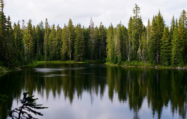
Gold Creek Pond (pictured above at the start of this post), which used to be a gravel pit created during the construction of Interstate 90 nearby, has recently been threatened with filling by the US Forest Service. Over the years, it has become an environment that supports thousands of trees and wildflowers, birds, beaver, elk, deer, bear and many smaller animals. Read about it here at the Save Gold Creek Pond website.

 Another Walk in the Woods
North of Seattle along Puget Sound are numerous greenbelts preserved as parks where you can walk through a forest down to the beach. Last week I joined a friend for a walk down through Lund's Gulch near Picnic Point at Meadowdale Beach Park.


We started down through second-growth forest, and farther along the trail passed numerous old stumps of what were formerly magnificent old cedar trees. I wish I could have seen this place before it was logged.


After a little over a mile of trail winding through forest, we passed a ranger residence cheerfully draped with Tibetan prayer flags, then strolled the final stretch through a small tunnel under train tracks to the beach.  I spotted what I think was a cute semipalmated plover darting on the beach between the mallard ducks. 


At about 2.5 miles, with a few hundred feet of elevation loss (and gain on the way back), this walk is a great way to get some good exercise and time in nature. I've been coming here several times over the summer and will miss these evening walks as the days get shorter.

So there you have it. Just a smattering of the local life here in Upper Left USA, where we're having a mild, smoke-free summer. Yes, I love fall, but summer is indeed special here.

Happy trails and thanks for visiting Pacific Northwest Seasons!   In between blog posts, visit Pacific NW Seasons on FaceBookTwitter, and Instagram for more Northwest photos and outdoors news. 


Friday, July 26, 2019

Hiking the Pacific Crest Trail: White Pass to Chinook Pass, Part 2

This is the second of two posts about a recent 28-mile backpack trip on the Pacific Crest National Scenic Trail  (PCT) from White Pass to Chinook Pass, Washington. Read about the first part of the trip here.

After hiking in perfect weather on the PCT for a couple days, I awoke on my third and final day on the trail to the delicate patter of rain on my tent. Within a few minutes, the patter turned more insistent.

Yes, here in the Pacific Northwest, before the "new normal" of drought-stricken summers, rain in July was not that unusual. In years past, I remember getting swamped with rain on summer backpack trips along the PCT.  

This is why we have rain gear.  

So after throwing on water-repellent jackets, packing up wet tents, and shielding our packs with rain covers, off we walked, northward. Because that's what we do here. (Rainy day bonus: hardly any mosquito action.)


With my friends Cedar and Rosario (trail names), I'd already hiked 18 miles from White Pass the last two days. I felt good this morning, like I could just keep on walking north all the way to Canada. (Ask me if I felt this way 6 hours later in a drenching downpour.)

Within a mile or two, we crossed back into Mt. Rainier National Park. I hear the views are stunning along this stretch of trail, but today not so much. However, the lush green and abundant wildflowers against a misty backdrop were stunning nonetheless.


With intermittent rain and drizzle, we tramped through verdant and healthy green subalpine forests and meadows without pausing much. However, we did pause trailside to chat with the PCT thru-hiker from North Carolina pictured above carrying the white umbrella. He was a "flipper," having started northward from Mexico, then stopped due to heavy Sierra Nevada snow, and skipped north to continue southward from Canada instead.

Within a few hours we'd clicked off 6 miles, and took a break in the cover of some big trees at Dewey Lake for lunch. (I guess technically it's lakes). With the rain picking up, we didn't stop for long. But oh those wildflowers, wow! I especially love the dark magenta pink paintbrush you see around Mt. Rainier and the tall, elegant beargrass.


During our final push back to Chinook Pass, the rain increased even more. I think we gained about 1,000 feet heading up from the lakes to connect with the always stunning and super popular Naches Peak Loop Trail.

In fact, I didn't realize we'd connected with that trail until Rosario said so. (She has hiked to Dewey Lakes several times.) But suddenly there we were, within only a mile or so of the highway and an enclosed, covered loo (ahem, that's British for toilet, but I think it sounds nicer).


 As you can see, it was getting darker and more foreboding, although still beautiful. While I had generally lagged a bit behind my two taller hiking mates, I picked up my pace and churned out the last mile, passing families in shorts and cotton sweatshirts with baby strollers and toddlers on the trail near the highway. They didn't know what they were in for shortly thereafter when the skies opened and a true Northwest mountain downpour commenced.


Soon the highway came into view, and suddenly I was there, near the entrance to the national park.


 When we got to the parking lot and Rosario's car, which we'd dropped three days earlier, said downpour began.  We threw our packs in the back and got inside, waiting for Lisa's (oops, Cedar's) husband to arrive with fresh food supplies for her continued trek north to Canada. Alas, Claudia (Rosario) and I (Jill, aka Motor Mouse) had to head back to Seattle and work the next day., which was jarring.

Overall, this trip was a wonderful break from urban, daily life: three nights and three days with smartphone turned off, in wilderness. And I really did feel like I could continue and get in better and better shape. In fact, as I write this now, almost two weeks later, I'm craving being out there again.

Lisa is continuing her thru hike of Washington, and Claudia and I hope to join her for a day hike at one of the highway crossings as she heads toward the Canadian border. With two backpack trips this summer so far, I'm hooked all over again with the mountain passion I developed as a teenager through skiing and mountain backpack trips here in the Northwest.

Here's a parting shot of me when I was 15 during a week-long backpack on the PCT in the Goat Rocks Wilderness. (We wore Pendleton wool shirts instead of fleece for warmth back then.)

Happy trails and thanks for visiting Pacific Northwest Seasons! 
  
In between blog posts, visit Pacific NW Seasons on FaceBookTwitter, and Instagram for more Northwest photos and outdoors news. 

Saturday, July 20, 2019

Hiking the Pacific Crest Trail: White Pass to Chinook Pass, Part 1

This is the first of a two-part series about my recent 3-day backpack trip along the Pacific Crest Trail in central Washington. You can read the second post here.

To get away from civilization, with only basic essentials for walking the landscapeno smartphone, no music but the sounds of nature, just whatever greets you in the moment—this to me is a gift.

And so some of us hit the trail for a night or two or more when we can. Life on the trail in wilderness landscapes is stripped down and clarifying.


When my friend Lisa (trail name: Cedar) said she was going to thru-hike our home state of Washington on the Pacific Crest Trail this summer, I asked to join her for a few days. I chose the relatively easy White Pass to Chinook Pass section of trail, a little over 28 miles and already on my list to hike.

When I hiked sections of the PCT as a teenager many years ago, we'd see hardly anyone else out there during a week on the trail. It's a very different scene today.

Back in the day, Goat Rocks Wilderness, Washington
Now several thousand people come to the West Coast of the USA each year to walk from Mexico to Canada on the PCT. Many more hike sections, like us. (In PCT lingo, we're LASHERS, short for Lazy Ass Section HikERS). Total use each year is likely over 100,000 hikers.


On a Friday evening in mid-July, my friend Claudia (trail name: Rosario, for her bright pink pants) and I got dropped off at White Pass with backpacks and food for 3 days on the trail. It didn't take us long to find Lisa at the Leech Lake campground, where we snagged a nice campsite beside the lake.


Leech Lake Campground at White Pass, Washington
Dinner included a salad of greens from my garden, which I knew Lisa would appreciate since she started hiking north from the Oregon border over 2 weeks ago. (Trail food is notoriously short on fresh produce.) Not long after sunset the persistent mosquitoes drove us to our tents, where I drifted to sleep quickly after reading a few pages of my book.

Day 1: White Pass to Snow Lake
With early mornings this time of year, we were up by daylight and on the trail by 8 a.m. For the full-on thru hikers who walk up to 30 miles a day, that's a really late start. For us, just fine.


Soon we entered the William O. Douglas Wilderness adjacent to the east side of Mt. Rainier National Park. Although we climbed a bit, overall our first day on the trail was fairly level, mostly above elevation 5,000 feet+, and we hiked a tad over 9 miles.

This area is characterized by lush subalpine forest, vivid green mountain meadows, and lots of alpine lakes and ponds. Good mosquito breeding territory. 


By mid-afternoon we reached Snow Lake and pitched our tents in a nice clearing above the serene lake, where we spied a mama duck and a few ducklings skittering across the surface. Then we read and napped, and later in the afternoon saw more hikers pass.  

As we were cooking dinner, a guy in his early 20s wandered up and decided this was the spot to camp after a 30-mile day. Such is the social and friendly way of the PCT. Bear Magnet (trail name) told us he'd thru hiked the Appalachian Trail a year or two ago and lost 40 pounds in the process.


Snow Lake
After dark, cozy in my sleeping bag, I heard a young couple wander up beside my tent in search of a place to camp for the night. I'd seen a sweet campsite farther up the lake on an after-dinner walk, and told them about it. Off they went. Then I slept soundly.

Day 2: Snow Lake to Two Lakes Junction
So this was the day for us, the one with blue skies, not nearly as many mosquitoes, and spectacular gorgeous breakout views after a first day mostly in forest.

Bear Magnet was up and off so early I didn't hear him leave, but we had a lazy morning, not hitting the trail until about 9:30. A splashing in the lake below turned out to be a fly fisherman, who was otherwise so quiet we didn't know he was around.


At the Bumping River crossing, we stopped to chat with Tinsel and Rocket (trail names, of course), two sisters in their 20s from Los Angeles whom Lisa had befriended earlier on her hike. Sadly, they were aborting their thru hike and jetting back to California due to Tinsel's sore knee.

As we continued north, a few other hikers Lisa had met along the way leapfrogged past us. There was a stream crossing too, where we had to take off our boots and roll up our pants to wade across.

After pausing to gaze at a particularly beautiful meadow sprinkled with purple lupine (my version of Heaven), we started our first big climb. Up and up we ascended, first through forest, then along a rocky, talus-strewn ridge, for a few miles.


Nearing the top, we had views back to White Pass, the Goat Rocks, and Mt. Adams beyond. This is what I truly love about hiking: reaching high ridges and peaks with expansive panorama views.


Goat Rocks, Mt. Adams beyond
Then it got even better. After topping out on the high end of the ridge, boom: Mt. Rainier (Tahoma) came into view, from an angle I've never seen before. Even though I've lived in its shadow most of my life, massive Rainier is always a startling sight.


Mt. Rainier

Can I just say, even though we only gained a little over 2,000 feet, I was beat. I've aged past my trail name (Motor Mouse), which I was bequeathed when I was younger, faster, and didn't have a cranky right knee. After a break, another mile on I got muscle cramps in my legs.

But I kept going because I Do Not Quit. And, um, what else would I do out there? (Several days later I found out I'm depleted of a key vitamin, so that explains some my dragginess.)


Thankfully we found a nice level campsite perched above Two Lakes junction at the head of a valley not long after, and witnessed a stunning moonrise. And yes, we were joined later by another solo, twenty-ish guy thru hiker (trail name Juicy Foot) who pitched a tent at our site.

After an almost 10-mile day, we all slipped to our tents not long after. Two days on the trail, feeling somewhat clarified, I was ready for more.


Check back for our third and final day soon...

Happy trails and thanks for visiting Pacific Northwest Seasons! 
  
In between blog posts, visit Pacific NW Seasons on FaceBookTwitter, and Instagram for more Northwest photos and outdoors news. 


When You Go 
Well, go prepared. These days, there are trail runners who do the whole 28 miles in one day, others backpack this stretch in just 2 days, and some take maybe 4 days. It all depends on your conditioning, available time, and inclination. Here's what the Washington Trails Association (WTA) says about this hike along with directions and logistics.

Monday, August 13, 2018

B.C.'s Sunshine Coast: Sailing through Paradise

This is the first of three posts about a recent trip on a sailboat along the Sunshine Coast north of Vancouver, British Columbia. Read the second post here and the third post here.

When my friend Mark invited friends and family to join him during a six-week sailing sabbatical in the Salish Sea, I jumped at the chancea bucket list opportunity must be seized. 

We decided I would join him at Pender Harbour on the Sunshine Coast north of Vancouver, B.C., and sail up into Princess Louisa Inlet, which several people had told Mark was a must-see. It's the deepest fjord in BC and sounded like a perfect destination.

On a Friday morning, I left Seattle around 6:30 a.m. and breezed through the border crossing just east of Blaine, Washington, with absolutely no waiting line. This is rare along the I-5 corridor.

After taking the ferry from Horseshoe Bay across Howe Sound, it was a scenic drive up the increasingly developed but still relatively rural Sunshine Coast (Highway 101). By mid-afternoon I arrived at John Henry's Resort & Marina on Hospital Bay in Pender Harbour and was immediately charmed by this cozy and picturesque little cove.


It didn't take me long to find Mark. After three weeks of sailing/cruising already, he looked tanned and relaxed. I found myself unwinding pretty quickly too.

Dinner at Cafe at John Henry's (attached to the marina's grocery store/gift shop) was excellent. Beforehand we started with (nonalcoholic) drinks on the deck. My glass of iced chamomile tea, which is generally a pretty bland drink, was artfully crafted by the bartender with a lemon twist and a hint of pink.

Rice, housemade hummus, and roast/fresh veggie bowl, Cafe at John Henry's
My first night on the boat I was quickly lulled to sleep by the gentle rocking on the water. Both Mark and I awoke just before the alarm was set to go off at 5 a.m. An early start was the plan for our long journey (48 miles) up Jervis Inlet to Princess Louisa Inlet.

Our route, starting from near Irvine's Landing. Map from Princess Louisa International Society website
I love the promise of early morning, when the new day is slowly emerging. I also love going places I've never been before. By 6:15 we set off motoring towards the Malaspina Strait with anticipation for the day ahead.


For you sailors, we were traveling on Mark's ~ 40-foot-long wooden sailboat Aeolus, which was built in the 1930s. It's a lovely old boatnot fancy but equipped with a modern electronic navigation system.                          

After we cleared Pender Harbour, Aeolus made a U-turn into Agamemnon Channel en route to Jervis Inlet. While the sun had already risen, it hadn't fully crested many of the hills and ridges, so we passed in and out of shade for a while.


Ahead, jagged peaks of the 800-mile-long Coast Range of BC looked dramatic on the distant skyline. Later in the day we were on the other side of that pointy peak in the middle of the photo below.


An hour or so into our cruise, a BC ferry passed in front of us where we merged into Jervis Inlet. Years ago I took that ferry heading southbound, and I remember being thrilled at the juxtaposition of mountains and sea together.

Dead ahead at the northern end of the first long reach (Prince of Wales) were some impressively craggy peaks. On the left are the Marlborough Heights, and the pointed peak on the right is Mt. Churchill. With stunning high granite walls, these are a destination for climbers.


And so we continued past mountainsides blanketed in evergreen forests, evidence of past clearcuts very visible in places. We curved around the Marlborough Heights into the Princess Royal Reach, the longest reach. 

Midday we crossed over to the western side of the reach to see a pictograph painted on a rockface about 20 feet above the tideline. Apparently there are many along the inlet and nearby channels. Centuries before loggers, trappers, and boaters began flocking to this area, the Sechelt Indian Band (shíshálh Nation) called these waters their home.


With the wind picking up and plenty of time to reach our destination, Mark decided to try sailing with the jib (front) and mizzen (back) sails. It was an especially peaceful 4 hours with just the sound of wind catching in the sails and light waves slapping against the hull.


"This ship is rat-infested." I turned around quickly to see Mark holding up two cute stuffed rats. I think his daughter Lena had something to do with these little guys. The skipper is not without humor. :)


One thing that struck me as we cruised past rugged high peaks is how evident it is that their glaciers have receded. It's obvious where they used to extend farther downslope. When I've traveled around the Coast Range in years past, the glaciers were much more prominent. It's hard to observe this change because the overall health of the mountain and coastal ecosystem is partially dependent on seasonal glacial melt.

But I digress.


Mark timed our arrival at the entrance to Princess Louisa Inlet to coincide with slack tide around 5:45 p.m. Water can run so fast through the very narrow entrance that British Captain George Vancouver's expedition here in the 1790s noted this as a river running into Jervis Inlet instead of an entrance into another inlet.

Entrance to Princess Louisa Inlet, the small gap shown above.
Aeolus passed easily through the gap, past the Malibu compound (a longtime Young Life camp for teenagers). And then we entered what felt and looked like an enchanted cathedral of mountains and sea...

Check back for the next post about Princess Louisa Inlet. (Too many photos to cram into one post.)


Happy trails and thanks for visiting Pacific Northwest Seasons! 

In between blog posts, visit Pacific NW Seasons on FaceBook, Twitter, and Instagram for more Northwest photos and outdoors news.
 
When You Go
Late July/early-mid August is peak season for boating along the Sunshine Coast and up into the inlets, with the mildest weather. While I was on a private boat, there are many tours and groups that take people up this way. Thankfully no big cruise ships yet (I don't think).