Showing posts with label Hiking - Oregon. Show all posts

Tuesday, April 23, 2019

Into the Woods: Forest Bathing in Mosslandia

While I've always felt better after hiking and playing in the woods, only in the last few years have I learned there's a movement that started in Japan called forest bathing (shinrin-yoku).   

Shinrin-yoku means bathing in the forest atmosphere, or taking in the forest through our senses. According to a 2016 study, forest bathing significantly reduced pulse rate and significantly increased the score for vigor and decreased the scores for depression, fatigue, anxiety, and confusion of the participants.

Not that I needed to be told all those years hiking through Pacific Northwest forests have been good for me. 

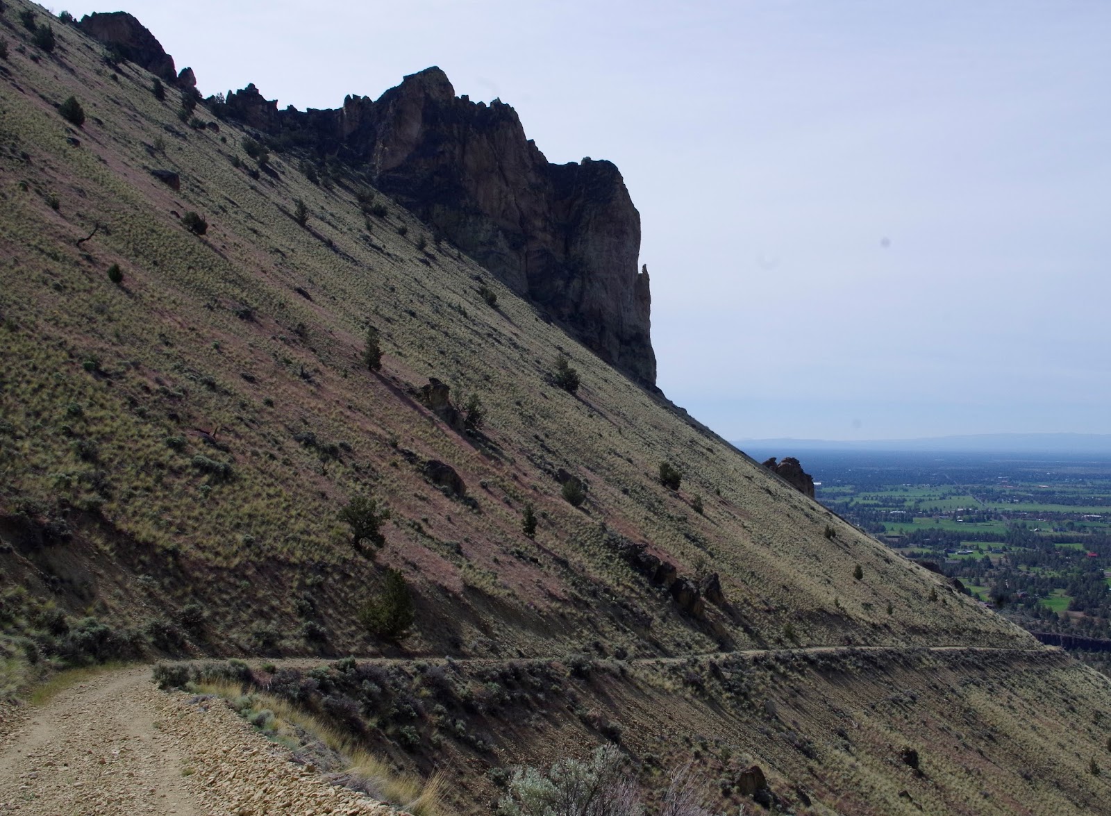
But with the explosive growth here, which has spilled over to hiking and all things outdoorsy (thank you social media), the hikes I used to take to mountaintops and spectacular views are being overwhelmed. These days, I often head to forest trails that don't particularly lead to a summit or lake. 


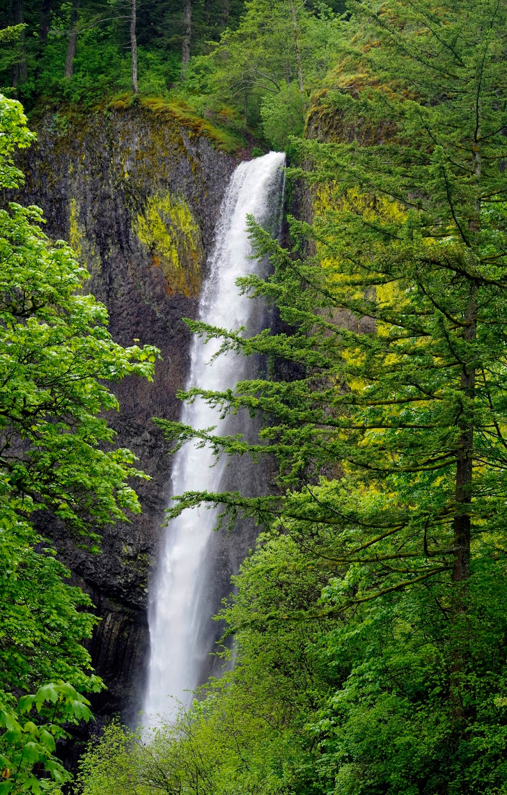
And I especially relish our lush forests west of the Cascades, where the ground and trees are carpeted in moss and ferns along with other native shrubs. Things grow in a western forest, often abundantly.

And when trees fall in the forest, lots more things grow on "nurse" logs. It's a big symbiotic chain reaction.


I've been reading The Hidden Life of Trees, and it raises interesting questions: Are trees sentient beings? Do they have feelings? Do they communicate with each other?

While we can't know for sure whether trees possess self-knowledge, the reactions of trees to various conditions and events is indeed real. And they do indeed communicate and support each other in a forest.


As the author concludes: A happy forest is a healthy forest. And I firmly believe that a healthy forest is a healthy place for people to pass through, with respect. Or, as John Muir said, more loftily:

“The clearest way into the Universe is through a forest wilderness.”

I've done many forest hikes over the years and a few recently. Sometimes, like this past weekend along the Salmon River east of Portland, I stop and just sit in silence in the woods, breathing deeply and inhaling the richness of life all around.


Sweet wildflowers sprout beneath trees and along the trail in the spring and summer. As I noted in my last blog post, trilliums are a favorite and still peaking. And this past weekend I was especially enchanted by the abundance of delicate fawn lilies, with mottled leaves resembling the back of baby fawns.


Trillium ovatum


Oregon fawn lily (erythronium oregonum)
So next time you hit the trail, think about a quiet walk in some woods. Observe all the trees and plants, and perhaps think about how they are interconnected. Notice different types and sizes of trees. And then, maybe consider how can you help protect such life and richness.


I no longer blog about every hike I do, but here are a few favorites where you'll get a good "bath" in the woods:

  • For a lowland forest walk near Seattle, try Japanese Gulch or Big Gulch trails in Mukilteo, WA.
    .
  • I've read that the Crater Loop Trail at Larch Mountain east of Portland, OR, has re-opened. However it has suffered from lack of trail maintenance during its prolonged closure after the Gorge fire in 2017. Proceed with caution!
  • Downey Creek Trail outside Darrington, WA, in the North Cascades is reliably quiet. Might have something to do with the 15 miles on rough road to get there.


Happy trails and thanks for visiting Pacific Northwest Seasons! 

In between blog posts, visit Pacific NW Seasons on FaceBookTwitter, andInstagram for more Northwest photos and outdoors news.  


When You Go
Check to see if a parking pass (Northwest Forest Pass, Discover Pass) is required for trailhead parking. And think about taking an extra big bag for picking up trash you find along the way, which sadly is not that uncommon these days. Also think about being quiet rather than talking loudly; focus on absorbing your surroundings. Enjoy!

Friday, July 13, 2018

Why do we hike?

Of all the paths you take in life, make sure a few of them are dirt.”
– John Muir

Why do we hike?
Such a big question. Many answers.

For me...it's complicated. But also really very simple. For starters, it makes me feel the most alive, walking in nature. It's what we evolved to do, physically. We're a species of bipedal walkers.

I began hiking as a kid here in the Pacific Northwest, before this region was "discovered" and our trails, even the most popular today, were relatively quieteven on summer weekends.

It was glorious. It still is, but hiking some of my old favorites with a steady stream of other hikers, music emanating from some hip belts, is a different experience. 


 I partly hike for the solitude in nature. To that end, I've started going farther afield from metro Seattle/Portland. I go earlier, I go in the rain, I go midweek if I can. And I've started being more private about where I go.


About 10 years ago, I thought hiking/backcountry travel might be dying out because I didn't see many teens or twentysomethings out there. Or a just a few would start up the trail late, as we were coming back down.

Not today. (Thank you Instagram and social media.)


I'm happy the next generation is getting outside and appreciating the natural beauty all around. I know some admirable Millennials who are giving back, doing trail maintenance, fighting for environmental causes, and working to save special places. 


Because that's partly what hiking is all about, too. Reveling in, protecting, and fighting for special places.


At a basic level, I hike for my mental and physical health. I also say that about swimming, bicycling, kayaking, skiing...but it's true. Being active outdoors is simply good for our bodies and minds.  

The Japanese go "forest bathing"; they even have a name for itshinrin-yoku. In the past several decades there have been many scientific studies that demonstrate the healing effects of simply being in wild and natural areas. 

 
But then, we really didn't need scientific studies to confirm that. At least I didn't.


And then there's the camaraderie. Some of my closest bonds and best friendships were forged while stuck in tents during downpours while backpacking. Or simply walking, talking, laughing, and being quiet together in beautiful, natural places.


So there you have it. For me it's about health, friendship, discovery, solitude, appreciation, the spiritual value of the "church of nature," exercise, and just plain fun. And a greater feeling of connection to this amazing planet when I'm outdoors. As I'm moving on in years, this also:

We don’t stop hiking because we grow old –
We grow old because we stop hiking.
Finis Mitchel

How about you? Why do you hike? I'd love to hear in a comment below.

Happy trails and thanks for visiting Pacific Northwest Seasons! 

In between blog posts, visit Pacific NW Seasons on FaceBook, Twitter, and Instagram for more Northwest photos and outdoors news.
When You Go
Well, although I didn't caption the photos, you probably recognize some of these places and trails. They're all in Oregon and Washington, mostly in the Cascades, but not every shot. How many places/trails do you recognize?

Wednesday, September 6, 2017

2017 Columbia River Gorge Fire: Grief and Hope


As I write this, the Eagle Creek Fire is still burning and growing in the Columbia River Gorge, threatening towns in eastern Multnomah County, Oregon.

In just one night, it engulfed some of the most unique and verdant landscapes on the planet in a maelstrom of exploding trees and racing flames, fanned by the Gorge's famous East Wind. A friend watched a whole mountainside go up in flames in about one minute.

It's too early and I've yet to see it, so I still can't quite conceive of what has happened. Has this sacred, nourishing, touchstone place for me, where I return as often as possible, been irrevocably changed, denuded, and altered forever (at least in my lifetime)?

This I can't yet comprehend.


Gorge lushness
 As a post on the Friends of the Columbia River Gorge FaceBook page said,   "We're hoping for the best, but fearing for the worst."

The Vista House on Crown Point. Still standing.


I'm having a hard time putting into words how important the Gorge has been to me throughout my life. It is, as they say, in my bones.

When I was three my family moved to the Troutdale area, where our home was just a few miles from the basalt cliffs across the Sandy River that mark the western entrance to the Gorge. I grew up there learning to love nature, waterfalls, and walking in the woods.

On warm summer nights, my mom would pack a picnic dinner and we'd head up to enjoy the particular refreshing cool in the woods near one of the waterfalls. We often had Oneonta Gorge to ourselvesonce my dad featured a shot of my sister and I there on the front page of his newspaper, calling us "woodland sprites" in the caption. (We got teased for that.)

Below Larch Mountain

As a teenager I started hiking/backpacking in earnest and explored the Gorge's trails more extensively.  Maybe it's because I was 17 and all my senses were heightened, but one great backpack trip stands out: 

Towards the end our hike from Mt. Hood down to the Gorge, I vividly remember the soft, forgiving earth underfoot and the richness of the forest as we descended switchbacks nearing Eagle Creek, singing silly trail songs. (Because back then there were no other hikers around to annoy.) To wash away some of the week's grime, we jumped into a pond in the upper creek. Decades later I can still almost feel the bracing, exhilarating chill from jumping into the icy cold water that left my skin tingling afterwards. When we arrived at the Eagle Creek trailhead, our parents had spread out a picnic for us, which we devoured after a week of Top ramen, dried salami, and homemade gorp. Fantastic memories!


Throughout my life the Gorge has been a place of refuge, a soothing balm for my soul. I’m a firm believer that Heaven is here on Earth and that it’s unique for everyone. My version encompasses the verdant western Gorge and its many trails.

At one of my happy places
 After hiking there I feel energized and especially alive. There’s something magical and life-affirming about the abundant and thriving plant life, coursing streams, and cascading falls.

I heard there are pockets of trees spared, and yes, there will be regrowth. But it will take time. A long time. And who knows how climate change will affect the ability of such a unique botanical treasure to return to its former fecund glory.

Lower Multnomah Fall. The cedar to the right appears to have survived the fire
So allow me, us, to grieve while we also carry hope that enough was spared from the flames to allow a quick natural regeneration and healing of the unique collection of ecosystems in the Gorge.


Remnant snags from an early 1990s fire atop Angel's Rest

Eagle Creek, Punchbowl Falls
Bicyclist on the historic Columbia River Highway just below Crown Point
Thanks for "listening." I'd love to hear what the Gorge has meant to you and your experiences there in a comment below.

Happy trails and thanks for visiting Pacific Northwest Seasons! In between blog posts, visit Pacific NW Seasons on FaceBook, Twitter, and Instagram for more Northwest photos and outdoors news.


.

Wednesday, January 13, 2016

Winter Hiking in the Columbia Gorge: Wahclella Falls

Sadly, this trail burned in the September 2017 fire and remains closed. Trail conditions for the first 0.3 mile were assessed as in poor condition. The trail is covered in rocks and tread is buried in multiple places. Special safety concerns: Continuous rock fall, upslope hazards, and possibility of slides along trail.


Like a homing pigeon, I'm drawn to the western Columbia River Gorge's abundant waterfalls and lush green riot of moss and ferns whenever I visit  Portland. I always try to sneak up for a hike along the Gorge's many trails, some I've walked since I was a girl and some for the first time.

On a rainy morning recently I hiked to Wahclella Falls, a first for me. When I was growing up in east Multnomah County this trail near Bonneville Dam wasn't open for public access, but now it's quite popular. Of course. It's easy, relatively close to Portland (about 30 minutes east up I-84), and gorgeous.

When I get to the trailhead around 8:30 on a Saturday morning, there's only one car in the parking lot. Anymore that's pretty unusual on a weekend.

After layering up in fleece and a water-repellent shell, I start up along swollen Tanner Creek through a forest of moss-encrusted trees. It rained heavily the last few days, so there's a lot of water rushing down the narrow canyon walls into the creek.


Pretty quickly I cross a small bridge with a waterfall (Munra Falls) gushing beside the trail with the intensity of a fire hose.

Looking back down Tanner Creek to Munra Falls and bridge on the right.
This short and easy hike (1.8 miles roundtrip with just 300 feet of elevation gain) starts out fairly flat along the creek before rising gently. Right away I pass evidence of slides down the steep basalt canyon walls.


It occurs to me that hiking after a heavy rain in a slide-prone area is not the safest place to be. (Same goes for those icy days when traversing sections of trail with steep drop-offs.) Just the day before a woman had been killed by a landslide on the Oregon coast. So I proceed  with caution, a little more quickly than usual.

One of several slides across the trail.
But I'm rewarded with ethereal beauty that makes me feel like I'm walking through an ancient Chinese landscape painting.


Ephemeral waterfalls that aren't there in the drier months have sprung all along the trail, mingling with remnant patches of snow from a few days earlier. After a very dry 2015, it's fantastic.


Not too far from the Main Event (Wahclella Falls), I come to a fork in the trail and decide to stay high.  From here it's not too far down to the end of the loop trail. 

I can feel and hear the falls before I see it. And then there it is, flowing full throttle.


Wahclella Falls

With the rain coming down harder, I don't linger too long after taking a few shots. It's hard to capture the falls with all the mist and rain.


Looking back up the trail

Of course I can't resist stopping to take more shots along the way. I especially love the vibrant aqua green-blue of the creek between the mossy rocks.


And the moss!


Traffic is picking up on the trail on the way back. I'm always slightly surprised at how many more people are on the trails than when I roamed the Gorge as a teenager.

'Twas a short hike, but I need to return to Portland to meet up with some friends. I drive back west on I-84 along the Columbia River happy and refreshed from this morning dose of nature nourishment.

Do you have a favorite hike in the Columbia Gorge? Would love to hear in the comments below.

Happy trails and thanks for visiting Pacific Northwest Seasons! In between blog posts, visit Pacific NW Seasons on FaceBook, Twitter, and Instagram for more Northwest photos and outdoors news.

When You Go
The trailhead is about 30 miles eastward up the Gorge from Portland. From I-84, take Exit #40/Bonneville Dam. Turn south at the stop sign and drive about 100 feet. Stay to the right, which takes you to Wahclella Falls trailhead.


Monday, August 10, 2015

Hiking Central Oregon: Smith Rock State Park Summit Loop Trail

My rock climber friends have raved about Smith Rock for years, but I didn't clue in until recently that it's also a fantastic place to hike. (I'm a failed rock climber who prefers my feet on solid ground...:)

Thanks to my friend Colleen for introducing me to the hiking trails there. Earlier this season we spent an excellent morning hiking through and around the enchanting and spectacular rock formations at Smith Rock State Park.

In geologically fascinating central Oregon, the Smith Rock complex is part of an ancient volcanic caldera that counts among the largest in the world. Things are quiet now (thankfully!), but over the millenia the Crooked River cut through layers of ancient rock and basalt flows, revealing the present dramatic rock formations known as Smith Rock tuff.


After parking (go early to get a spot) and stopping to take the requisite shots of the rock drama ahead, we drop down to the Crooked River, cross the wooden bridge, and head up the Wolf Tree Trail along the river, part of the relatively new Summit Loop Trail.

Within 10 minutes we've left the crowds behind, most of which are heading up the more popular Misery Trail.


In fact we have the trail to ourselves for the first several miles as we loop up along the river and then take the junction up the Burma Road Trail (an old fire road and now part of the Summit Loop Trail). 


Along the way, occasionally I catch the scents of pine and sage on this more arid, dry side of the Cascades. Of couse this year it's way too dry on either side of the mountains here in the Northwest. The Wolf Tree Trail to the Burma Road junction is the most forested part of the park.

Although it's not steep, the Burma Road Trail rises about 1,200 feet up from the river to the highest point, gradually. And the views just get more and more ahhh-some looking down to the rock formations and the volcanoes beyond.

Broken Top and the Three Sisters on the horizon.
Can you spot the wood bridge where we started?
 
Looking back at the gradual incline of the Burma Road Trail.
 

By now we've shed a layer and are down to tank tops and shorts.  Up here the trail meanders through shrub-steppe and then starts switchbacking downward and back towards the main rock formations.


Despite getting a tad lost because the trail junctions aren't well marked up here, we manage to find our way and loop back down to the river again, onto the River Trail.


Crooked River below, snowy Mt. Jefferson on the horizon.


When we return down to the river level, the trail is basically flat the few couple miles back to the bridge and parking area. So we enjoy the easy stroll and appreciate the solitude we had until getting to the River Trail.


After making a hairpin turn, the River Trail loops back, passing many climbing routes that draw climbers from all over the world.  Climbers in colorful helmets  clutter the basalt cliff faces, but we don't linger to watch.


By the time we finish after about 3 hours, the day is heating up and lots more people are here taking pictures and walking the trails. Time for a cold one over in nearby Terrebone.

After Hike Eats
After a short drive of not more than 10 minutes, we land a table on the deck at the Pump House in Terrebone. I split an order of the fish tacos, which hit the spot and were quite tasty. Two thumbs up.

Happy trails and thanks for visiting Pacific Northwest Seasons!

In between blog posts, visit Pacific NW Seasons on FaceBook, Twitter, and Instagram for more Northwest photos and outdoors news.    

When You Go

Here is a trail map of Smith Rock State Park. The Summit Loop Trail, which is about 7.5 miles overall, is shown as several connecting trails (Wolf Tree, Burma Road, Summit Trail, to River Trail). Entrance to the park is off Highway 97 in Terrebone, about 27 miles north of Bend, Oregon. Day use parking is $5, and walk-in camping is available on a first-come, first-served basis.