

So it's a thrill these days to hike 6 hours in the Cascade Mountains without seeing any other hikers. We enjoyed this solitude in nature on a holiday weekend no less, just two hours drive from Seattle.
I'm tempted to not divulge this quiet trail, but that would just be silly. After all, we did this hike based on author Craig Romano's notice on FaceBook that the Downey Creek Wilderness trail was the Hike of the Week.
I expected a busy trail. Instead, just one other party signed the trail register before us on a Saturday morning. And none came in after us.

After driving over 20 miles up the Suiattle River Road off Highway 530 outside Darrington, the last 10 miles on dirt/gravel, we pull into the parking lot after initially passing it by. (There's no sign at the lot entrance. Intentional?)
As far as trails go, it doesn't exactly shout "Here I am!" We wander up the parking lot looking for it, dead-end, backtrack to the sign (INSIDE the parking lot), and finally notice the small trail. Then we cross the road and start up into the woods.

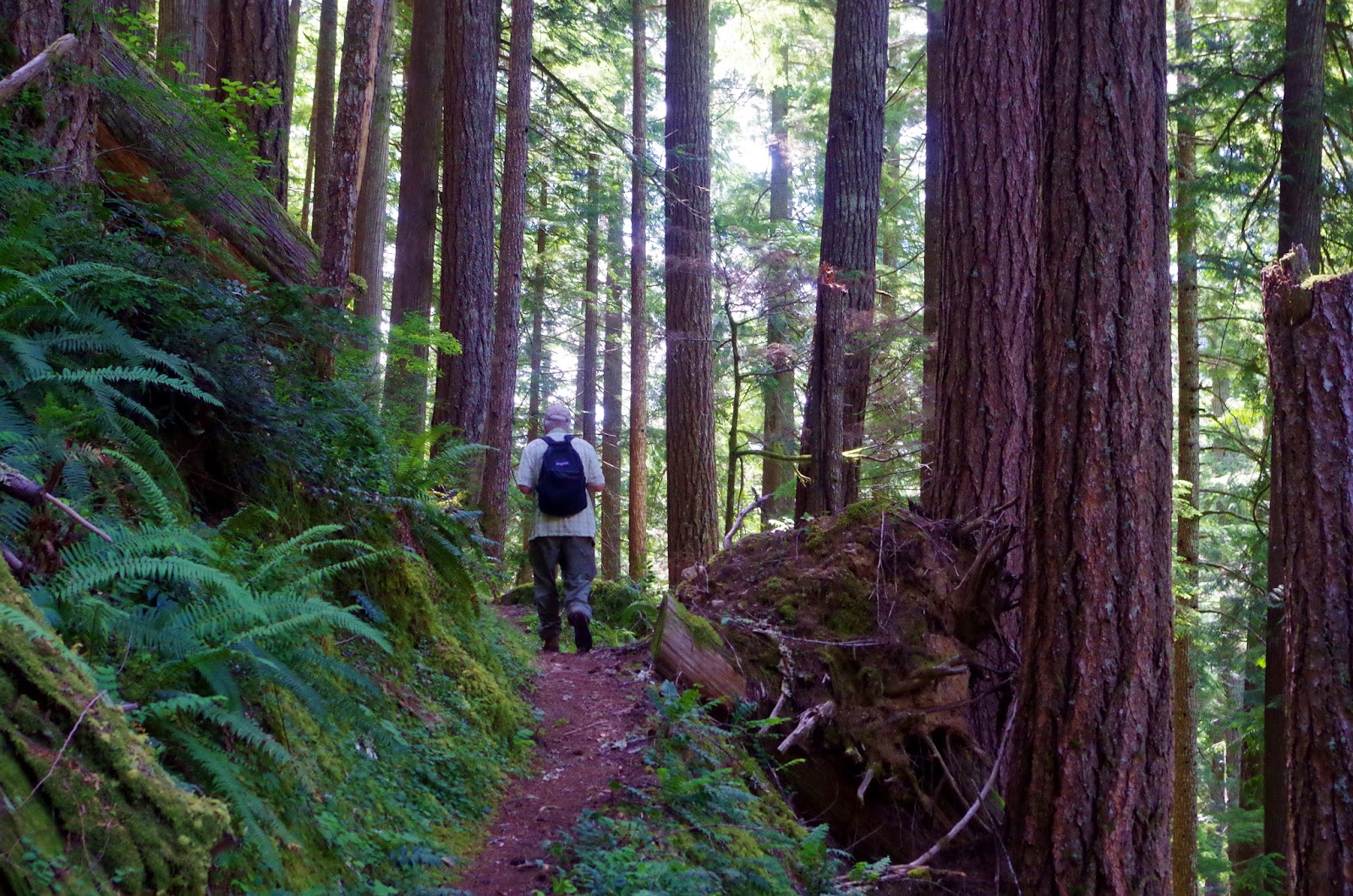
And the woods! Lush, lovely, enchanting, park-like, scattered old growth...this is what the Downey Creek hike is all about.

The masses are no doubt across the valley scrambling up Green Mountain to spectacular views. Here, we wander through the forest skirting steep slopes, crawl over a few big downed trees across the trail, slosh through and over streams, and wish for clouds (well, at least me) so the light would be better to shoot this lovely place.

 |
| Don, Jennifer, and Betty crossed the log. I walked across rocks in the stream. |
As we head up the trail, the elevation gain is pretty mild. Jenifer's GPS, which we don't think was entirely reliable, recorded a total gain of about 1,700 feet (up and down) for the day. The WTA description says a little over 1,200 feet elevation gain. The most consistent uphill is the first half mile before we enter the Glacier Peak Wilderness.
Then the trail traverses a steep hillside, with Downey Creek rushing a few hundred feet below. Thankfully notches have been cut in the two big trees across the trail, so you can step without sliding down the trunk onto the steep slope below.
Particularly lovely were the sections of forest floor covered with moss, like a plush green carpet. (Sorry, I didn't get the best shots due to the sunlight glare.)

About 3 miles along we finally reach some clearings in the forest and draw closer to the creek. Across the creek, the historic fire lookout on Green Mountain is visible far above us. (It's there in the photo below on the right side of the green mountaintop.)

As the trail passes near the creek, it crosses over marshy areas rich with native moisture-loving plants like skunk cabbage, ferns, and devil's club, on boardwalks. This is where the bugs like to hang out. Not too bad today though.

We dine right beside the trail in a mossy spot just above the rushing creek because, of course, there's no one else out here. (Look for a future blog post about trail lunches; I love seeing the variety of food everyone brings.)

Right before the trail leaves the stream again we find a nice clearing with a firepit and some makeshift benches, a perfect campsite. We think we've reached the 4-mile point here, although the GPS says otherwise (3.3 miles).
While the trail continues another few miles (6.4 total) to a steep incline that climbs up to Dome Peak and the southern end of the legendary Ptarmigan Traverse, we opt to turn around here. (The Ptarmigan Traverse is the North Cascades equivalent to the Alpine Haute Route.)
Overall, we estimated either an 8-mile or 6.5-mile hike. My legs told me the shorter length, but a couple others thought it was farther. There aren't markers along the trail, so it's hard to tell since we didn't count the streams we crossed. I'll see if I can figure it out and get back to you. :)
After Hike Eats
By the time we get back to the car and arrive in Darrington, it's around 5 pm and we're all pretty hungry. The proprietor at River Time Brewing recommended the Hawk's Nest sports bar, where they serve his beer along with food.
Gotta say, the burgers and my pork slider are just okay, but the real standout is the Tater Tots. Crispy on the outside, soft on the inside, a Northwest classic. Figure you'll share because the portions are huge. The side order is a pound. Yes, a pound of tater tots.

Hopefully I consumed fewer calories in tots than I burned on the trail.
So have you hiked the Downey Creek trail? Or perhaps even passed through on your way up or down from the Ptarmigan Traverse? I definitely want to go back in the fall, perhaps on a misty morning, armed to shoot with my Pentax.
Happy trails and thanks for visiting Pacific Northwest Seasons! In between blog posts, visit Pacific NW Seasons on FaceBook, Twitter, and Instagram for more Northwest photos and outdoors news.
When You Go
Drive Highway 530 north from Darrington or south from Highway 20 near Rockport. Turn east on FR 26, the Suiattle River Road, and drive to a parking lot on the other side of Downey Creek bridge, approximately 20 miles from Highway 530. The last 10 miles or so of this road is gravel, and watch out for big rocks on the road at about 20 miles along (and a short distance from the parking lot). You need a Northwest Forest Pass to park here.


1 comment:
Jill, great job capturing our day on the trail. It's a beautiful forest. I also appreciate the lack of crowds. Betty
Post a Comment