

Since I consider a ferry ride across the Salish Sea a must for visitors (sometimes you see whales!), I decided an overnight in historic Port Townsend then a hike up Mt. Townsend would be perfect. On a clear day, this mountaintop ridge at the northeastern corner of the Olympic Mountains offers sweeping, magnificent 360 views.
From the summit, you can see downtown Seattle and the Cascades Mountains across Puget Sound to the east, Mt. Baker floating above foothills and islands to the northeast, Vancouver Island in Canada across the Strait of Juan de Fuca to the north, and the craggy Olympics peaks to the west-southwest-south.
Well....on a cloudy mid-July day, the higher we hiked up the mountain, the thicker the mist and fog. By the time we got to the summit, visibility was only about 20 feet.

But still, it was lovely in its own damp, enveloping way. We Northwesterners don't cherry pick the nice days to get outdoors.
Fast forward to a recent beautiful September day—the best kind of hiking day around here. It's not too hot, not too cold. Pesky bugs are done for the year. Our days on the trail before the snow flies at higher elevations are numbered, so a fall hike is especially sweet.
And even sweeter if it starts with a ferry ride during a colorful sunrise.
 |
| Edmonds to Kingston |
From the ferry terminal at Kingston, the drive to the trailhead off Highway 101 near Quilcene took about 90 minutes, some of it on gravel Forest Service Roads. When we arrived at the upper trailhead around 8:30 a.m., a group of volunteers from the Washington Trails Association tried to recruit us to help with trail work. Another time.
Rich green forest thick with rhododendrons encompasses the first mile or two of the hike, although we noticed the rhodies looking droopy, no doubt due our driest summer ever. (Come in May for a spectacular rhododendron blossom display.)

Within a mile or so, the trail starts moving in and out of the woods, revealing views up mountain and down valley. After about 2.5 miles, we cleared most of the forest, and the rest of the hike is through meadows, subalpine trees, and occasional krummholz to the top.
I remember thinking the switchbacks were brutal when I hiked here on a some backpack trips to Silver Lakes, but none of it is very steep. (I think the trail has been regraded a bit since my earlier trips.)


As we crested the up-and-down ridge that runs along the mountain top, we're out in the open, with unobstructed views.
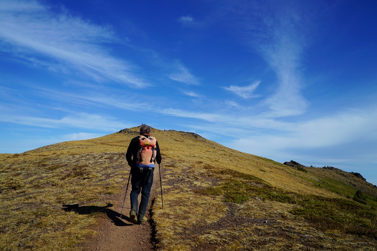 |
| Final push to the summit. |
 |
| End of the line. Looking north, Salish Sea. |
 |
| View northwest. Strait of Juan de Fuca to the right. |
On our way back south along the ridge, we saw a low layer of mist rolling in and wondered if it was fog or smoke from our many forest fires. As it got thicker and brownish, we could tell it was obviously smoke.
 |
| Looking southeast, smoke to the left. |
Some seismologists posit that the subduction zone is locked on the eastern side of the Olympics - that is, directly beneath Mt. Townsend. When the stress builds up too much, the plates will slip and produce a megaquake (9.0 or greater).
I'm glad it didn't during our hike. :)


With the smoke and morning clouds, we weren't able to see downtown Seattle nor much of the Cascade Mountains. Mt. Baker was barely visible above the smog. But no matter, it was still an exhilarating hike and workout.
And on the ferry ride back to Edmonds, I was lucky enough to notice something dark just above the waterline not far north from the ferry. Definitely not a boat. As it submerged I saw the unmistakable fluke tail of a humpback whale thrust up out of the water right before it disappeared. I've spent most of my life here and never before have spotted a humpback in my home waters.
Excellent cap to a splendid day.
Happy trails and thanks for visiting Pacific Northwest Seasons! In between blog posts, visit Pacific NW Seasons on FaceBook, Twitter, and Instagram for more Northwest photos and outdoors news.
When You Go
Elevation gain on this hike is just a tad over/under 3,000 feet (depends on whether you trust your GPS or the WTA trail guide), and mileage is about 8 miles roundtrip. There are several trailheads for hiking up Mt. Townsend, but we chose the upper trailhead, accessed from Quilcene to the east. A lower trailhead starts a little over a mile below and goes through some impressive old growth forest, which I did some years ago.There is also access from the western/Sequim side, but it's a steeper trail.
To access the upper trailhead, take US 101 south from the Quilcene Ranger Station 0.9 mile, the take the slight right onto Penny Creek Road. In 1.5 miles, take the left fork onto Forest Road 27 and follow it 13.5 miles before turning left onto FR27-190. The trailhead is at the end of this spur road, and there's a vault toilet there. Since this is in the Buckhorn Wilderness, east of Olympic National Park, no passes are required to park.


No comments:
Post a Comment