Tuesday, October 26, 2010

Northwest Fall Road Trip: Hiking Naches Peak Loop, Cruising Chinook Scenic Byway

If you time it just right between storms and the first big snows, late October is a spectacular time to hike and explore the Cascades and east of the mountains. This is the first of several posts on my fall road trip to southeast Washington, northeast Oregon, and a teeny bit of Idaho. And just two days after I did this hike, the first big snowstorm hit the Cascades. Close, huh?

As we’re driving east on Highway 410 (Chinook Scenic Byway) on the northern edge of Mount Rainier National Park, the two-lane road climbs and switchbacks up and up to increasingly magnificent views of surrounding peaks and autumn colors. “Ohmygosh, can you believe that big patch of red?” I yelp, pointing to a brilliant slash of scarlet foliage on the slopes above.

Just before we arrive at Chinook Pass, the sun comes out. I can tell this is the beginning of a great autumn road trip.


It’s a perfect day to hike the 3-mile Naches Peak Loop, one of the region’s most popular hikes. (Of course, I’d say every day is a perfect day to hike unless it’s cold and raining or snowing.) On a nice summer weekend, this relatively easy trail with splendid views can get too crowded for my taste. But this late in the season and on a weekday, there’s not many others out here.

Usually I’d say hike this loop counterclockwise to get the best shots of Rainier, but today she’s obscured by clouds. We park at the Tipsoo Lake lot (where my Yakima relatives used to meet us Coasters for family picnics) and cross the road over to the trailhead.

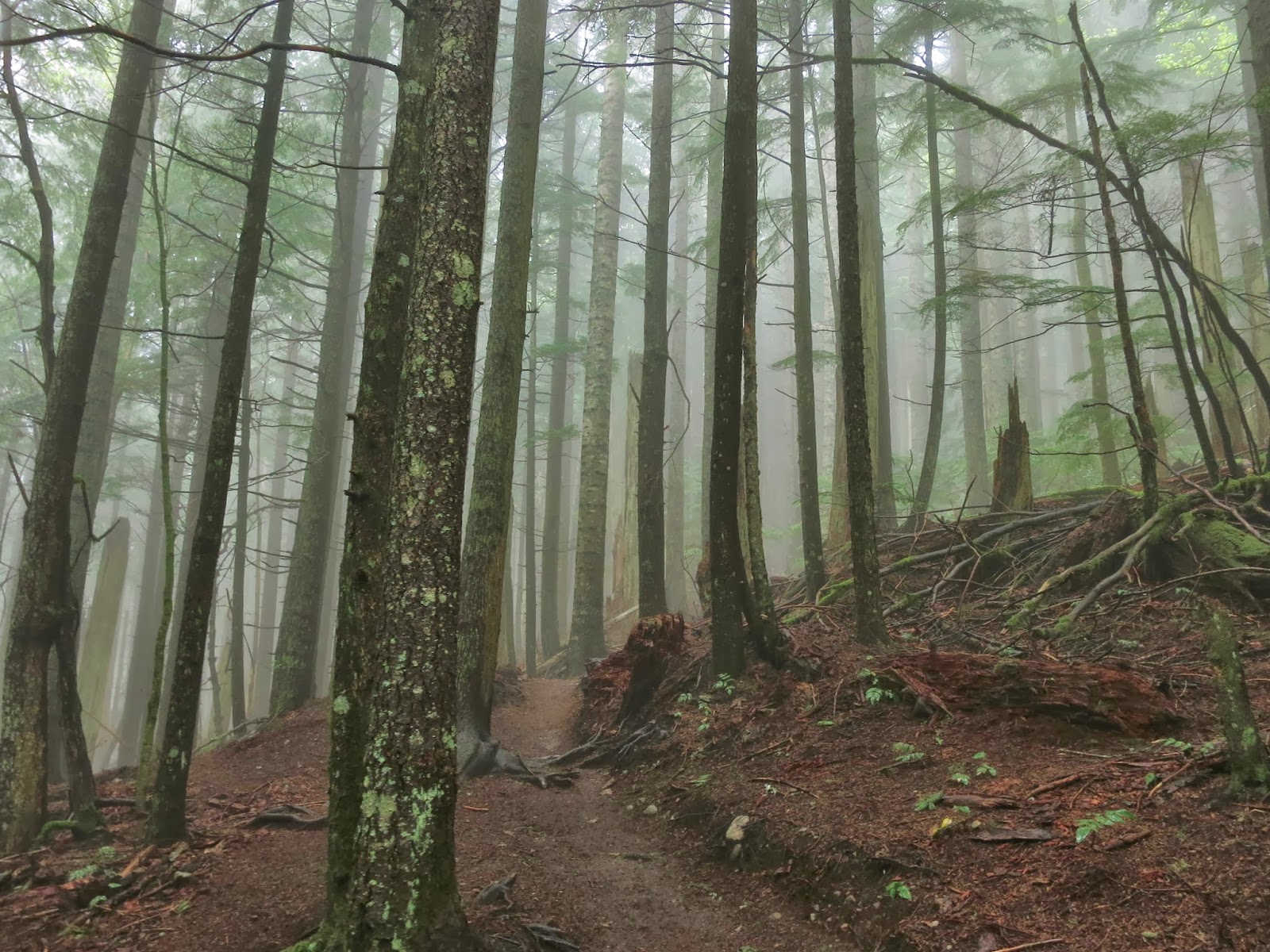
We begin climbing up a pretty mild grade, in and out of forest, until we emerge into open alpine meadows on the back side of Naches Peak away from the highway. Glowing orange, red, and gold along the trail are huckleberries and other alpine shrubs.


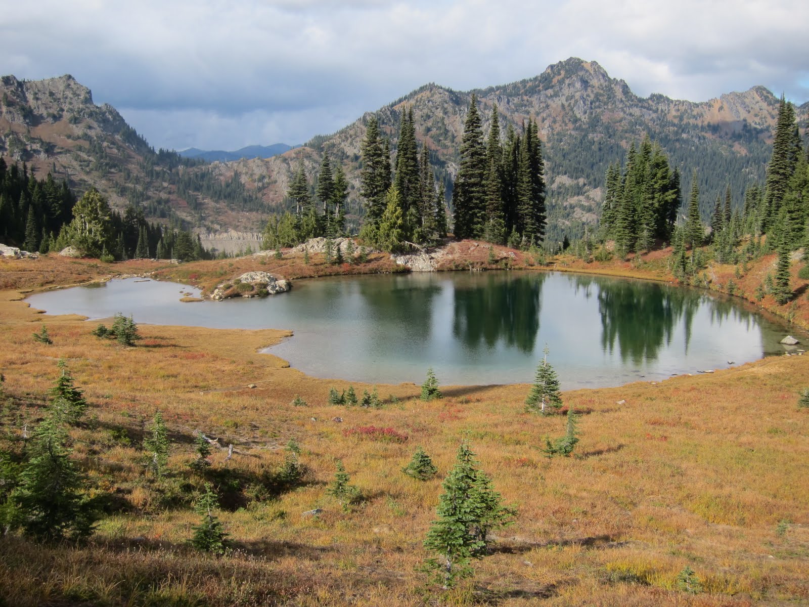
Within a mile or so, we see Dewey Lake to our right several hundred feet below in a glacial cirque, and pass a lovely clear alpine lake just to our left. To the southeast, the forested valley stretches away below us. The going is easy and the scenery is superb.


As we loop around the north side of Naches Peak another mile or so farther on, I pull on my wool cap and gloves. It’s chilly here in the shade, with crunched up ice in the muddy footprints ahead. Yes, there are lots of footprints on the trail, but we pass only a few people today.

After passing through the shady side and starting to loop back toward Chinook Pass, an enchanting alpine lake spreads below like a scene out of Shangri-La. An art director couldn’t have designed a better set to evoke oohs and ahhhs.


At the end of the hike, we cross the highway and descend through a short stretch of forest and come out at Tipsoo Lake and back to the car. Good hike in mountain fresh air.


I’ve never driven the stretch of Highway 410 east from Chinook Pass to Yakima, so I’m excited to travel a new route. Within just 10 minutes of descending east down the pass, I notice the evergreen forests are sprinkled with golden trees.

New England’s fall colors are vivid (yes, I spent a few autumns there), but they’ve got nothing on the Northwest’s golden larches that light up evergreen forests like trees on fire.


“It’s so beautiful!” I keep on saying. Western larches grow in pretty specific areas—between elevations of 2,000 to 7,000 feet on the eastern slopes of the Cascades and mountains of the Columbia Basin and southern B.C. They’re a uniquely deciduous conifer sometimes called tamarack.

As we follow the American River, then the Naches River, the fall colors and scenery continue to give us a good show.


We roll into Yakima about dinner time, and find a Mexican restaurant recommended by a guy we met at a gas station a few miles out of town. I figured with the large Mexican immigrant population, Yakima would have luscious, authentic Mexican restaurants and taco trucks.

Here’s what I learned: While it’s good to get recommendations from locals, it can backfire too. I’m sure there are decent Mexican restaurants in Yakima, but there are bad ones too, like the one where we had dinner (which shall remain nameless – I’m not about dissing anyone and affecting their business). Next time I’ll check on Yelp or Chowhound!

When You Go
The Chinook Scenic Byway begins in Enumclaw and follows the highway through two national forests and Mount Rainier National Park to US 12 in Naches. Chinook Pass is about two hours southeast of Seattle. I recommend hiking the Naches Peak loop on a weekday if at all possible.

Friday, October 22, 2010

Kayaking Shilshole: Exploring Urban Wilds

You have to grab the nice fall days while you can here in the Pacific Northwest. With a light breeze and blue skies, I must take advantage of this lovely day. So I strap my Mariner Coaster on the Subie and head down to Golden Gardens for a quick afternoon paddle.

What's not to love about a few hours on the water on a beautiful day?


I'm lucky to live close to Puget Sound, and Golden Gardens on the northwestern edge of Seattle in Ballard is such an easy place to launch kayaks. I park about 40 feet from the smooth sandy beach where we put in.


Since we don't have more than a couple hours and the breeze is picking up, we paddle south on the inside of the Shilshole Marina jetty past scores of sailboats and catamarans. Clear of the jetty, we turn east towards the Ballard Locks.


"Hey, see the swallow's nests and bird condos?" says Matt, who's visiting from Portland. We don't see any swallows today, but a few seagulls are lounging atop the pilings.


Along the shoreline here it's mostly condos and yacht clubs, but we paddle below the iconic Ray's Boathouse, which is packed today with happy people sipping and soaking in the sun. Maybe we provide a little extra entertainment for them as we kayak by.


It's quick trip and so this is a quick post. Enjoy the quick film clip!

Wednesday, October 13, 2010

Rattlesnake Ledge: Great Workout, Gorgeous Views

With vine maples turning crimson in the Cascade foothills, October is just about my favorite month to be out hiking in the mountains here in the Pacific Northwest. It’s also a good time to train the legs for the ski season ahead.

I used to be all about dashing up and down Mt. Si due east of Seattle for a good sweat-inducing quad, glute, and cardio workout (my record: 84 minutes from the base to the summit). These days I never seem to have enough time to do it all, so instead I often head to Rattlesnake Ridge directly south across the valley for a shorter hike but still a great workout.

I was out there a few days ago with the crowds on a weekend. I generally go earlier in the day so I can park in the small lot on the right side of the road before the main Rattlesnake Lake parking lot.

I follow the dirt road around the end of the lake for about a quarter mile to the trailhead on the right, where the trail starts climbing up mellow switchbacks through lush second-growth forest.


About 5 or 6 years ago, part of the trail up to Rattlesnake Ledge was altered to a gentler grade. So now instead of ascending over 1,000 feet to the ledge in a little over a mile, the trail covers the same distance in about 2 miles. I see a lot more people hiking up to the ledge since the trail regrade, but the trail is in much better shape and less prone to erosion.

When I reach the fork in the trail just below Rattlesnake Ledge, I turn right and scramble up to the ledge for the awesome panorama. Most people stop here.


Straight ahead from the prow of the ledge is Chester Morse Lake in the protected and off-limits Cedar River Watershed, which supplies the City of Seattle with the bulk of its water. To keep the water relatively clean, this watershed has been spared much of the brutal clearcutting that occurred along the I-90 corridor in the latter twentieth century.


Down below, Rattlesnake Lake is more full than normal. I watch for peregrine falcons flying by since they like to nest on the cliffs. I saw one a few years ago, but not today.


I don’t linger too long on the ledge and scoot back down to the fork in the trail and continue up the ridge trail through the forest. Not that many people continue upward, so it’s much quieter up here.


About a quarter mile farther, I duck through an opening in the brush and walk carefully (I repeat—carefully) out to some more rock ledges. Every year it seems at least one person falls to their death off the cliffs (hopefully the recent fatality is the last one for this year.)


In hikes past I’ve continued a few miles farther up the ridge, which you can hike for 11 miles end to end, but not today. I’ve run out of time but got what I wanted – I’m sweating, my legs feel more toned and strong, and I feel great.

When You Go
To get to the Rattlesnake Ledge end of Rattlesnake Ridge, take I-90 about 35 miles east from the Seattle area to exit 32 (436th Ave S.E- Cedar Falls Road.). Go south (right) on Cedar Falls Road for 3.5 miles. (If you continue another ¾ mile, you’ll eventually reach the Cedar River Watershed Education Center.) Dogs are allowed but please have them leashed.

Wednesday, October 6, 2010

Burke Museum of Natural History and Culture: Weaving Magic

I’ve been trying to channel my inner art critic to write about the Weaving Traditions exhibit at Seattle’s Burke Museum, but what keeps on popping into my mind is:

Wow!

I’m used to thinking of the Burke as a place for dinosaur fossils, the Pacific Rim culture exhibit, and interesting photography exhibits about the natural world. But the brilliant splashes of color and texture that comprise the Weaving Traditions exhibit left me feeling as if I’d spent the evening amongst Old Masters at the Louvre.

“We wanted to highlight pieces from our ethnology collection,” says Burke Director of Communications MaryAnn Barron Wagner. And have they ever!


On display in the gallery exhibit space is a stunning collection of traditional weaving masterpieces. According to MaryAnn, the museum has been collecting textiles from the Pacific Rim regions for 125 years. “Textiles are a strong interest of curator emeritus Dr. James Nason in particular, so he has been adding to the collection quite actively over his 35-year tenure at the Burke.” The result is a treasure trove of cultural and artistic riches.


From rustic South American and Micronesian blankets and garments made from wool and bark to exquisite silk Japanese kimonos and Chinese robes, the diverse array of hand-crafted textiles is impressive. Blankets, robes, skirts, and all manner of woven fabrics are artfully arranged from eye level upwards toward the high ceiling. (Thanks to exhibit designer Andrew Whiteman for the well-designed show.)


After passing the bright South American blankets, I linger in front of the Northwest Coast Indian weavings. A vintage Chilkat blanket of traditional form-line design and colors is set above a masterful contemporary piece woven by the Damascus Ravenstail weavers from Oregon.


Then I pass the Southeast Asian group, next to American Southwest Hopi and Navajo blankets. The bold geometric patterns and rusty red, black,and earth tones of the blankets pop out against the whitewashed walls. And the beautiful hand-embroidered Tibetan silk robes shimmer in rich shades of crimson, saffron, gold, and plum.


An especially poignant part of the exhibit is the educational captions for each cultural group of textiles. The boards describe briefly the history of weaving unique to the region, then touch on the uses (often ceremonial along with everyday), and summarize the current state of the art. A repeating theme is that most people now wear western garb, and very few still wear the traditional woven fabrics. Very few.

Sadly, much of this traditional weaving exemplified at the Burke exhibit is endangered, although efforts are being made to revive and maintain the art and craft of traditional weaving throughout the Pacific Rim.


After I browse slowly past the Indonesian batik, Chinese, Micronesian, Japanese, and Guatemalan displays, I study the large wooden looms. Since the Burke is first and foremost an educational institution, videos of traditional weaving are playing, and you can fiddle with a small loom prototype.


Better yet, go on a weekend and see master weavers at work from around the region, or take some of the special weaving classes. The Burke is offering a full schedule of weaving demonstrations every weekend throughout the show (check their website).

"In bringing together this exhibit, we collaborated with many of the local communities of the cultures represented,” explains MaryAnn.

I’m glad to know the Burke is caring for these rich reminders of such artistic and cultural diversity.

When You Go
You can catch the Weaving Traditions exhibit until February 27, 2011. The Burke Museum is at the northwest corner of the University of Washington main campus in Seattle. You have to pay to park on campus, or take a Metro bus, bicycle, or walk.