Sunday, November 23, 2008

Gratitude


I’ll be honest with you. I’ve had a rough autumn. Health issues left me battling chronic fatigue for a couple months. After six weeks of napping alot and working a little, one day I just knew I had to get out and move. In the fresh air. Even if my legs still felt draggy and leaden.

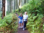
So I started with a 30-minute walk in Carkeek Park near my home in Seattle, shuffling along the leaf-strewn trails. A couple days later I went for 45 minutes. I didn’t feel much better, but I sure didn’t feel worse.

Over the next few weeks the debilitating fatigue gradually started to abate as I increased the pace and distance of my walks. I’m still not 100 percent. But my gut faith in the restorative power of fresh air and exercise out in nature is strong.

One day while walking through the forest, I remembered an article I’d read about the health benefits of keeping a gratitude journal, such as fewer and less severe colds. So I decided to give it a try. For starters, I’m grateful for my morning shower—hot, steamy, and cleansing. And for a soft clean towel when I step out. Many people in the world don’t have that simple luxury.

Once I got started, my mind ran like crazy. I’m grateful for flannel sheets, the raspberries and blueberries that I pick with my niece every summer, the scent of daphne in the spring, shooting stars, a good laugh, good books, good films, good friends, family, pumpkin spice cupcakes, avalanche lilies, the spiraling song of a Swainson’s thrush, persimmons, being raised and living in such a beautiful region...I could go on and on. So could you, no doubt.

So during this holiday season and beyond, may we all be grateful and have fewer colds. Have a wonderful Thanksgiving!

Friday, November 14, 2008

Aberdeen/Hoquiam: A Taste of the Old Northwest


“Here you go, honey!” says our friendly waitress as she places my burger in front of me. Our group of 10 tromps into Lana’s Hangar Cafe for lunch and, undaunted, she gets every order right. This is service with an easygoing smile. We’re in Hoquiam and Aberdeen today for a work-related outing, but that doesn’t mean we can’t have some fun and a good lunch.

Lana’s is located next to Bowerman Airport, a few miles west from downtown Hoquiam on the shore of Grays Harbor. With kitschy Betty Boop artwork and the front grill of an old car mounted on the wall behind the counter, it has a retro diner vibe. We’re tucked into a row of booths with a view of the water.

My cheeseburger hits the spot. The sesame seed bun is fresh and soft, layered with all the right stuff (fresh lettuce, tomato, onion, pickle) and a classic Thousand Island-type sauce, which I supplement with catsup and mustard. Nothing fancy, just a good All-American burger. I didn’t order fries, but I snagged a few from my co-worker Dennis. I’m impressed. Not too greasy, slightly crispy on the outside and soft on the inside—I can actually taste the potato. Dennis is so thrilled with his creamy vanilla milkshake that he asks the waitress, “Do you throw in a special secret ingredient that makes it so good?”

We lucked out with a fairly dry November day in an area that gets twice as much rain per year as Seattle and Portland. “Today is the first day it hasn’t poured in eight days,” a local man tells me as I wait in line to pay my bill after lunch. We all roll out of the cafe full and satisfied.

If you want to get a sense of old Pacific Northwest logging towns that ruled the region 100 years ago, head to Aberdeen/Hoquiam on Grays Harbor. The soggy lowland hills of southwest Washington comprise one of the most productive timber-growing regions in the world, and Grays Harbor towns still support some logging. The legendary old growth trees were mostly cut over 75 years ago. A few timber and pulp mills survive, although at a much reduced scale since the industry peak from the 1920s through the 1950s.

As late as the 1970s, timber was the economic backbone of many small Northwest towns. Aberdeen/Hoquiam has been economically depressed since then, decades before our current recession. With all that rain, gray skies, and unemployment, it’s easy to imagine how the area spawned the raw grunge music of Nirvana’s Kurt Cobain and Krist Novoselic, who both grew up here.

Most travelers just drive through Aberdeen/Hoquiam on their way to Ocean Shores, Westport, Moclips, or other coastal vacation towns. But I say Aberdeen and Hoquiam are worth a visit. Besides experiencing the local culture and the good burgers and shakes at Lana’s, take your binoculars and head to the Grays Harbor National Wildlife Refuge near the airport. This birding destination is one of four major migratory stops in North America and hosts one of the largest concentrations of shorebirds on the West Coast in the spring and fall. You might even spot a threatened species on your way there—logging truck.

When You Go

Aberdeen is 83 miles from Seattle and 143 miles from Portland. From Seattle, take the US 101 exit off I-5 in Olympia. From Portland, cut off a few miles (albeit on a slower road) by taking the State Route 12 junction off I-5 near Grand Mound. To be fair, there are other good burgers to be had in the area. Sources tell me that Clarks Restaurant between Cosmopolis and Raymond south of Aberdeen on US 101 is worth a stop, especially for their milkshakes topped with a scoop of homemade vanilla ice cream.

Friday, November 7, 2008

Salmon Sex in the City


Okay, so it’s sex without touching. But right now you can watch salmon as they shuffle and dance their way up numerous Puget Sound streams to reproduce. In Seattle, Piper’s Creek in Carkeek Park sustains a restored salmon run that’s underway through mid-December. This G-rated event draws kids from schools all over the city as well as curious adults. Have you ever seen spawning salmon up close in a small stream?

As they’ve been doing for thousands of years, fall-run salmon are returning from the Pacific Ocean to their home streams to spawn and die. They wait for the fall rains to kick in, their signal to head upstream. And the fall rains hit us big time this past week.

I hike the forested trails along Piper’s Creek in Carkeek Park year-round, but I look forward to the fall salmon run like a kid excited for Christmas presents. Today I see a pair of salmon in the creek—my first sighting of the season. It’s raining steadily, and water drips from the profuse big-leaf maples and sword ferns that line the creek. The salmon hang in a pool on the edge of the muddy stream, occasionally splashing above the surface. With their shiny olive green and reddish mottled skin, they blend in to the leave-littered creek. The bigger of the two is at least 18 inches long, maybe 2 feet.

These could be coho but are likely chum salmon. “We get a few coho, but the chum do better because they don’t stay in the stream as long and aren’t as affected by the stormwater,” says Jean Murphy-Ouellette, a park naturalist with the Carkeek Park Environmental Learning Center. The sad reality is that although Piper’s Creek runs through a forested ravine, the water flowing into this creek and other Seattle creeks contains traces of toxins from yard and road runoff.

“Wild salmon are nature's main means of returning nutrients from the ocean to the land, completing the essential nutrient cycle that underlies the ecological stability of the North Pacific Rim,” says Bruce Brown, author of Mountain in the Clouds, the seminal book on disappearing wild salmon runs of the Olympic Peninsula. I find it heartbreaking and inspiring that after so much abuse from humans, a few wild runs survive and some restored runs are doing well.

When You Go
Click on the Salmon Seeson page of the Lake Washington/Cedar/Sammamish Watershed website to find a map showing salmon spawning streams in the greater Seattle area. You can also see returning salmon right now elsewhere in the region. Try the Kennedy Creek Salmon Trail on Totten Inlet near Olympia in south Puget Sound to see one of the most productive chum salmon streams in the region. To find out what you can do to help salmon, click on the Puget Sound Partnership Resource Center.

Saturday, November 1, 2008

Sunset City

With backdrop that could have been conjured by a movie set designer, Seattle is a city of spectacular sunsets. While the setting sun drops behind the jagged silhouette of the Olympic Mountains, the expansive waters of Puget Sound or Lake Washington reflect the changing hue of the sky. So where are the best spots around town to catch this splendor?

I remember with vivid clarity the first Seattle sunset that made me gasp for its stunning beauty: it was a warm summer evening as I drove west across Lake Washington on the Evergreen Point floating bridge. Spread before me like a gift was a deep tangerine-pink sky, the cobalt blue Olympics, and the surface of the lake shimmering icy white-blue, lighter than the sky and land above. “Wow!” I yelled to myself several times.

Now I'm a sunset seeker.

With so many great places to watch the sunset around Seattle, it’s hard to suggest just a few. Jump in and share your favorite spots with a comment below!

The deck of a Washington State ferry. Vashon-Fauntleroy, Bremerton, Bainbridge, and Edmonds-Kingston runs are best because they’re all within the shadow of the Olympics. From the ferries (and a few of the bluffs listed below) you get the extra treat of a strawberry-ice-cream-pink Mount Rainier on the southeast horizon.

On a sailboat, power boat, or in a sea kayak on Puget Sound. Be sure your boat is equipped with good lights for the ride back to land after dark.

Any western-facing beach on Puget Sound. Alki, Golden Gardens, and Carkeek are easily accessible beaches.

City parks on hills and bluffs. Try Magnolia Park off Magnolia Boulevard, Highland Place and Kinnear Parks on Queen Anne Hill, the south bluff of Discovery Park, Carkeek Park, the aptly named Sunset Hill Park in Ballard, in front of the Seattle Asian Art Museum in Volunteer Park, and Victor Steinbruck Park at the north end of the Pike Place Market.


Consider yourself lucky if you score an invite to (or live in) many of the homes with views of the Olympics behind Puget Sound. I’ve been fortunate to watch several sunsets from the rooftop deck of a three-story home on Magnolia—most recently while sipping a perfectly mixed mojito. Now that was truly an ahhh-worthy event. You, too, could have a similar experience from, say, the deck at Ray’s Boathouse at Shilshole in the western edge of Ballard.

Don’t think this is just a summer pleasure. Some of our best sunsets are on those cold, clear fall and winter evenings. Grab a blanket, a thermos of hot tea or spiced wine, someone to cuddle with and get out there next time those clouds blow away.

Monday, October 27, 2008

Mt. Hood Scenic Drive, Part 3: Hood River Valley


If you want a perfect apple, you gotta go to the source. Soil laced with volcanic ash, cool nights, and sunny days create an ideal microclimate for growing succulent pears and apples in Hood River Valley. As far back as the 1850s farmers started planting orchards here. This afternoon we’re sampling the valley’s rich bounty.

After descending from Timberline Lodge, we take Route 35 a few miles east of Government Camp. Soon we’re driving down the arid East Fork Hood River canyon. Here on the east side of Mt. Hood, sparse pine forest lines the canyon slopes instead of the dense undergrowth typical of the west side.

When we emerge from the canyon, the Hood River Valley spreads out below us in shades of green, gold, and brown. Farms, vineyards, and orchards lie mixed among fir and pine forests and rolling ridges.

“I’m ready for some apples,” declares my niece. Our first stop is Kiyokawa Family Orchards in the upper valley, a couple miles off Route 35. After passing rows and rows of trees heavy with apples, we park in front of the well-marked farm stand. Large white plastic bins heaped full of apples and pears are lined up inside. I grab a bag and fill it with my current favorite apple—round and red-streaked Honeycrisp. My niece wants oversized Fujiis. My sister goes for the classic Red Delicious and some Bosc pears. In the car, my niece bites noisily into an apple, and I can smell the sweet pungent ripeness on her satisfied exhale.

Several few miles north on Route 35, I see it. “This is the place!” I tell my sister to pull over at Draper Girls Country Farm, where bales of hay piled with pumpkins and bright yellow sunflowers line the parking area next to an orchard. Mt. Hood looms large in the distance, looking elegant and graceful from this angle.

A few years ago I stopped at Draper Girls and want to stock up on their famous cinnamon and sugar-dried apples. Just sniffing these chewy sweet delicacies takes me back to my grandmother’s kitchen. Inside the large open-air farm stand, shelves are packed high with jars of pickles, jams and jellies, spicy chutneys, pear and apple butter, and more. My sister nabs several jars of Northwest huckleberry and blackcap jam to take home to Virginia.

By late afternoon, my niece is ready for a snack. Just above Hood River, the highway curves broadly and we sweep down toward the Columbia River. Wind and kite surfers fleck the river below us like big butterflies fluttering on the surface. Hood River has grown much larger and hipper than the small orchard town I remember as a kid, but the downtown retains its historic charm. We dash into Hood River Bagel Company close to the Route 35 junction so my niece can get a PB&J bagel. (Hood River deserves it own whole post...later.)

We’ve run out of time and need to zip the 65 miles back to Portland through the scenic Columbia River Gorge on I-84. Steep forested slopes and basalt cliffs rise 1,000 feet and more on either side of the Columbia until the river widens just east of Troutdale.

Get Active

Want to burn some calories along the way? Drive 10 miles up a dirt road to 6,000 on the northeast side of Mt. Hood and hike to spectacular views above timberline in the Cloud Cap area. Turn off Route 35 onto the Cooper Spur Road before you reach the valley. After you reach the ski area, take Forest Service Road 3512 to Cloud Cap campground . At this old Civilian Conservation Corps camp (and present-day small campground), walk left as you face the mountain and soon you’ll pass an old wooden amphitheater just beyond the campground. Continue through alpine meadows and upward into the exposed rocky slopes and ridges, where you’ll find an old weathered rock and wood shelter. On a clear day you can see the distant brown stretch of eastern Oregon; glacier-studded Mounts Rainier, St. Helens, and Adams to the north in Washington; and the pastoral Hood River Valley below.

Another thigh-burner is a dash to the top of Multnomah Falls in the western Columbia Gorge. As you’re driving west on I-84, get off at the clearly marked Multnomah Falls exit. Park and follow the signs behind Multnomah Falls Lodge to the trail. The paved path switchbacks up 600 feet in 1.2 miles and tops out just above the lip of the waterfall. Catch your breath on the circular deck just above where Multnomah creek plunges off the basalt cliff. Wear shoes with good traction; the asphalt can be slick even on dry days from seeps in the hillside.

When You Go
For a map of this trip, go to Mt. Hood Scenic Byway. The Hood River County Fruit Loop website shows how to get to the farms and their events. Thanks to www.byways.org for letting me download the photo of Mt. Hood above Hood River Valley by Peter Marbach (Digital Media Library © 2008 Multimedia Data Services Corp.).

Friday, October 17, 2008

Mt. Hood Scenic Drive: Part 2, Timberline Lodge

So many vivid memories from my youth belong to Timberline on Mt. Hood. Where do I begin?

A standout was the last day of ski race camp when I was just 15. A group of us racers and coaches climbed to the base of Crater Rock, which juts skyward below the summit like a massive fang, and skied several miles back down the mountain. While I tried to keep up with the mostly stronger skiers, including some former Olympic racers, the cold air tore through my light parka and teared up my eyes beneath my goggles. My teeth and skis chattered as I skidded fast and almost out of control over frozen sun-cupped snow. I was so happy to finally glide to a stop just above the lodge, my thighs and lungs burning. A few decades later, I'm still happy to come back to Timberline.

On this late fall afternoon, it's time to head up to the lodge and check in for the night. Leaving Government Camp, we turn off US 26 onto the Timberline road, which winds six miles up the mountain. As we climb higher, the Douglas fir forest transitions to smaller alpine firs, until we top out at elevation 6,000 feet, timberline at this latitude. A brisk blast of fresh mountain air hits us as we park in front of the lodge and hop out.

I’m in love all over again as we haul our bags into this vintage 1930s-era ski lodge. Timberline is a majestic testament to the artisans and craftsmen who built it as a Worker’s Progress Administration/Civilian Conservation Corps project during the Great Depression. President Roosevelt even came to Timberline to dedicate the lodge in 1938. An enormous circular stone fireplace anchors the central great room, with two wings on either side. Massive timber beams indicate Timberline was built when old growth Douglas fir was plentiful in the Pacific Northwest.

High-paned windows reveal a close up view of the mountain summit looming above. The jagged and imposing rock formations near Mt. Hood’s crown could be the Hall of the Mountain Kings of Norwegian folkore.

Timberline is a bit of an aging movie star itself. Although the lodge isn’t haunted, the outside was featured in the 1980 classic horror movie The Shining, based on a Stephen King novel. As a kid staying at Timberline for ski race camp, I shared the lodge with a Hollywood film crew for a pretty bad and mostly forgotten remake of The Lost Horizon.

“Hey, I’m smallest so I get the smallest bed,” says my niece as I head for the twin in the cute little nook in our room. So my sister and I share the double. With handmade bedspreads, rough-hewn wooden bed frames, and wood-paneled walls, the décor is straight from the 1930s, warm and inviting. We all sleep well.

"Mom, I'm hungry for a real breakfast," says my niece when we wake up to another brilliant fall day. We join other hikers and tourists in the lodge’s rustically elegant main dining room and splurge on the full buffet brunch. Eggs, waffles, muffins, sausage, fruit, pancakes, potatoes, oatmeal, granola, yogurt—it’s all there and all tasty. We don’t need lunch today.
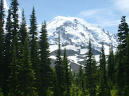
After breakfast we hike up the mountain on the trails above the lodge. In fact, the Pacific Crest Trail skirts behind Timberline along the Timberline Trail that circumnavigates Mt. Hood. When I was 17 I backpacked the 41 miles around the mountain on the trail, starting and ending at Timberline. My badge of honor was a huge blister covering the whole arch of my right foot.

“Snow!” cries my niece as she takes off toward a remnant patch of crusty old snow in a big gully slicing down the slope. An hour later I’m racing her across the heated pool that was a later addition to the lodge. Then it's time to pack up and continue our journey. Next Post: Part 3, Northeast to Hood River.

When You Go
Timberline’s rates are comparable to a nice Portland hotel. We paid $155 for our room—a good deal considering it’s a National Historic Landmark full of beautiful art and craftwork. To view a map of this trip, click on Mt. Hood National Scenic Byway .

Tuesday, October 14, 2008

Mt. Hood Scenic Drive: Part 1, Heading East


Lots of adolescent girls have a passion for horses, but my passion was volcanoes—the glacier-covered, dramatic Cascade volcanoes. My main squeeze was Mt. Hood (or Wy’east as the natives called it), just an hour’s drive east from my childhood home near Portland. I climbed up and skied down its slopes, backpacked around it, slept in its alpine meadows, and floated down rivers sourced from its glaciers. One of my favorite ways to reconnect with “my mountain” is the Mt. Hood Scenic Drive that loops around the mountain.

My sister, niece, and I do the loop on a late September weekend, with an overnight at historic Timberline Lodge high up the mountain. During the fall you pass blazing crimson vine maples up near the mountain, and farm stands full of fresh apples and pears above Hood River. If you go before the ski season kicks into full gear (usually mid to late November), you’ll find fewer crowds. (As of October 12, Timberline already got some new snow, with limited skiing on the Palmer Lift.)

East of Sandy on US 26, we lose the suburban strip malls and developments and drive along mostly tree-lined roadway past the villages of Brightwood, Wemme, Rhododendron, and Zig Zag and into Mt. Hood National Forest. Just past Zig Zag, the road starts climbing towards Government Camp. Soon Hood comes into full view, surprising in its craggy closeness.

My sister is on a mission today. She wants a maple bar at Huckleberry Inn in Government Camp, the ski-focused community of cabins and condos at 3,500 feet on Hood’s south flank. Huckleberry Inn has been here for decades and retains a classic Americana café vibe. Their motto is "A cup of coffee and a slice of that world famous huckleberry pie has drawn visitors up the mountain for years." We grab stools at the counter and order a maple bar and huckleberry shake to share. (This is a definitely a nostalgic, not a nutritious snack.) The maple bar is HUGE (we can’t finish it) but soft and wonderful, without the typical greasy fried dough aftertaste. We spoil our dinner. Next post: Part 2, Topping out at Timberline.

When You Go
To view a map of this trip, click on Mt. Hood National Scenic Byway . I usually start by heading east on U.S. Route 26 in Gresham, turning northeast on Route 35 around the east side of Hood and heading down through the Hood River valley, then returning west toward Portland on I-84 through the Columbia Gorge (a little over 150 miles total). The beginning of this route has variations, and the official Mt. Hood National Scenic Byway starts in Troutdale and joins US 26 in Sandy. You can do this in a day from the Portland area or make it a leisurely overnight. Or two overnights if you want to stay up at the mountain, then stay another night in the Hood River area. Hey, you could even make this a several day trip with all the hiking and sightseeing along the way.

Tuesday, October 7, 2008

Whidbey Island Winery: Zen and the Art of Grape Harvesting


Autumn has blown in sunny rainy windy cloudy crazy here in the Pacific Northwest as usual. Orchards and vineyards are in full-on harvesting mode, and for some farms that means extra help is needed for short bursts. With many wineries in our region, opportunities to get in on the action are abundant.

I decide to connect with the spirit of my farming ancestors and sign up for this weekend's grape harvest at Whidbey Island Winery near Langley. We spend a morning picking grapes—then we get fed a catered lunch with all the wine we care to drink. I'm good with that. In fact, I'm great with that. I learned a few lessons along the way though.

Lesson #1: Check the ferry schedule—carefully. Duh. This should be a no brainer, right? I live so close to Puget Sound that I can often smell the salty sea air. I ride ferries a lot. Julie and Mary Ann arrive at my house at 6:45 (a 6:00 a.m. alarm is especially brutal on a Sunday morning). We pull into the Mukilteo ferry terminal for the 7:30 ferry. We’re first in line. For good reason. There is no 7:30 ferry on Sunday. We wait 40 minutes for the 8:00 ferry.

Elizabeth Osenbach, who owns the winery with her husband Greg, says of the turnout today, “It’s incredible. We couldn’t do this without the volunteers because we’re a small operation.” Last year I couldn’t get anyone to join me. This year five friends jump at my invite.

Elizabeth instructs our motley band of 20 volunteers to gather ‘round just outside their main building. “Welcome and thanks for coming!” Today we're picking Madeline Sylvaner, the primary grape in their fruity, fragrant Island White blend. We follow Elizabeth down to the lush green rows of grapes and get a quick lesson in harvesting. “A few moldy grapes are okay, but not if it’s over half the bunch.”

Lesson #2: If it rains the night before, bring your rain gear. Double duh. Rain pants and jackets are like a second skin to an outdoorsy Mossback between September and June. And grape leaves full of raindrops shed lots of moisture when you’re rooting around searching for grape clusters. My jeans get soaked.


Three hours pass quickly, and soon we’re hosing down the big plastic buckets and scraping mud off our shoes. Then we mill around patiently while Beth the caterer sets up the wonderful feast on the lawn. The lavish spread includes salads, fruit and cheese (it’s a winery after all!), black bean and chicken burrito fixin’s, and sweet Marion berry pie and brownies. The food is divine. Huge kudos to Beth ! An early fall windstorm knocked out power on Whidbey the day before, and she had to get up before dawn to prepare everything before our noon lunch. And of course the wine with lunch is fabulous

Lesson #3: Just pick grapes. (Okay, this is where the Zen comes in.) When you’re picking grapes, don’t fret about things like getting wet or losing a half an hour of sleep. Just pick. Breathe in the aroma of sweet ripe grapes and rich brown earth beneath your feet. Listen to the toad ribbets echoing from the forest behind the vineyard.
Enjoy the weight of a fat cluster of grapes dropping into your hand as they release from the vine with a thonk of your clippers. And know you’ll enjoy the fruits of previous year’s labors very soon with lunch. Salud!

When You Go
The bigger wineries mostly use paid labor for harvests, but smaller wineries often rely on volunteers. Check out the growers on the Washington State Wine Commission or Oregon Wine.org websites.