Wednesday, September 16, 2009

Pacific Northwest Seasons: Has it really been a year?


It seems like just a few months ago that I posted my first piece about a hike to Snow Lake in the Alpine Lakes Wilderness. But today is the first anniversary of Pacific Northwest Seasons. Already?

Yea, I was a little hasty in putting up those first posts before I got a better sense of this whole blog thing. Thank goodness I’ve since sought layout and design input from Macenka Design (thanks Mary!) and writing/editing feedback from a few experts (thanks to Lisa, Andy, and Stephanie).


My goal for Pacific Northwest Seasons is to share my love of getting out and enjoying this region—both indoors and outdoors—and to build a consistent body of work. To be honest, I don’t have much patience or time to submit query letters and pitch freelance articles.


So I just do my own thing here. If I motivate you to try some of these “adventures,” so much the better.


And you know what? I’m really enjoying myself. (I hope you enjoy visiting this site too.) Sometimes I just can’t wait to get home from a great kayak trip, hike, tea house, or local event and write about it.


Then sometimes I let adventures simmer for a few months before I’m inspired to write. And, I’m the first to admit, what I write is not always that inspired.


Between juggling almost full-time environmental consulting and contract work, I try to squeeze in a post a week…but sometimes I’ve slipped to almost three weeks between posts. Thanks for hanging with me!


A few of you have suggested a book (you flatter me beyond words)…we’ll see. But in the meantime, I’d love to hear more from you.


Do you find this site a helpful resource for ideas of things to do or when planning to visit the region? Anything else/more you’d like to see (or not) here? What are your favorite (or least favorite) posts here and why? Just click on the Comments link below at the bottom of this post and type away—it’s really easy.


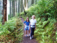
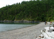
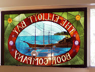
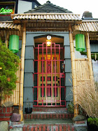
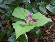
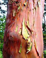
Hope you enjoy some of these random shots from my local adventures over the last couple years. Stay tuned for more sea kayaking and island outings soon. And have a great fall—my favorite time of year.

Happy trails,
Jill

(And thanks to Andy and Don for taking a couple of the shots on today's post!)

Thursday, September 10, 2009

Mount Rainier National Park: Beating the rush to Tolmie Peak


Where there’s a fire lookout on a peak in the Cascades, there’s sure to be amazing views in every direction. If you want a moderate hike through lush green forest, past fresh alpine meadows and lakes, and with stunning close-up views of Mount Rainier, you can’t do much better than Tolmie Peak fire lookout. But with all this splendor, is it a tad crowded on a nice weekend?

The Trip There
We leave Seattle around 8 a.m. on a foggy Sunday morning. I just know we’ll clear the fog by the time we get to Mowich Lake at almost 5,000 feet on the northwest flank of Mount Rainer. Since it takes about 2 hours to drive there, we’ll be lucky to find a parking space and share the peak with the masses, as guide books suggest.


En route to the Carbon River park entrance, we go through the increasingly small towns of Buckley and Wilkeson, passing forest-fringed pastures where horses and livestock roam. After crossing the fragile-looking old bridge over the narrow Carbon River gorge, the last 17 miles or so is unpaved road. Much of this is through extensive clearcuts that resemble a barren war zone of denuded ridges—or what I think a war zone might look like. When we hit the entrance to Mount Rainier National Park, thankfully the forest returns.

The Destination
With Julie’s good parking karma, we score a spot near the lake. True, lots of cars are already here, but it’s also the trailhead for the Spray Park hike. When we find the trailhead and start skirting around the translucent blue waters of Mowich Lake, it’s about 10 a.m. We lose the crowd as soon as we leave the parking area.


The Hike
Soon we’re in forest, where the trail winds up a gentle grade and drops on the other side of a ridge. From there it’s another 30 minutes of fairly level traverse. The hiking is pleasant and easy here. We pass a few large columnar basalt outcrops along the trail, reminders that we’re on the fringes of a massive volcano.

At 1.6 miles, we reach a junction and cut off toward Tolmie Peak instead of continuing to Ipsut Pass on the Wonderland Trail that circumnavigates Rainier. “Wait a minute! We’re not supposed to be going down to go up to the peak are we?” I kvetch as the trail heads downhill. We drop about a hundred feet and then the trail resumes climbing steadily through the mostly Douglas fir and spruce forest.


After another 20 minutes or so we emerge from the forest into a series of rolling alpine meadows, with wildflowers like purple lupine and bright orange Indian paintbrush sprinkled through the native grasses. Beyond the dwarf fir trees I catch a glimpse of another sapphire blue lake. “That must be Eunice Lake,” says Julie. “And that must be the fire lookout.” I squint upward and see a square, two-story wood building at the top of the rock ridge almost 1,000 feet or so above the other side of the lake.


The Summit
At first the thought of climbing up there seems daunting, but it’s really not bad at all. We angle up a few long switchbacks past the meadows and weave in and out of forest. As we ascend, the views down to Eunice Lake and across to Rainier just get better and better.


We scramble up the last incline to the fire lookout, expecting a crowd, only to find there’s nobody else up here.


It’s about 11:30 a.m. on a beautiful late summer weekend. Julie’s hiking book wrote almost derisively about the gobs of people to expect here.

“Hey, where is everybody?” I ask Julie, as if she knows.

Although the wooden steps up to the wraparound lookout balcony look a bit dicey, we clomp up anyway, drop our daypacks, and sit down, legs dangling over the edge.


I can’t believe I’ve never been here before. Mount Rainier is so close that the waterfalls coursing down its crevasse-scarred glaciers are visible. Spectacular!


Within 15 minutes, a couple tromps up and joins us on the balcony. Then another older couple shows up a few minutes later…then a few more.


By the time we’ve relaxed a bit, taken lots of pictures, reveled in the glorious views, munched our lunches, and head down there’s maybe a half a dozen others up here. We beat the rush, but it’s really not that bad anyway. In fact, it’s great.

When You Go
The round trip hike from Mowich Lake is about 5.6 miles (the distance varies on maps, but figure between 5.5 and 6 miles round trip) and climbs a little over 1,000 feet. Go early if you can on a weekend to have the place to yourself. The entrance fee to Mount Rainier National Park is $15/day, which you have to stop and pay at an unmanned entrance pullout. Remember to bring insect repellent since bugs love alpine meadows and the potential sources of food (you) traveling through them.

Thanks to hiking/kayaking/skiing buddy extraordinaire Julie for letting me use a few of her shots on this post!

Friday, September 4, 2009

Along the Cascade Loop: Orchards, Rivers, and Sunshine


With the apple harvest kicking into full gear and the leaves starting to turn gold and scarlet on the mountain passes, September is a brilliant time to head over the Cascade Loop. Take at least three days if you can. This is the third and final installment about my trip around this scenic drive earlier this summer.

Although I’m on the drier, eastern side of the Cascades, much of my drive along the Cascade Loop today is along water: the Methow, Columbia, and Wenatchee rivers, and Lake Chelan. The Columbia River Basin—a land of prolific orchards and farms—was reshaped by irrigation from the mighty Columbia and its tributaries. Not so good for the once abundant wild salmon runs (actually terrible), but a boon to agriculture. It’s all about water rights over here. And lots more sunshine than west of the Cascades.

Day 3
Meandering down the Methow
After two rejuvenating nights at Sun Mountain Lodge above Winthrop, I head south down the Methow Valley. Through a quirk of ice ages past, this lovely valley extends over 60 miles from the North Cascades down to arid upper Columbia River steppes.


Along the way I pass pastoral ranches, shrubby range land, hillsides dotted with orchards, narrow dry gulches, and historical marker signs from the valley’s silver mining days.

My first stop is the Cinnamon Twisp Bakery in “downtown” Twisp, a two-block stretch of low-rise buildings. I knew word had gotten out about this great place when I spotted someone wearing a Cinnamon Twisp T-shirt on a flight from Chicago to Richmond, Virginia. The bakery has expanded since I was here in 2005.


Now they offer cafe fare too: sandwiches on fresh-baked bread, salads, pizza, homemade soup, and more, made using as much organic and local ingredients as possible.

Since I’m in no hurry and it’s a glorious sunny day, my next stop is just outside the town of Methow, where the valley narrows. I wander down to the river, sit on a log, and squish my toes in the cool white sand while some kids splash in the water nearby.


Toward the mouth of the valley, the Methow widens before it flows into the Columbia. The Homestead roadside farm stand looms ahead on my right, so I pull over again. Since I’m a smoothie fanatic, I order one of their berry smoothies made from fresh seasonal fruit. I enjoy the thick and frosty smoothie in the shade of their verdant orchard overlooking the river.

Can you believe that rich berry color?

Swinging through Chelan
I turn south onto State Route 97 and drive along the western bank of the Columbia River. Here the once wild river is basically a series of reservoir lakes between dams. It’s still a dramatic landscape, though, with brown hills rising hundreds of feet on either side of the river. For another scenic diversion, I take the junction just past Chelan Falls up to the town of Chelan at the south end of Lake Chelan.


I’m due in Wenatchee in a few hours, so I just drive through town and stop briefly to visit some friends who live up the First Creek drainage. Chelan used to be primarily an orchard town but now is a major vacation destination, with second homes sprawling farther north up the east side of the long, narrow glacial lake.


From Chelan, I wind back down to the Columbia River via Highway 971, which travels through a lovely ponderosa pine-stippled canyon and past some small farms before descending to the river.

Bicycling the Apple Capitol
Tonight I’m staying in Wenatchee with my friend Lesley, amazing athlete and all-around renaissance woman. So I’m not surprised when she gets home from a long day at work and asks, “Want to go for a hike in the hills above town or go bicycling?” On this warm summer evening a bike ride sounds more refreshing, so I opt for a ride along the 13-mile Apple Capitol Recreation Loop Trail.

We cycle downhill several blocks and hop on the riverfront trail in downtown Wenatchee. On this side of the Columbia, the mostly flat paved trail cuts through neatly landscaped lawn along the river.


As we clear town on the west side of the trail, we peddle furiously up a few switchbacks to a bridge and cross the river to East Wenatchee. Over here the trail passes through more a natural, arid landscape, with nice views of Wenatchee and hills across the river. The whole loop ride takes us about 45 minutes. As we’re cycling back uphill through Wenatchee, we slice through soft, dry evening air. Perfect.

Day 4
Heading over Stevens Pass
My drive back west over Stevens Pass is scenic but faster-paced than my meanderings yesterday. I’m disappointed to find the Anjou Bakery on State Route 2/97 in Cashmere is closed today. Lesley raved about their pear tarts and other wonderful pastries. I stop briefly in Leavenworth, but on a weekday morning this Bavarian-themed tourist town feels like a party that was over hours ago. I slow down while driving through the narrow Tumwater Canyon just beyond Leavenworth, where the mountains rise steeply on either side of the Wenatchee River.


After crossing Stevens Pass and heading back to “the coast,” I make one more stop in Index for another good berry smoothie at the Espresso Chalet. If any of you remember the John Lithgow film Harry and the Hendersons, numerous scenes were shot here. Besides good smoothies and coffee, the view of Mount Index from this spot isn’t too bad either.


When You Go
Here is a map of the Cascade Loop. You can break your trip down into longer stretches; for example, take a few days to soak up the sun and water ski at Lake Chelan. Or stay at Sleeping Lady Resort on the outskirts of Leavenworth and do some rock climbing or hiking on one of the many challenging trails up Icicle Creek Canyon. Detour off the highway west of Stevens Pass into the town of Index and go for a river rafting trip down the Skykomish River with WaveTrek (limited by season of course). There are many possible variations. Enjoy!

Wednesday, August 19, 2009

Lopez Island’s Chadwick Head: An Antidote for Stress

I recently spent a perfect afternoon on the summit of Chadwick Head. I can’t think of a better place to unwind and let your worries float away. And there was nobody else here this lovely August day.


When I arrive on Lopez Island, I make a beeline to Watmough Bight on the southeastern edge of the island. After parking at the end of the gravel road, I walk through the tunnel of leafy green trees to the beach.


A father and son kayak past in the tranquil bay as I walk along the beach.


Just shy of the rock wall at the other end of the beach, I hop over a few driftwood logs and cut inland on a narrow trail through the tall shrubs. Soon I’m in the forest where Chadwick Head rises steeply to my right.


About 10 minutes into my hike I stop and gaze over the natural wetland behind the beach.


After angling up the hillside along the loose trail, the forest clears into a series of rolling brown meadows interspersed with madrona and pine trees. Surely I’ll see other people up here on this sunny afternoon. But it’s just me and the ravens and dragonflies.

Remember the opening scene in the Sound of Music where Julie Andrews flings her arms wide and breaks into song on an Alpine hilltop? That’s what I feel like doing up here.


I meander along the hilltop until I go as far as I can. Below the hill drops away into the forest and azure waters of Rosario Strait beyond. I settle on the ground at a comfy spot just below a rocky outcrop.

Then I just sit.


After a while I pull out the Tao te Ching and read some ancient words of Lau Tzu. This one strikes me today:

One who lives in accordance with nature
does not go against the way of things
He moves in harmony with the present moment
always knowing the truth of just what to do


I decide the truth of just what to do right now is to just breathe in the fresh clean air and exhale my pent up stress about work, money, family, life. Because this is my life at the present moment, and it’s pretty sweet.

I lean back against a rock and take in the view below. Across the strait lie several forest-covered islands—Burrows, Allen, Fidalgo, and northern Whidbey.


From the north a huge oil tanker comes cruising past not that far offshore, sinister-looking in its scale and contrast to the natural marine setting of the San Juan Islands.


Then I hear a loud slap and splash in the water a few hundred feet below and see a white circle of bubbles rise to the surface. Perhaps it’s a seal or sea lion trying to stir up some fish or just messin’ around.


Drowsy with all this pure island air and sunshine, I close my eyes and drift into a light sleep. I’m awakened by the drone of a small propeller plane, which dips its wings and heads straight in my direction, passing just a hundred feet directly above me. I think the pilot saw me.

A few hours pass and it’s time to head down to meet up with some friends. I see a makeshift swing someone has rigged onto the strong branch of a gnarled pine tree. It’s a little high, so I have to leap up onto the seat, which gets me really swinging. Now this is moving in harmony with the present moment. I highly recommend it.


When You Go
There are no signs to Watmough, but it’s not that big an island. Eventually you’ll find your way there. Click here for a map of the island showing Watmough and here for another more detailed map. Since this is a nature preserve and valuable ecosystem, be respectful of this special place and leave no trace when you leave.

Monday, August 3, 2009

Lummi Island Kayak Camping : Get some Solitude

You don't have to travel far from the city here in the Pacific Northwest to get away and revel in Nature's embrace. Head to most any Salish Sea island, and you'll find that crossing the water from the mainland quickly takes you worlds away.

On a warm August weekend, a friend and I kayak to Lummi Island, the most northeastern of the San Juan Islands, for an overnight camping trip. For being so close to Bellingham and a short ferry ride from the mainland, the south end of Lummi feels surprisingly remote.

Putting in and Taking Off
On Saturday morning with a light wind at our backs, we haul our sea kayaks down to the beach at Gooseberry Point just north of the Lummi ferry terminal. We’ll paddle about 6 miles south down Hale Passage to the rustic but lovely Lummi Island Department of Natural Resources site.

After we manage to stuff all our camping gear (and ourselves) into the kayaks, we shove off into the water. (Packing and loading a kayak efficiently for camping is an art that I’ve not entirely mastered.) Today we’re lucky to have fairly benign water, with minimal currents and not much chop. Conditions in Hale Passage can be tricky and dangerous for kayakers, so we time our trip to avoid the peak flood current. With strong tidal currents moving around Puget Sound’s many islands, always check the tide charts before any paddle—something novice paddlers often neglect to do.

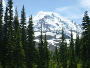
Lummi lies directly across the mile-wide passage from Gooseberry Point, but with the strongest flood current in the middle of the channel, Norm suggests “Let’s angle across to catch as much current as possible.” As we reach the Lummi Island side of the passage, Norm points out the dramatic topographical difference between the relatively flat northern half of the island and the hilly southern half. “There’s a thrust fault extending midway through the island,” points out Norm, who happens to be a hydrogeologist. Southern Lummi is a long, forested ridge with rocky headlands that plunge steeply into the water—especially on the west side of the island. It’s also a 661-acre Natural Resource Conservation Area mantled with mixed-aged forest of mostly Douglas fir and madrona trees.
Arriving
“We’re here,” says Norm after a few hours kayaking along the mostly undeveloped, forested shoreline. We pull into a lovely little tree-lined cove, pull off our cockpit spray skirts, and climb out onto the rocky beach. With government budgets slashed, the Lummi DNR marine campground is maintained largely by volunteers from WAKE (Whatcom Area Kayak Enthusiasts) club. Thanks WAKE!

I start pulling dry sacks out of my kayak and piling them on the beach, then need several trips to ferry gear up the steep steps to the campsites nestled in the forest above. “Does this spot work for you?” says Norm as he nabs a campsite with a picnic table and a peak-a-boo view down to the cove through the trees.

Exploring
When our tent is up and gear stashed inside, we paddle another mile to the south end of the island and up the west side to explore. At this end of Lummi, there are no decent landing spots along the steep, rocky cliffs.

As we approach the very southern tip of Lummi, several forest-covered islands to the south come into view—Samish, Guemes, Cypress, Vendovi, and Sinclair. Even though it’s close to slack tide, there’s still a strong, choppy eddyline to cross as we round the end of the island. Adrenaline courses through me as I power paddle through the squirrely water and the lowering sun hits me full in the face. Be careful if you venture here—an experienced solo kayaker died a few years ago here after he capsized in the strong currents.

For the next hour we mosey up the western shoreline past wild, untamed, and precipitous rock headlands. A few miles west across Rosario Strait looms the blue silhouette of Mount Constitution on Orcas Island. Visible in the distance beyond Orcas are the mountains of Vancouver Island. On the southern horizon are the Olympic Mountains, backlit by the lowering sun.

Only one power boat and three other kayakers are out here on this warm summer weekend evening. We pass them and soon they’re gone. I’m always amazed at the solitude you can find at beautiful spots in this populous region.

“Keep your eye to the south end of the island,” says Norm as we turn around and head back south. “The Alaska Marine Highway ferry should be passing by pretty soon.”
In a few minutes the big white ship comes barreling around the south end of the island a quarter-mile or so away. Soon it recedes to the north. We both decide that rolling our kayaks on that boat and heading to Alaska is a dream trip.

Returning
Another warm morning greets us after a fitful night sleep—I rarely sleep well camping, although I love to camp. Go figure. We pack up the kayaks and head back north, but today we’re battling the tide and wind. Still, it could be much worse. Three hours and sore muscles later, we’re back at Gooseberry Point, tired but happy.

When You Go
Be sure to check the marine forecast and current and tide tables if you plan a paddle to Lummi. And go early on a weekend to snag a good camping spot. Bring your own water since it’s a rustic, dry campsite. And leave no trace when you leave!

Thursday, July 30, 2009

Gone to the Berries


Okay, too hot here in Ecotopia for me! July has been about work, but I did manage my annual trip out to Carnation in the Snoqualmie Valley to u-pick raspberries and blueberries, now tucked into zip-lock bags in the freezer.

Raspberries are done for the season, but you can still pick blueberries each weekend well into August at Henna Blueberry Farms on the Fall City-Carnation Road. Tip: For the best frozen berries, take the time to rinse and then freeze them individually on a wax paper-lined cookie sheet before putting your berries in the freezer bags. And here's my "recipe" for one of my favorite ways to use the bounty. Be creative and improvise your own favorite:

Northwest Berry Smoothie

Throw the following into a blender:

1/3 frozen banana
handful mixed frozen local raspberries
blueberries
strawberries
or maybe blackberries!

1/3 cup lowfat plain yogurt (I like Nancy's)
1/2 cup organic apple juice
1T ground flax seeds

Blend until smooth and creamy. Enjoy!

(I personally like my smoothies thick enough to need a spoon.)

Check back in the next couple days for my next post about sea kayaking to Lummi Island. In the meantime, keep cool!