Wednesday, September 23, 2015

Quiet Time on the Trail

Have you ever tried hiking in intentional silence? 

Whether you meditate or not, taking that intention out into the woods or mountains is a powerful sensory experience. I guarantee you'll notice your surroundings with a sharper focus.

Every few months I lead a silent meditation hike somewhere out in the Cascade foothills within an hour or two of Seattle. 

We talk and laugh on the ride out and back, and sometimes stop for a snack afterwards. But when we start hiking, for the next few hours we refrain from conversation. 

Often we're wrapped up in our thoughts, but everyone is encouraged to just walk and take it all in as we go.


This past Sunday we were out hiking in silence on what was forecasted to be a blustery, wet afternoon. I considered cancelling, but everyone was game so we went anyway. Surprisingly it was calm and precipitation-free.

Where did we go?

Well...I seek trails that will be as quiet and uncrowded as possible relatively close to Seattle. So that means not divulging said uncrowded trails.


But it's beautiful and especially vivid without the distractions of smartphones and talking.

Every 30 minutes, we stop and sit beside the trail for about 10 minutes. Maybe we'll quietly nibble on snacks, sip water, put on bug juice, adjust our layers. But we sit without talking.


And get up and do it again.


And then sit again.


 And walk again. 


Just five minutes from the trailhead at the end of our hike, RIBBET RIBBET echoes through the surrounding forest. Tree frog.

Lush green moss-draped forest, sometimes muddy trail, gently flowing streams, slick wet stepping stone rocks, a slight breeze rustling vine maple leaves, resting on my sit pad on a damp log... all my senses are engaged.


Almost three hours after starting, we emerge from the forest surprisingly refreshed. At least that's how I feel afterwards. 


Consider joining us in the months ahead if you're in the Puget Sound region (link below). We try to go year-round, depending on the weather. Or try a hike with friends/family and make a pact to not talk for all or part of the hike.

You might be surprised what you notice.

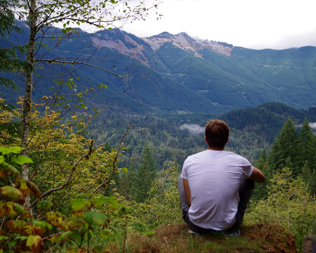
Happy trails and thanks for visiting Pacific Northwest Seasons! And bonus points if you recognize the trail from the shots above. :)

In between blog posts, visit Pacific NW Seasons on FaceBook, Twitter, and Instagram for more Northwest photos and outdoors news. 


 When You Go 
Here's a link to the Blue Heron Zen calendar. The next hike isn't scheduled yet, but check back. I'm hoping to get something on the calendar for late October/early November. Forecasts are for a dry autumn 2015 here in the Pacific Northwest.



Wednesday, September 16, 2015

Road Tripping Southward: Into the Redwoods

While I've hiked many trails and traveled widely around the Pacific Northwest, until last week I'd never been along the Redwoods Highway in southwest Oregon/northern California. 

Wow. Just wow.

With most old growth Sitka spruce gone, the coast redwoods (Sequoia sempervirens) comprise the last significant remnants of what was no doubt mind-boggling forest magnificence along the Left Coast of North America.

Today only 5 percent remain of the estimated 2 million acres of the coast redwood habitat. Thank goodness for the Save the Redwoods campaign that began in 1918. 

For those of us so inclined, they are a sacred destination. Walking and sitting in the redwoods feels akin to being in the ancient cathedrals that I've visited in Europe, like a Chartres of nature.

I'm especially thankful for these trees, these ancient and magical forests, because on this particular trip they provided a perfect place to reflect on the life of my recently deceased, much loved brother.


With a couple days to get to San Francisco for my brother's memorial service, my sister and I make a mini-road trip of it, starting with an overnight in downtown Eugene, Oregon, at the pleasant and well-situated Timbers Motel.

After driving south the next morning on I-5 a couple hours to Grants Pass, we take the exit to Highway 199/Redwoods Highway and angle southwest through winding canyon country on into northern California.

And before we know it, we're amongst the big trees on a narrow, curvy roadway through Jebediah Smith Redwoods State Park, the northernmost in the Redwoods park complex.


Before this trip, I hadn't realized Redwoods National Park,World Heritage Site and International Biosphere Reserve, is actually a series of national and state parks strung out over 40 or so miles in the tippy top, northwest corner of California. The loopy road through them slaloms past a glorious panorama of the rugged Pacific Ocean coastline.


While we don't have time to explore and hike as much as I'd like, the ranger at the visitor center recommends a short hike through the woods in Prairie Creek Redwoods State Park along the 10-mile Newton B. Drury Parkway.  This side road off Highway 101 threads through giant redwoods closely bracketing the roadway. 


Our destination is the Zigzag Trail #1, connecting to the West Ridge Trail to Zigzag Trail #2, for a 3.2-mile loop. So the trailhead signs aren't well-marked and we didn't end up on the trail we expected; it was still a refreshing 90 minutes walking up and down through the forest.

Why they call them redwoods.
 
And because it's a healthy forest, there are diverse tree species.
After tramping for a while through a grove of huge old trees, past a stream and wetland, we reach a junction and head up towards the west ridge on this mild September afternoon.


Up here, with views into the rich forest below, around, and above, my sister decides to take a break and sit on a log beside the trail. As I join her, I suggest we sit in silence for a bit. Or maybe she suggests it, doesn't really matter.

What does matter is how incredibly powerful it is to just sit quietly in an ancient redwoods forest, listening, breathing steadily. I try to absorb the still, silent forest with all my senses.


For the briefest of moments I swear I feel the forest breathing too, then a slight breeze picks up. The mystic in me thinks immediately of our brother, whom we've both been thinking about and remembering as we travel to say goodbye in San Francisco.


Above in the forest canopy, a delicate, sweet bird call echos, and we rise to continue.

After cresting the ridge and not being sure which way to go (the directional sign points the opposite way our instincts tell us to go), an oncoming hiker comes along. Good thing; from her map we realize our instincts were right and we were on the wrong trail.

[Note to self: you know better than to hike without a map.]

So we descend, enjoying the truly awesome forest and big trees, so photogenic, as we go.


With gratitude to these splendid old trees and those who work to protect them. And may you, too, enjoy and feel their truly discernible presence. 

Happy trails and thanks for visiting Pacific Northwest Seasons!

In between blog posts, visit Pacific NW Seasons on FaceBook, Twitter, and Instagram for more Northwest photos and outdoors news. 


Good Eats Along the Way
Good eats in Eugene included tasty Thai dinner at the Ta Ra Rin Thai Cuisine and an inexpensive and quality breakfast at the Full City coffee shop/Palace bakery.

Based on a recommendation from Lonely Planet, we had delicious fresh halibut tacos for lunch at the Good Harvest cafe across the street from the marina in Crescent City, California.

Monday, September 7, 2015

Lake Valhalla Hike: Late Season Push on the PCT

For alpine lake loveliness, Lake Valhalla is right up there with the most beautiful lakes nestled in Washington's craggy northern Cascade Mountains

On a chilly day fresh with early autumn, we drive up from Seattle and meet a Wenatchee friend at the Stevens Pass trailheadit's a perfect place for friends from different sides of the Cascades to meet.

At only 5 miles and 1,000 feet elevation gain from Stevens Pass, the trip to Lake Valhalla is a relatively easy hike along a section of the Pacific Crest Trail (PCT). Generally the PCT is pretty well-graded and maintained compared to some trails, so it's always a treat to hike.  What makes it an extra special treat today is the abundance of PCT thru hikers on the last few weeks of their 2,500+ mile, 4+ month journey from the Mexican border.

With a fairly early start, we set off on the relatively flat first mile along a former railroad bed. Occasionally we pass openings in the forest while crossing old landslide boulder fields. Each autumn the hillsides right above and below Stevens Pass are streaked with patches of crimson and orange from huckleberry and other alpine shrubs. Things are just warming up this season.


The view heading back down the trail, obscured by mist going up.

About 30 minutes into the hike, we meet our first thru hikers: Veggie and Square from Atlanta, Georgia. Don't they look happy and healthy? Check out their blog about thru hiking, including thru hiking the Appalachian Trail a few years ago.


Veggie and Square
Here's the deal:  As part of the trail culture, thru hikers all go by a trail name. So I start introducing myself to them using my trail name (Motor Mouse), bestowed on me by hiking buddies years ago. As thru hiker Lebowski told me, "You should own that name." 

As we ascend above the grade and the mist lowers, the trail passes through lovely fall colors and clearings in the subalpine forest. Of course I can't resist stopping to take lots of photos. (Thanks to my hiking buddies Julie and Lesley for their patience.)


With no steep grades on the trail, a couple hours pass easily by the time we reach the lake, which initially is just a partial view. Resist the temptation to take the boot paths straight down to the lake at first viewing; it's really steep and not an official trail anyway (and exacerbates erosion).


After going left at the junction, we circle around and down past a little meadow, then right down to what you rarely see at an alpine lake: a beautiful light sand beach.


Notice that the hiker above is bundled up in hat and gloves?  It was so chilly that we didn't linger at the lake after a quick snack. Mt. Lichtenberg, which juts above the lakeshore, remained shrouded in mist most of the time. We all decided we have to come back on a sunny day.


On the way back down, the real thru hiker fun begins. This section of trail (Section K) northward has been closed due to wildfire hazards for weeks, and it just reopened. So the thru hikers have been waiting for their chance to grind out the final push to the Canadian border.

Uniformly they all are friendly, happy to stop and talk a bit, and oblige us with our questions.  And they're mostly in their twenties except for two solo men pushing 60. Extra cheers for the older dudes; they're an inspiration to my aging knees.

You Again
Beetlejuice

Mountain John. Yay Boomer!
Phoenix, from...just guess.
 
Chelsey Rose and homegrown Allred from Orcas Island.


Bagsides (Berlin) and Sneezl (Netherlands)

We start pegging the thru hikers by their footwear: No boots, just trail runners.  Veggie told me she was on her fifth pair since she started hiking in April. They all must have ankles of steel, unlike Motor Mouse here who has twisted ankles many times.

One thru hiker (Jack Daniels, or maybe it was Johnny Walker?) was munching a bag of nacho cheese Doritos and declines our motherly offers of organically grown Washington apples. The pair from Orcas Island, though, are vegans who brought lots of rice and bean entrees and dried organic fruit they prepared in advance (like good progressive Northwesterners :). 

So our way back down is fun, with lots of stops to talk. Clouds lift a bit, revealing more views. And of course I'm besotted, as always, with the gorgeousness of hiking an alpine trail in my beloved Cascades. 

Happy trails and thanks for visiting Pacific Northwest Seasons!

In between blog posts, visit Pacific NW Seasons on FaceBook, Twitter, and Instagram for more Northwest photos and outdoors news. 


When You Go
The trailhead to the PCT and Lake Valhalla from Stevens Pass is just to the right of and behind the utility substation on the north side of State Route/Highway 2 at Stevens Pass, across the highway from the downhill ski area. Park at the easternmost edge of the lot. Because it's a private ski area parking, you don't need a Northwest Forest Pass. There's another access from a different direction via Smithbrook Road, farther east on 2 past the pass. Find driving directions here at the WTA hike description. On an early morning with relatively little traffic, it took us about 90 minutes to drive there from north Seattle.


Wednesday, September 2, 2015

Climbing Mt. Adams South Side: A Most Satisfying Slog

Although many many moons have passed since I summited Mt. Adams (aka Klickitat) in south-central Washington, it remains a peak experience of my life.
 
Lots of memories of that invigorating and challenging hike/climb on a brilliant August weekend are still fresh. I was at my peak fitness before chronic Achilles tendinitis set in. (My friends called me Motor Mouse back then.)

Predawn on a warm summer morning, we left Hood River and drove north across the Columbia River, through Trout Lake, and up bumpy Forest Service roads to the trailhead, which back then wasn't too well marked or crowded.

I remember a slog up through forest, then emerging onto the exposed flanks of the volcano. I'm sure we had to slather on sunscreen as we neared granular, late summer corn snow while trudging upwards toward the Lunch Counter, our destination for the night.

[Apologies for the image quality of the subsequent photos; they are scanned from old prints, pre-digital 1990s.]

Motor Mouse with Matt's old skinny tele skis, Adams behind.

At about 9,500 feet, the Lunch Counter is a ridge on the route up the South Climb where most stop for lunch or pitch tents and sleep while acclimating to the altitude. 

It was only about noon when we arrived and dumped our heavy packs at the Lunch Counter. I remember trying to nap, reading, chatting up other climbers, eating, watching a Chinook helicopter fly nearby--clearly on a search and rescue. And watching the spectacular, 360 sunset. (My mom saw on the news that a climber had died on Adams and knew I was on the mountain. She had several hours of anxiety until she heard from me.)


Our tent, Mt. Hood (Wy'East) on the southern horizon
Mt. St. Helens in the dusky distance

Did I mention that Adams, at about 12,280 feet in elevation, is the second-highest peak in Washington and the third highest Cascade volcano after (1) Mt. Rainier and (2) Mt. Shasta? So getting to the summit is no small feat.

It's a sorta big feat, which requires being in pretty decent shape. Although as we got to the Lunch Counter, we saw a father with two little girls wearing light windbreakers, shorts, and Keds sneakers descending from above. Yikes!

Climbing partner Matt chillin' at the Lunch Counter
After sleeping fitfully for a few hours, Matt roused me at midnight to get ready for our ascent under a bright moon. Ice axe in hands, crampons on boots, and headlamps on, we headed up the steep 3,000-foot south face (a snowfield, no glacier here) in the middle-of-the-night chill.

Halfway up the well-defined path in the snow, we cruised past a solo climber, and just below the summit passed another solo man. First on the summit that day! Yeah, I was in great shape. I don't remember even being tired.

As the sky started to glow reddish-orange before sunrise, we were lucky to witness one of those sights that make you smile in wonder at the beauty of this world:  A brilliant shooting star streaked low across the horizon, seemingly below where we stood on high on the mountain. Was that for real?

Beneath a sky as spectacular as the sunset the night before, we watched the sunrise from the snow-encrusted summit. I recall a sense of immense space all around, below us, with incredible views of Mt. St. Helens, Mt. Rainier, and Hood to our south. If only I had the camera then that I have today.

Adams summit sunrise.
Then the other climber up there offered to snap a summit shot of us. Ha, I was surprised by the kiss, a sweet celebratory gesture. (We weren't dating, still lifelong friends.)


Summit celebration
I think we lingered a little while after sunrise on the summit, but it was still pretty cold as we began our descent. We stopped for a few panorama shots above the south face to show a sense of the mountain dropping away below.

Chilly me
Unfortunately for Matt it was a rough ski down over frozen suncups, while I glissaded the long south face. I can't remember who got down first.

I do remember a long trudge out, but we got back to Trout Lake for an afternoon lunch at a gas station-burger joint. I think it was about the best cheeseburger I've ever had. I also think it mightn't have tasted as good if I hadn't just climbed a 12,000+ foot volcano that morning.

Looking back from Trout Lake to the summit where we stood early the same morning.
Will I ever climb Adams again? Probably not. Aging knees and that pesky Achilles tendon have slowed me down. 

I do have my sights on climbing Mt. St. Helens again this fall. We'll see.  But I find it so satisfying to look at Mt. Adams from different perspectives and know I walked up to the top and back.

Adams from 20,000-ish feet. I stood on top of that once!
How about you? Have you climbed Mt. Adams or other Cascade volcanoes? Would love to hear about it in a comment below.

Happy trails and thanks for visiting Pacific Northwest Seasons!

In between blog posts, visit Pacific NW Seasons on FaceBook, Twitter, and Instagram for more Northwest photos and outdoors news. 


When You Go
 You know, it has been a couple decades since I did this climb, so I'm going to leave the descriptions and particulars to others. Check out the WTA climb description here. Summit Post has a better description here. As of mid-August, the climb was closed due to forest fires near the access.