Tuesday, November 25, 2014

Paddling Seattle: Lake to Lake

Between Puget Sound, lakes, and waterways, greater Seattle is blessed with many great paddling destinations.  Most kayakers, canoeists, and paddleboarders first take to the water here in the stretch from Lake Union through Portage Bay over to the Lake Washington/Washington Park Arboretum areas. Generally mellow, mostly protected, and scenic in an urban setting sort of way.

On what turns out to be a surprisingly beautiful late November afternoon after a stormy night, some friends and I opt for a mellow lake to lake (Union to Washington) "tour de bridges." It's close, easy, and good to be out on the water with friends.

Our goal, besides exercise and the sheer pleasure of paddling, is to check out construction on the new SR 520 Floating Bridge in Lake Washington. A couple of us worked on the bridge replacement project environmental analysis and design, so it's fun to see the fruits of our and many others' labor.

Since Seattle is surrounded and constricted by water, of course we have lots of  bridges.  First up as we head from Lake Union to Portage Bay is University Bridge, a bascule draw bridge. This bridge was originally built in 1919, just a couple years after the major project to create the Ship Canal connecting Lake Washington to Puget Sound.


University Bridge crossing the Lake Washington Ship Canal
 After passing under the bridge, the much higher Interstate 5 Ship Canal bridge looms overhead. Tucked beneath and beyond these bridges are live-aboard houseboats. Some are tidier and better maintained than others.


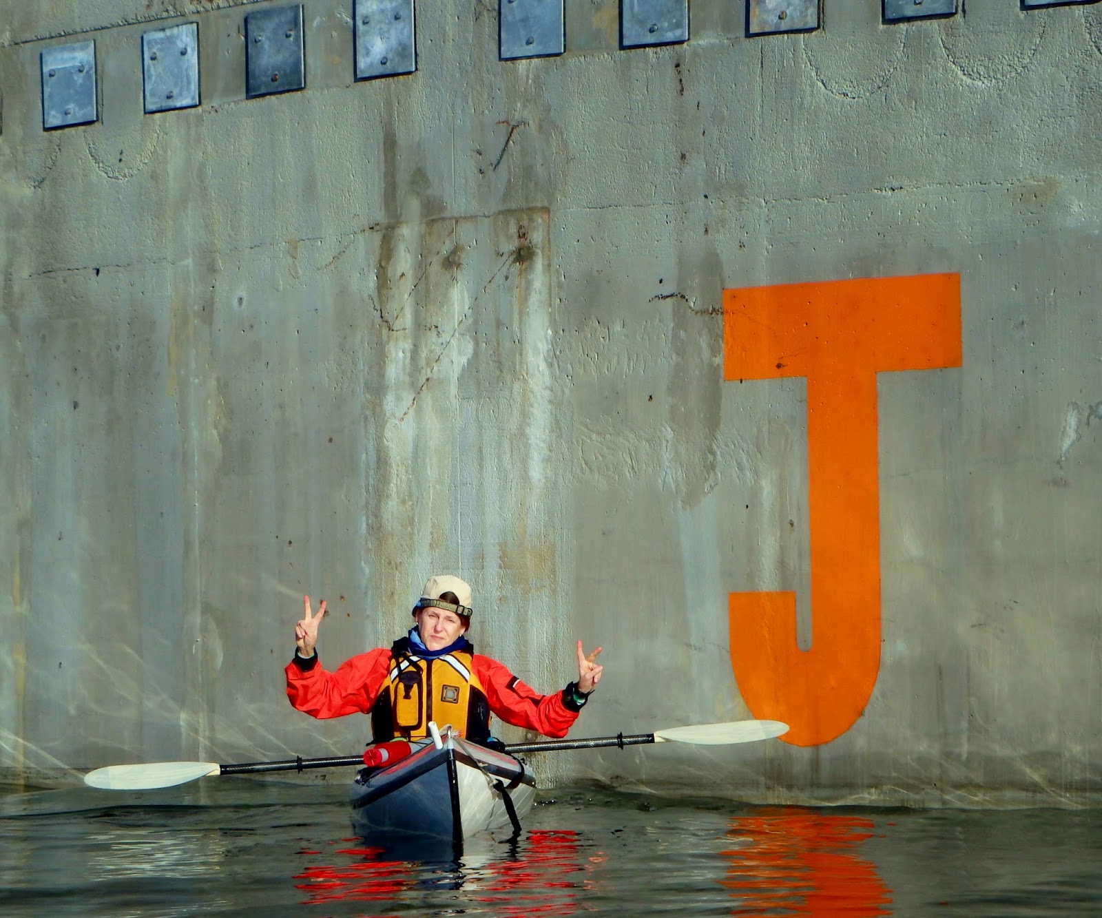
Enroute to Lake Washington, we skirt the southern edge of my alma mater University of Washington (Go Dawgs!) through Portage Bay. Choppy, bouncy water is usually the norm for narrow, manmade Montlake Cut, where hundreds of rowers have raced over the last century. Every year different Husky crews leave their mark on the sloped concrete walls lining the Cut beneath the beloved Gothic-style Montlake Bridge, another drawbridge/traffic bottleneck dating to 1925.


As we paddle through the Cut eastward into Lake Washington, it's fun to read all the spray-painted messages. Leaving the Cut, we enter the Arboretum to the right for a short detour. State Route 520 crosses through this wetland area, which today would be protected from a new highway construction under current environmental regulations.


Since we're blocked in by 520 construction staging, it's time to cut back out into Union Bay and around past Foster Island, a former native burial ground and now wildlife viewing trail. This part of the present-day Arboretum is rich in native history and use and a great wildlife watching area. As we approach the island, a flock of distinctive wild buffleheads hustle away in a splash of wings and webbed feet.


Foster Island
SR 520 western highrise ahead, Eastside and Bellevue beyond.
Out here we mingle with muskrats, beavers, and western pond turtles along with all sorts of waterfowl. You'd be surprised how many other creatures are out there living in our urban watersheds and forests. And how many you see while out on a hand-powered watercraft.


Aurora Borealis Sculpture
Wish I had on film: the time the dude in the red kayak pictured above climbed up to the Aurora Borealis sculpture platform, hauled up his kayak, and launched back into the lake in his kayak. Impressive and a little bit crazy.


After a short detour to check out the floating pontoons, we scoot over to and under the new 520 highrise being built. When it's finished, there will be a bicycle and pedestrian path on the north side.


Old bridge left, new bridge right
On our way back west, great views of Husky Stadium echo the excitement of just last night when we watched the Husky football team clobber the Oregon State Beavers there. (My two Beaver friends who were also at the game last night and are paddling with me today weren't so excited.)


Husky Stadium, where many arrive by boat.
And it's a cruise back to our put-in on north Lake Union via the Montlake Cut/Portage Bay. The weather cooperated nicely this afternoon. If you're lucky, that can happen any time of year, although less reliably so in the fall/winter.


Entering the Montlake Cut heading west.

UW research vessel, Lake Washington Ship Canal bridge above.
While we kayak in Puget Sound more often, this interlude in the lakes is a nice respite and always refreshing.  On this nice autumn day, when the Seahawks were in town and playing, we saw very few other boaters and enjoyed relative solitude on our urban waterways.

Have you paddled this area? Would love to hear your comments below.
Happy water trails and thanks for visiting Pacific Northwest Seasons!


When You Go


There are many launch sites, but we put in just east of Gasworks Park near Dunato's Boat Yard, where we parked on the street and walk across  to a perfect little beach to launch. (Thanks to John for the tip.) Northwest Outdoor Center (NWOC) on Lake Union rents kayaks and paddleboards year-round. Other options to check out are Aqua Verde Paddle Club on Portage Bay and the University of Washington Canoe Center below Husky Stadium.

Friday, November 14, 2014

Hiking to Blanca Lake Before the Snow Flies

Some things are definitely worth the wait. 

Take Blanca Lake, crown jewel of the Cascades alpine lakes: Years ago I tried to hike there, but a road washout left us unable to reach the trailhead.  Then years passed, I developed chronic Achilles tendinitis, had to stop hiking for several years, worked back up to longer hikes again, and finally made my way to Blanca Lake.

We got a late start on this unseasonably mild and clear November day after driving several miles off Highway 2 and finding the road to Tonga Ridge gated closed. Thanks to my hiking buddy Jennifer for a  perfect Plan B, Blanca Lake.

After the long drive up backroads north of Skykomish and a wrong turn that led us to a makeshift shooting range, which was sort of scary,  we finally hit the trail around 11 a.m. (FYI, at the five-way intersection, take a true left.)


Essentially it's an upward grind through what seems to be mostly second-growth forest up 3 miles over 30 switchbacks, an elevation gain of 2,700 feet.  When we reach peek-a-boo views through the trees, over an hour has passed. In another 20 minutes we top out at a ridge with great views of nearby Glacier Peak.

A lot of this...


Glacier Peak

This late in the season we've missed what was likely, a few weeks ago, brilliant scarlet leaves on the thick huckleberry covering the steep slopes below. After pausing for a swig of water and snack above small Virgin Lake, we enter the Henry M. Jackson Wilderness (RIP Scoop) and plunge down somewhat rougher switchbacks for 600 feet in elevation loss feet to Blanca Lake. 


Columbia Glacier shown lower left feeds Blanca Lake

 We're not alone by any stretch.  Many are out taking advantage of this late season day in the mountains before the snow flies, and, thankfully, after the deer flies.  No bugs is a bonus for fall hiking.

First views of Blanca Lake evoke wows! and ooohhhs! Set in a basin below Monte Cristo, Kyes, and Columbia peaks, it's a postcard-perfect image of a beautiful mountain lake. For a relatively high, natural alpine lake, Blanca Lake is large and almost mirage-like.


Yes the water really is that turquoise-colored.

Of course photos don't capture what it's truly like to be somewhere, but I try with a zillion shots. The unusual opaque turquoise shade of the lake is caused by the glacial melt streaming down from the hanging Columbia Glacier across the lake.


One downside of hiking this late in the year, after the clocks have turned back to Standard Time, is much shorter days. Unfortunately we can't explore when we get to the lake because it'll likely be dark by the time we get back down. The sun is already setting around 4:30 pm.

So we backtrack after about 10 minutes, enjoying the alpine meadows above the lake and a last lingering view of Glacier Peak before dropping into the many switchbacked forest below.


Luckily we made it back down to the trailhead before it got too dark and managed without our headlamps.  I hope the numerous hikers behind us had  flashlights.

Some rate this hike strenuous and difficult; it all depends on your conditioning. I sure felt it the next day, with my quads and outside back of the knees talking to me. It's comparable to hiking Mt. Si, but perhaps a bit more. Various sources place it as about 7.5 miles with 3,300 feet in elevation gain and loss.

Regardless, it's a good workout, it's spectacular, and I'll do it again. Let me know if you do, too.

Happy trails and thanks for visiting Pacific Northwest Seasons!

When You Go
It's about a 2-hour drive from the Seattle area to the trailhead. Reach the Blanca Lake trailhead via Beckler Road (FR 65) just past Skykomish. Take FR 65 for 15 miles all the way to the intersection of FR 63 and the private Garland Mineral Springs Road. Take a right on FR 63 and proceed about 2 miles. The trailhead is on a small spur road to the left, up another small hill. You need a Northwest Forest Pass to park here.

 AND this late in the season the restroom at the trailhead is closed. DO NOT leave toilet paper lying on the ground in the woods behind the vault restroom. We go by a Leave No Trace ethic here in the Northwest, so bury it or better, stick it in a plastic bag and take with!


Friday, November 7, 2014

Yes We Have Fall Color in the Pacific Northwest

Seattle Japanese Garden
Here in the Pacific Northwest, our fall colors are a myriad tapestry of greens, yellow-golds, oranges, scarlets, and browns.  While our forests run more evergreen, brilliant displays can still be found scattered around the region.

Recent wind and rain have brought down leaves, but the show isn't over yet. As someone commented on Pacific Northwest Season's FaceBook page recently, our fall show is better than New England's because the season lasts longer than our northeastern compatriots.  Agree?

Over the last few years this blog has become as much or more about the photos than the prose (begrudingly admits this writer), but that's not a bad thing. I've also become more compulsive about taking pictures. Hey, most of the world seems more compulsive about taking pictures with their handhelds.

Autumn leaves and sunsets are two of my favorite subjects. Perhaps I'm drawn to warm colors (ergo my mango-colored dining room walls, pumpkin-colored hallway, and cinnamon-colored guest room) because I live in an often damp and chilly climate.

 
Golden Gardens Park, Seattle


So today's post is simply sharing shots of fall color here in the Northwest and where you can find it, whether it's vine maples, golden larches, or huckleberry shrubs in the mountains or bigleaf and ornamental maples in our cities.

Golden larches above Lake Ann on Maple Pass Loop Trail, North Cascades, WA

Sidewalk tree, Sunset Hill neighborhood, Seattle
Seattle Japanese Garden

Golden larches, evergreens, dry grass, and mist. Wallowa Mountains, Oregon
On their way down, leaves can land in unnatural habitats, like a slash of scarlet in an evergreen shrub, that create brilliant juxtapositions.


And in the aftermath, downed leaves drop into often artistic, graceful collages waiting to be captured.


Bigleaf maple leaves, Golden Gardens Park, Seattle

Downtown Joseph, Oregon
I love this season, when so many trees look like they're dressed up for the biggest party of the year. Which, in fact, they are.

And you? Where are your favorite fall colors? Would love to hear in a comment below!

Happy trails and thanks for visiting Pacific Northwest Seasons!