Friday, October 31, 2014

Happy Halloween! Random Acts of Pumpkins

How are you celebrating Halloween?  My favorite holiday caps my favorite month here in the great Northwest.  

Sure it's fun to dress up, or dress up the kids, but to me pumpkins are the most evocative of this campiest of holidays. We grow huge and interesting pumpkins here (well, pumpkins grow well many places) and display them with pride.

Except for the obese-looking pumpkin pictured below that was part of a contest for the biggest pumpkin, the other shots here were what I call "random acts of pumpkins":  Pumpkins carved or decorated and placed in public places, sorta like a Halloween version of yarn bombing.

While torrential downpours here west of the Cascade have brought down many autumn leaves, pumpkins still glow with autumn orange. 


Pumpkin pie anyone?


Wednesday, October 22, 2014

Along the Cascade Loop: North Cascades Scenic Byway

Come along for a virtual road trip over Washington's scenic North Cascades Highway.  It's a "windshield tour" across this designated Scenic Byway that traverses the North Cascades National Park Complex through stunning mountain terrain.

By December each year, this stretch of State Route 20 in far northern Washington is usually closed for the winter, subject to avalanches and rockslides when storms roll in off the Pacific and dump heavy rain and snow in the North Cascades.

Up until the 1970s, there was no road across these mountains beyond present-day Ross Lake. The North Cascades are still vast and mostly roadless. There's deep wilderness lurking beyond the peaks, where wolverines breed and grizzlies are known to stray.

We're heading east-southeast from Newhalem, where we leave the upper Skagit Valley and enter the much more narrow Skagit River Gorge.  

Yes, the windshield needed a good scrub. :)


If you see the river flowing free (as in the photo below) in this canyon, consider yourself very lucky. Over 100 years ago portions of this Wild and Scenic River  above Newhalem were tamed by a series of hydroelectric dams developed for the City of Seattle.  Nowadays the river only flows free above Newhalem when the dams upriver are being drawn down. Above this gorge, the river is a series of dammed lakes (Diablo, Ross).


Skagit River
When it's raining, waterfalls course down the canyon walls.

Skagit River Canyon above Newhalem
This portion of the highway traverses a steep slope as it meanders up and down above the narrow Skagit gorge, with a few viewpoints and tunnels.


Be very careful along this highway and don't speed! On this trip traffic was stopped by an SUV that flipped while going too fast around a blind curve. Fortunately the driver was okay.


I've slipped in a couple lake shots from a summer trip across the highway because I didn't get any decent shots on this trip.

The highway crosses Thunder Arm of Diablo Lake just past Colonial Creek Campground.

After passing above the southern edge of Ross Lake, there's a lot of this for a good 20+ miles:


The highway gradually climbs (you really notice the ascent when bicycling) toward two passes. Mountains are now visible above the surrounding hills that bracket the highway.


Rainy Pass, where the Pacific Crest Trail crosses the highway, is the first and lower pass at elevation 4,875 feet. We stopped at Rainy Pass for a break when I bicycled over the North Cascades on a summer weekend.  This solo bicyclist had guts going it alone on a damp October weekend.

Rainy Pass


When we clear Rainy Pass and approach Washington Pass 4 miles beyond the Cascade crest, rain gives way to bits of blue sky. It definitely rains more at Rainy Pass.

Washington Pass

This is as far east as we go before turning back, but the Washington Pass Overlook just off the highway is worth the stop for the stunning views of the granite Liberty Bell spires and the glacially scoured valley below.

Liberty Bell spires

From here, after a dramatic switchback of the highway, it's all downhill for about 20 miles to the upper Methow Valley. Next trip...


The highway below heading northeast from Washington Pass Overlook.

Happy trails and thanks for visiting Pacific Northwest Seasons!

When You Go
Here's a map of most of the route pictured, but starting farther east than Newhalem, just above Ross Lake. From where we started at Newhalem to Washington Pass is about 45 miles. There are no gas stations or public amenities along the North Cascades Highway between Newhalem and Mazama in the Methow Valley.


Wednesday, October 15, 2014

Northwest Fall Hiking: Golden Larches on the Maple Pass Loop


For a few magical weeks each autumn before the snow falls too thick and deep in the Cascades, Northwest hikers stalk the golden glow of larches. The rewards of this gold rush are a riches of startling beauty.

Peak viewing of these subalpline larches (Larex lyallii) in the North Cascades is generally mid-October, perhaps after the first snow dusting adds drama to the alpine landscape.  I was right on target for a hike on the Heather-Maple Pass Loop this past weekend with hiking writer/guidebook author extraordinaire Craig Romano and a group from the North Cascades Institute.

I should just stop with the prose here and post a bazillion photos. It was such an extraordinarily beautiful day/time to bear witness to the splendor that I could hardly stop taking pictures.


But I did manage to hike a good 7.2 miles up and down a few thousand feet in elevation (about 4,000 total) in the process.  We started the loop going clockwise at the Rainy Pass parking lot trailhead (elevation 4,875 feet) on the south side of Highway 20 (North Cascades Highway). Our trip co-leader Sam tells us this direction is steeper but a more mellow grade going down, which sounds just fine for fussy knees.  

But none of it seems that steep really. Or maybe we're  just so elated from the alpine landscape we don't notice. I do remember sweating.

We start up switchbacks through forest for a mile or so until we see the first golden larches. These trees only grow at 5,000 feet up to about 8,000 feet elevation on the eastern crest of the Cascades.


Just the beginning
From here on it only gets more and more spectacular. We skirt along a steep ridge with views down to Lake Ann and Rainy Lake on either side, and pass through alpine meadows laced with scarlet and gold.


 Soon we're hiking through rocky, mostly treeless slopes towards the passes above.


On a clear day, there are panoramic views along this hike of many North Cascades peaks, but today we're shrouded in mist that rises and falls. Which, I think, makes it even more lovely.


Because it's so cool and scenic up here, I've lost track of time and can't tell you how long it took to get to Maple Pass (a couple hours?). It's a party up here when we break for lunch, with at least a dozen other hikers around.

Holiday card shot, Lake Ann in cirque below
Looking back the way we came.
Then we continue down to Heather Pass, which is also dusted in snow, and beyond.  We pass many more hikers coming from the other direction now, including a young couple wearing nothing but shorts and thin tops, without packs (not smart). In contrast, I'm in four layers, with fleece, Gore-tex, hat, and gloves.


Sam, who was up here a few weeks ago putting up signs for the U.S. Forest Service telling people to stay off "social" (unofficial) trails, checks out how they're holding up. Reminder, DO NOT stray off the main trail in these fragile alpine areas.


Heather Pass area
As we descend below snow level and get closer to Lake Ann, the fall colors are even more stunning again, with the golden larches blending with colorful shrubs like huckleberry and Sitka mountain ash.


Don't they look like a happy family?
Writer/author Craig Romano on the trail.
Although Craig Romano is one of the most loquacious men I've ever met, I can't come up with a good quote from him. But as we hike together, his conversation is always entertaining, sincere, and informative. (Go hear him speak at one of his upcoming events if you can.)

 After we get below Lake Ann, the trail is mostly enclosed in forest, except one colorful patch of talus, where I've seen a resident marmot on hikes past.


Overall the going seemed relatively easy, what with the awesome scenery, enchanting fall colors, and fun company. Most hiking guides rate this a moderate hike.


Happy trails and thanks for visiting Pacific Northwest Seasons!

When You Go
To hike this loop before it gets too snow covered, go soon (it's snowing as I write this above 5,000 feet in the Cascades, so....). Check the North Cascades forecast. With the snow flying today, you might already need Yaktrax for traction and hiking poles for stability when venturing there before the highway closes for the season. 

Rainy Pass is about a 3-hour drive from Seattle and about 50 miles east of Marblemount on the eastern edge of North Cascades National Park. Check out the topo map of the area on the WTA website.


Friday, October 10, 2014

Bicycling Vancouver, B.C.: Easy Does It

When in Vancouver, B.C., be sure and have a bicycle ready to ride. What a great way to see this gorgeous city and get some good exercise!

On a recent weekend road trip from Seattle to Vancouver, we decided to bring bicycles.  Wise choice. Vancouver has it all over Seattle as a bicycle friendly city, with well-established and safe bike lanes.


 From the English Bay Bed & Breakfast where we stayed and had the indulgent breakfast shown below (splurge, but nice), we bicycled over 20 miles around the city all day on Saturday, with multiple stops to eat and take pictures.


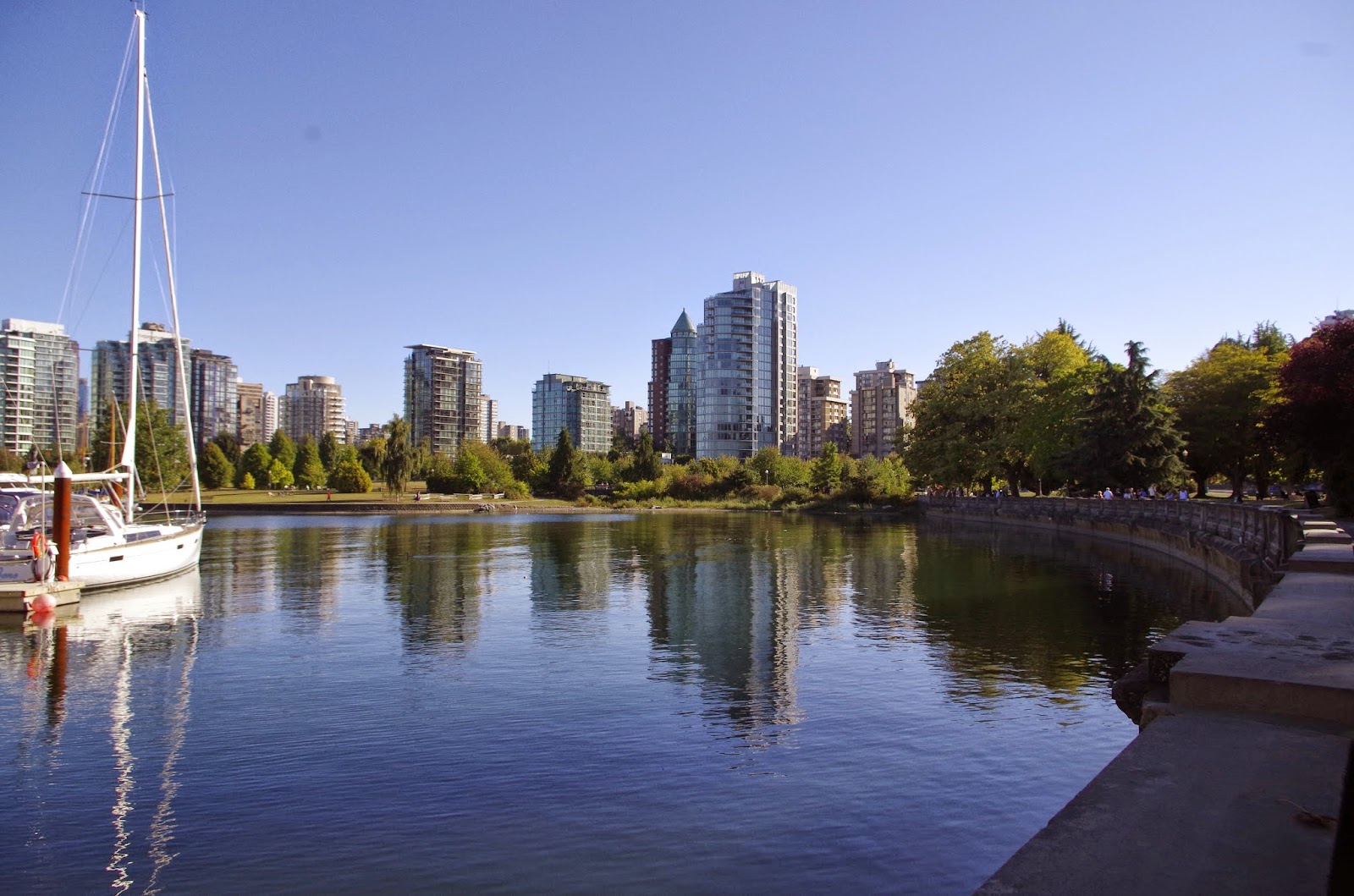
While we couldn't find a bicycle trail map, the trails were easy to find and well-marked.  From our B&B, we hopped just two blocks down to the Seawall that extends 22 kilometers along most of the waterfront in the West End.


Our first stop was Granville Island after crossing False Creek on the Burrard Street Bridge. Sure it's tourist Grand Central, like Pike Place Market in Seattle, but it's fun to see the gorgeous food stalls and enjoy the waterfront.


Granville Market

Then we headed west up Fourth Avenue (and then up side streets) all the way out the Westside/Point Grey Peninsula to UBC (University of British Columbia) to visit the Museum of Anthropology. The going was very pleasant, with some mild uphills through leafy, prosperous residential neighborhoods, and a great viewpoint park.

Looking back east towards the West End from  Point Grey area
Looking north toward North Vancouver and Coast Range beyond

We calculated about 4 or 5 miles out to the UBC campus, with several hundred feet in gradual elevation gain. After a great visit to the museum, we meandered back to Broadway for a tasty lunch along this busy street.

Then we cut back to the West End across the Burrard Street Bridge again, with a safe and well-traveled bicycle/pedestrian lane on each side of the bridge. Of course we had to stop for the views.


Because we'd only been out for 5 hours :) and it was a gorgeous day, we decided to continue on around Stanley Park on the Seawall. Not too far along we discovered that bicycles can only travel counterclockwise on the trail. With the  help of a friendly well-situated local, we managed to cut across the middle of the park and get to the other side to continue bicycling.


In the woods, Stanley Park


I can't get over the nonstop glorious scenery along this trail. As we rounded Brockton Point (and a wild party in progress) over to the Burrard Inlet side, the trail traffic thinned out a bit.  We had to stop several times to take pictures.

Looking across Burrard Inlet to North Vancouver
Occasionally along the trail at higher-traffic spots, bicyclists are required to dismount and walk, and sometimes the trail is not very wide. But it's one-way, so no worries.

Lion's Gate Bridge
The high and narrow Lion's Gate Bridge span always scares me a little bit to drive across (like the Tacoma Narrows Bridge too). Call it a healthy fear of heights. But no problem bicycling beneath it along the Seawall.

After winding around to the western, English Bay side of the seawall, we slowed down and savoured the end of this scenic day of good exercise.


The next day we hopped on our bikes again and cycled along the Seawall down to Yaletown and then back through the heart of the West End back to English Bay. Very pleasant, very easy, very safe.

For more photos of Pacific Northwest adventures between blog posts, Like our page on FaceBook. Thanks for visiting Pacific Northwest Seasons and happy trails!

When You Go 
Here is a link to an official City of Vancouver cycling map; however, we bypassed some trails on the Westside to travel along quiet residential streets. If you don't bring your own bicycle, it's easy to rent one. We stopped by English Bay Bike Rentals to ask about maps, and they were very helpful.