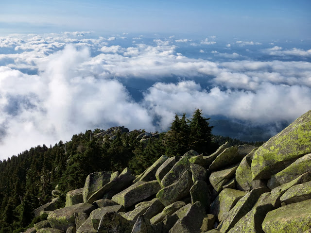
The stunning 360 panorama of jagged peaks and deep forested valleys was worth every drop of sweat.
Two miles beyond the Skykomish Ranger Station we turn off State Route 2 onto Forest Service Road 6066 (well-signed) and continue 6.6 miles on dirt road up to the trailhead at 2,800 feet. Officially the Jennifer Dunn Trail, named after former Congresswoman Dunn who co-sponsored the Wild Sky bill designating Washington's newest Wilderness Area, the trail starts up old logging road through a recovering clearcut area.
This is the least scenic part of the hike (about a mile), but it's still nice to be outside in the woods.
After hiking about 45 minutes, we finally reach a clearing of old downed timber where the view south down and across the Skykomish Valley gives us a taste of what's to come.
Soon we plunge into a lovely forest, where the trail smooths out and angles gently upward through old growth silver fir. For the next 45 minutes or so we meander upward through sun-dappled forest until we reach a few patches of snow left over from our late September snowfall.
Since it's a weekday (one of the benefits of self-employment), we only see a solo man and then two women and their fluffy cute dogs coming down as we're ascending.
"You're only about 10 minutes from the summit," says one of the friendly women.
Note to self (and you): Take the estimates of people you meet on the trail with a grain of sea salt. For us it was another 20 to 25 minutes up increasingly short and steep switchbacks.
 |
| Stone steps on the trail just below the summit. |
But like I said, worth the effort when we scrambled over granite boulders to the top.
 |
| Beckler Peak summit, looking east |
We're the only ones here right now, which is a good thing because there's not a lot of room at the tippy top. And the peak, which is technically East Beckler Peak and part of a dramatic granite ridge, drops off steeply to the north. A long way....
Despite the brilliant autumn sun, there's a chill in the breeze up here. So I throw on my fleece vest and start taking pictures.
 | |
| View westward along ridge to West Beckler Peak, Mt. Index and Baring beyond. |
 |
| Monte Cristo peaks, north-northwest |
 | |
| Glacier Peak, Washington's least-known volcano, view northeast. |
 | |
| Mt. Fernow to the east. |
 | |||||
| View south, Mt. Daniel and Hinman (I think!). |
After a snack and lots of picture-taking, we start down, which is always easier on the lungs but harder on the knees and toes. The views are still awesome for the first few switchbacks until we drop back into the forest.
On the way down several more groups and solo hikers are coming up, but it's still much less traffic than it would be on a weekend day. Many of us outdoorsy types who live near the Salish Sea (Puget Sound and northward) know each other even though several million live in the region, and I bump into someone I know on the way down the trail. This often happens, actually.
Soon the snows will fly, likely making this summit inaccessible until next summer. I'm so glad we got out for what might be one of the last great days of the year for peak bagging in the Cascades and Olympics. I hope you can, too.
I learned about this hike through someone I just met last weekend who raved about it. Big thanks to Jim!
Happy trails!
When You Go
 |
| Happy just below Beckler Peak summit. |
For lots more photos and Northwest news between blog posts, Like the Pacific Northwest Seasons page on FaceBook or follow us on Twitter.


