Wednesday, July 17, 2013

Kayaking the Sky: A Long But Fun Day on the Skykomish River


"After the second rapid, it should mostly be a float down the river," says Larry as we're getting ready to launch our kayaks onto Washington's Skykomish River.

Several hours later, we rib Larry each time we hear the sound of yet another approaching rapids. Granted, most of us are in sea kayaks and the rapids are just Class I and Class II. 

But still.  For those us of accustomed to wind, tidal currents, or calm sea conditions, this is an exciting change of pace.

The plan today was to meet at 9 a.m. in Monroe at Skykomish River Centennial Park, car shuttle up to Big Eddy a couple miles beyond Gold Bar, and be off the river by 3 p.m.--a paddle of about 18 river miles.

With a few folks running late, we don't get going until close to 11 a.m., which sort of sets the pace for the day. But it's a glorious, beautiful, clear blue sky summer day. 


Looking back at Class II rapid just past put-in, US Route 2 and railroad bridges in background.
The Skykomish River, often called "the Sky" for short by rafters, kayakers, and locals, winds 29 miles through the Cascade Mountains and foothills to the Puget lowlands, where it merges with the Snohomish River north of Seattle. In the popular whitewater and kayaking reaches upriver, and where we start today, our backdrop is thick forest-covered hills and some craggy, snow-capped peaks of the Cascades beyond, including dramatic Mt. Index.

It's a lovely stretch of river.

Our most challenging rapid is a Class II just a short way below our put-in spot, at the first bend in the river.  We let our two whitewater kayakers lead the charge, then the rest of us sea kayakers proceed carefully through the persistent standing waves. What an adrenaline rush for a sea kayaker! 


Chilling after the first rapid
In the second rapid, not too far downriver, two kayakers in our group capsize in the tricky, rocky stretch of river.  I get hung up broadside on a big rock and almost go over too but manage to stay upright. 

But everyone is okay. At this point in the summer, the water speed and level is about half the spring snowmelt peak. (I heard something about 3,000 cfs vs 6,000 cfs, but don't quote me on that.)

After three capsizes in the early rapids, our trip leader Larry stops and scouts a few times before proceeding down what sounds like more rapids, so we hang back a bit.   Who minds hanging out when it's a gorgeous July day and the temperature is a near perfect high 70s to 80 degrees (F)?

Our lunch break isn't as far down river as planned (Sultan), but it's after 1 pm and we're hungry.  So we lounge in the sun on a big cobbled sandbar in the river and enjoy ourselves.


After lunch the river really does get more mellow, but it's not over yet. 

We pass numerous fly fishers along the way, some gracefully arcing their line overhead for casting off. When I ask about their catch today, no one has had any luck. It's a bit early in the salmon season.

We stop in Sultan for a pit stop at Sportsman Park where the Wallace River flows into the Sky.  Gotta say, the Honey Bucket there is best avoided if at all possible.

At one point downriver from Sultan the river is split by several large bars, where our group split up and lost each other for a while.  If you're on the river and hit an area that fits this description, stay river left!

Then we just meander down river past occasional homes with people out on their docks partying, undeveloped forest-lined stretches of river, and reaches adjacent to US Route 2. And yes, run several more Class I rapids.


We finally get back to Monroe a bit after 7 p.m., and then there's the car shuttle back up US Route 2 to Big Eddy through weekend traffic, which adds another hour to our outing. I'm tired after almost 8 hours on the river and all the hauling and loading kayaks.

Regardless, it's a fantastic day and a real treat for us sea kayakers to be on a beautiful stretch of river in the mountains. Overall it's a relaxing and exhilarating trip. 

When You Go
If you'd like to embark on a similar trip down the Sky, be sure and check the water levels and velocity.  Also, a Washington State Discover Pass is required for parking at Big Eddy.

The first part of our trip, from Big Eddy To Sultan, is described here in the Paddling Washington guidebook.  Big caveat:  My fiberglass kayak is sporting a few new gouges and bruises from this river trip.  I highly recommend using a more durable (but heavier) plastic sea kayak if you plan to do this trip in a sea kayak. If you're a whitewater kayaker, this is all tame stuff.
And special thanks to Ron for letting me use several of his photos in this blog post.


Thursday, July 11, 2013

Hiking the Teanaway: Iron Peak

View of Enchantment Peaks in Stuart Range from Iron Peak summit
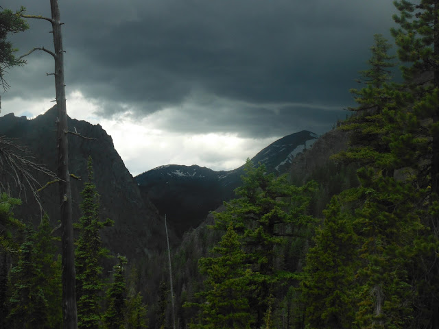
From the top of Iron Peak, I've been keeping a wary eye on the dark thunder clouds gathering in the distance.  They're closer now than 20 minutes ago when I reached the 6,510-foot-high summit. 

While it's a record-breaking heat down in the lowlands east and west of the Cascades today, here above the Teanaway Valley in Washington's central Cascades, thunder clouds are all around us. This isn't the first time I've skirted thunderstorms while hiking in the Teanaway area.


"Okay, it's time to head down," says Rich.  When easygoing and calm Rich says it's time to go, everyone goes.  

Our group of about eight hikers starts to meander down this rocky and open summit ridge. There's no need to rush, really. I'm just a bit of a worrywort.

On the summit ridge, Iron Peak.
I'm enjoying a great hike today on this relatively open and mellow summit hike.  We camped last night at Beverly Campground up the North Fork Teanaway Road, about 25 miles north of Cle Elum, so we had just a 4-mile drive up the road to the trailhead at elevation 3,900 feet.

Reverberating thunder and a smattering of rain woke me up early this morning in my tent, but it dissipated by the time we hit the trail around 9:30.  The weather is still somewhat unstable, but not enough to keep us off the trail. 

Here on the eastern crest of the Cascades, the vegetation is more sparse than the west side, with less underbrush. Although the first quarter mile or so of the trail skirts a stream, with lush green riparian vegetation, we shortly emerge into more open, scrubby forest with expansive views.


Easy hiking up through subalpine forest.

A few of us leading the pack emerge out of the switchbacks and top out at the saddle between Iron Peak and Mt. Teanaway after a couple hours of steady hiking. We've ascended 1,700 feet in 3.5 miles, according to my Green Trails Map (Mt. Stuart, WA - No. 209).
At the saddle between Iron Peak (to the right) and Mt. Teanaway.

Iron Peak summit ridge.

Then it's about a half mile scramble up and along the ridge to a pile of rocks with a summit register that marks the top of Iron Peak. With the hanging clouds, the Mt. Stuart summit never quite reveals herself to us today.  But the granitic Stuart Range about 5 miles due north still provides a dramatic skyline.  

Mt. Stuart in the distance.

About 14 miles  north beyond Stuart lies glacier-clad Mt. Daniel and Mt. Hinman, still impressively snow-covered for a summer day.  Some of us mistake it for Glacier Peak (oops).


Glacier-covered Mt. Daniel and Mt. Hinman
Apparently the Iron Peak hike is notable for unique and hardy wildflowers that grow in this harsh environment.  On the spur ridge to the summit, I step carefully over what I'm told are alpine anenome by the plant experts in our group.


Alpine anenome near the Iron Peak summit.

And then there's the iron that gives this peak its name. 

Iron in the rock on Iron Peak.

With a very bruised-looking sky looming just north of Mt. Stuart, I scoot down right behind the strongest guys in the group, with barely a stop on the 4-mile descent.  At one point thunder echoes overhead, but by the time we get down to the trailhead, it's gone. 

Rich leads the charge back down off Iron Peak.


Thunder clouds threaten, but pass by without getting closer. Whew!
 In a stark contrast to the harsh summit vegetation zone, I spot some lovely columbine right alongside the trail near the trailhead.


Columbine.
After about 5 hours on the trail, some of us jump in Beverly Creek back at the campground, despite the snowmelt chill of the water. 

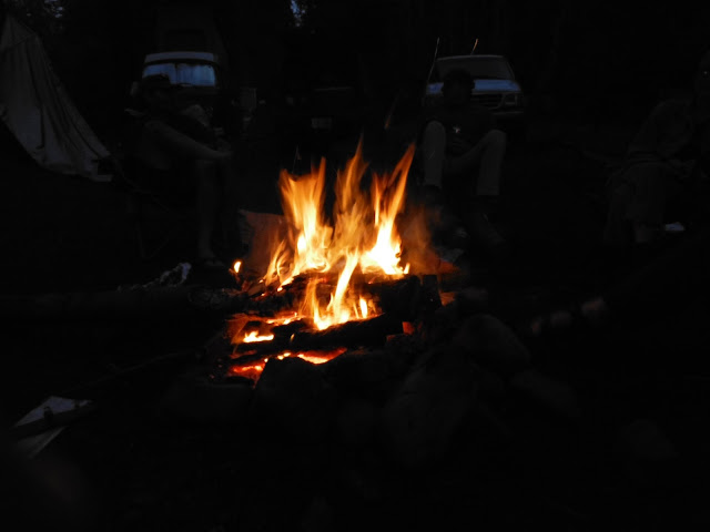
Then we enjoy an evening around the campfire out of cell and WiFi range. It's liberating.

Instead we sit in the waning light and talk, laugh, and toast marshmallows for Wendy's special s'mores:  marshmallows stuck between two Pepperidge Farms Geneva cookies

It's primal.


I hope you get to enjoy such a pleasant hike (despite the thunder) and off-the-grid camping trip this summer too.

When You Go
This topo map shows the trail and Iron Peak.  Access the Beverly Campground and Iron Peak trailhead via the North Fork Teanaway Road, a turnoff from Highway 97 about 10 miles northeast of Cle Elum.  According to my Green Trails map, we hiked about 8 miles roundtrip and gained a little over 2,600 feet in elevation.  But other hiking books put this hike at 7 to 7.5 miles. I'm inclined to believe the map. 

Although there's not a sign at the trailhead, display your Northwest Forest Pass on your dashboard just in case. This pass is required at the campgrounds along this stretch of dirt road. Also be sure to bring plenty of water! And bug spray...I got bites on my legs at the saddle, and Rich found a tick on my shirt before it had a chance to burrow into my skin.


Tuesday, July 2, 2013

Kayaking Puget Sound: Maury Island Circumnavigation

"Paddling on placid Puget pond," says Aaron.  He's nailed it. We're crossing a very smooth East Passage in Puget Sound from Dash Point over to Maury Island, and not a trace of wind or wave mars our course.

As everyone in our kayaking group knows, the calm sea is deceptive. It's not always like this. The open Sound can be a hazardous place for kayakers on many days.

We're doing an overnight trip, crossing the Sound from just north of Tacoma and circumnavigating Maury Island, where we'll camp, then kayaking back to the mainland the next day.  Trip leader Aaron has timed our route to coincide with the annual Low Tide Celebration at Point Robinson.

When we load up our kayaks and shove off on this sunny Saturday morning, the tide is way out (making for a longer slog with our gear to the water line), and there's no breeze or chop. Like Aaron says, placid.

Heading west across Puget Sound from Dash Point to Maury Island in the distance.
Our target on this first leg of the trip is Piner Point on the south end of Maury Island, which juts out from the east side of Vashon Island, connected by a narrow isthmus.  Within 30 minutes or so, we arrive at an undeveloped shoreline thick with leafy trees above the cobbled beach, with great views of Mt. Rainier back across the Sound.

Mt. Rainier looms large over East Passage in Puget Sound.


As we round the southern end of Maury and pass some waterfront vacation homes, a bald eagle watches us from his perch on an old piling just offshore.  Then we see a great blue heron eyeing us from the beach.  Sea kayaking is a great way to see lots of wildlife and marine waterfowl.

Turning north to paddle up Quartermaster Harbor that separates Vashon and Maury islands.
Our lunch destination is Dockton Beach Park on Maury about halfway up Quartermaster Harbor. While this park is used mainly as a marina and stop for boaters, we enjoy the nice covered picnic tables and clean, spacious bathrooms.


Low tide at Dockton Beach Park.
Next stop is Burton, a small community on Vashon on the inner harbor.  Originally we'd planned on dinner in Burton, but the one restaurant closed. So we grab sandwiches at the Burton General Store. 

Finding a place to land and secure our kayaks is a bit tricky, but we get permission from some guys at a drydock to come ashore and scramble up the bank to Burton. Then I enjoy one of the best ice cream bars ever on the bench outside the general store. Was it the charming setting, warm summer day, and good company? Maybe.


By the time we returned, this beach was submerged and our kayaks were fully floating.
Downtown Burton

Our only wind the entire weekend is a northerly headwind as we paddle north to the portage at the top of the harbor. No problem. As Aaron says, it makes things more interesting anyway.

"There must be hundreds of jellyfish," says John as we near the beach takeout.  I try not to hit any of the translucent, pearly white creatures with each stroke of my paddle.  It's near impossible to get a decent picture of them while moving, but they remind me of raw eggs just cracked and dumped into a pot of water.

So far today we've paddled about 8 miles, and now it's time for the 200-yard portage across the isthmus connecting Maury to Vashon.  A  kayak fully loaded for camping is just too heavy to carry that far, so we strap the kayaks on wheels and pull them across on the short road to the other side.

The take out, high tide at the south side of isthmus.
 
North side of isthmus, with strange collection of exercise bicycles (Portage Athletic Club).

T. and John hauling kayaks down to the beach on north side of Maury.
For meteorological reasons I don't fully understand, the northerly wind has died. Now we're paddling eastward along the north side of Maury through creamy smooth sea.  Our destination is Point Robinson, where we'll camp tonight.

Aaron and John cruising east, West Seattle in far background to the north.
 
Mt. Rainer and the Cascades are visible as we near the tip of Pt. Robinson.

Although car camping is not allowed at Point Robinson Park, there are a few sites for sea kayakers on a bluff above the beach. We stash our kayaks on the racks just above the high tideline, carry our camping gear up a short path through the woods, and set up at a nice big site with peek-a-boo views to the east.


This evening we witness a truly spectacular sunset from the beach, where I dash back and forth across the point several times to see the neon orange sky over the Olympic Mountains on the west and Mt. Rainier turning strawberry ice cream pink on the east.


Sunset over the Olympics from Pt. Robinson.
Pt. Robinson historic lighthouse, view north.

The Mountain.
Sleep comes fairly easily tonight, although occasionally we hear the rumble of jets landing or taking off at SeaTac airport just across the Sound.

By about 6 a.m., I'm awakened by a persistent rain on my tent. This is western Washington after all. However, the rain doesn't last, but just spits off and on the rest of the morning.  As I blogged about last week,  we enjoy a relaxing morning at the annual Point Robinson Low Tide Celebration.

By early afternoon we're off on our final leg, paddling south along the east side of Maury Island, then crossing back to Dash Point.  The Sound is still a placid pond today, which makes for a fairly swift crossing (about 40 minutes) back to Dash Point, although we get a bit of wake from a passing freighter.

Our group heading south along the eastern Maury Island shoreline.

A highlight of the trip comes close to the end:  We spot the circular up and down swimming of a harbor porpoise straight ahead as we're about halfway across the Sound.  This is only the second time I've seen this marine mammal that's listed as a Species of Concern in Washington.

By about 4 p.m. Sunday we're back at Dash Point, sweating from the steady pace of our crossing in protective drysuits or paddling jackets.  Happily for us, the tide is much higher than when we left yesterday, and we've a lot less beach to cover hauling our kayaks and gear to our cars. 

While I usually prefer to head north to the San Juans or around Deception Pass area for kayaking, this trip has made me reconsider paddling closer to home in the more southern Sound.

When You Go
We covered about 20 miles on this weekend. For trips like this, there are several kayaking groups that do weekend kayak outings.  Recently I've been doing outings with the Seattle Area Sea Kayaking Meetup Group, run by volunteers. In the past I've also done trips with the Washington Kayak Club and the Boeing kayak club (BWET).  Some people have spare kayaks to loan, but generally you need to provide your own gear.