Friday, June 28, 2013

Celebrating Puget Sound's Annual Lowest Tides

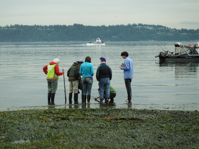
"Would you like to see a gunnel?" asks a cheerful beach volunteer, holding up a clear plastic container filled with water.  

It's inhabited by the tiniest sea creatures I've ever seen.  A translucent eel-like thing (the gunnel) moves sinuously through the water, brushing past a teensy little seashell with a snail peaking out.

"We had a bigger gunnel in here, but it tried to eat the snail."
Big things eat little things everywhere.


I'm walking along the beach at Point Robinson Park on this cloudy June day, enjoying the eighth annual Vashon-Maury Island Low Tide Celebration as part of a kayaking weekend (next blog post). We're here on the edge of the Salish Sea, which encompasses Puget Sound in northwestern Washington. 

The Salish Sea, one of the largest and most biologically rich stretches of inland sea in the world, is teeming with marine life that's seldom seen. But around the summer solstice, the lowest tides of the year expose little seen shorelines and tide pools full of worms, crabs, snails, and other sea life.

Jellyfish, high and dry on the beach until the tide comes back up.
Volunteers set up signs for the low tide event, amongst exposed eelgrass beds.
Despite the abundant sea life, however, Puget Sound and the Salish Sea overall are imperiled by pollution and human development.  Point Robinson is part of the Maury Island Aquatic Reserve, which still has immense biodiversity. 

While there are naturalists on the beach enthusiastically sharing their knowledge and pointing out creatures to anyone willing to look, the celebration offers other temptations.  Free tours are being offered of the historic Point Robinson Lighthouse, and educational booths are set up on the adjacent lawn by organizations such as the Vashon-Maury Island Audubon Society chapter.

Point Robinson Lighthouse (night before the festival).
Descending the lighthouse tower stairs. 
While I'm atop the lighthouse tower, stepping gingerly around the outside balcony, I see a traditional Coast Salish tribal canoe pull up on the beach to the south.  Something I've never seen before!  So I go dashing down the stairs (while watching my step) to check it out.

View southwest from the Point Robinson lighthouse.


The Blue Heron canoe makes a tribal journey in the Northwest each summer.
As the Blue Heron Canoe crew starts to wander up the beach for lunch, I strike up a conversation with a tall, handsome member of the Duwamish Tribe who is one of the paddlers.  Ken tells me he recently did some research on his ancestry and discovered he's a direct descendant of Chief Seattle (Si'ahl).  I'm duly awed and impressed to meet a living connection to my city's namesake.

Before they eat, the tribal members do a traditional pre-meal chant with their drums, adding another touch of regional authenticity and a sense of history to the event.

Blue Heron Canoe skipper Mike Evans of the Snohomish Tribe, on the right, leads the crew in chanting.
After a couple hours enjoying the celebration (and the tasty grilled hot dogs,  shrimp, and homemade snickerdoodle cookies), most of my kayaking buddies are ready to continue our journey south.  The tide is now rising quickly. 

As we round the point, the Blue Heron Canoe is also on the water.  I find the image arresting, reminiscent of Edward S. Curtis photographs I've seen from over a century ago. We all paddle off on the calm sea in the gentle summer rain.

Blue Heron Canoe on Puget Sound
When You Go
If you'd like to get involved in protecting and preserving the Maury Island or other Puget Sound aquatic reserves, contact the People for Puget Sound's Aquatic Reserves Project Coordinator Maddie Foutch at Maddie@wecprotects.org or 206-631-2644. 

For next year's low tide celebration, check out the Vashon Park District website around early April. Although the celebration has come and gone for 2013, I hear there's a low tide beach cleanup event here in the Maury Island Aquatic Reserve the weekend of July 19/20. I couldn't find it on a Google search, but I suggest checking again soon.


You can also take a tour of the Point Robinson Lighthouse each Sunday afternoon from noon to 4 pm.

Monday, June 24, 2013

Hiking the Cascades' Greatest Hits: Annette Lake

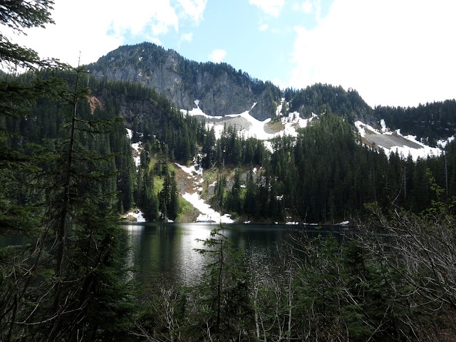
"How is it that I've never done this hike?" says Nanette as we're gazing at postcard perfect Annette Lake.  This über popular 7.5-mile hike to an alpine lake near Snoqualmie Pass is what I call one of the "Greatest Hits" Cascades hikes.

It's my first time here, too. So I can't give Nanette a good answer.  Maybe I avoided  Annette Lake because it is so popular.  But on an early summer week day when the trail is almost snow free and the wildflowers and waterfalls are at their peak, I'm glad we're here.

Here in the Mountains to Sound Greenway along the I-90 corridor east of Seattle, many of the more scenic trails are heavily used.  Think proximity to a major metropolitan area.  But those of us who can escape midweek get to enjoy these treasures without the overbearing crowds.

We start hiking in second-growth forest and soon cross a wooden bridge over Humpback Creek, which is raging today with all the snowmelt.  


Humpback Creek from the lower footbridge.


Antidote for a hot summer day.
We continue up a relatively mild grade through forest, then traverse a major power line corridor, where the wires buzz and crackle overhead.  Within a mile or so we cross the Iron Horse Trail and leave behind signs of civilization (besides the trail) in the increasingly lush forest.


For another couple miles, the trail meanders and switchbacks upward through lovely forest, a few major rock slides, and finally, a bit of snow right before we arrive at the lake.  Along the way we stop and gape at some beautiful little waterfalls and wildflowers.

This huge old downed tree makes a perfect bridge.
After a couple miles we get views of the adjacent ridge.
 
Trilliums were abundant in some rockslides.

One of many early summer snowmelt waterfalls along the trail.
While hiking upward, we pass an elderly couple on their way down already.  Now these are the type of classic old Pacific Northwest hikers who inspire me.  

Jerry and his wife have been married 62 years and hiked all over the world, as evidenced by patches on their packs from Nepal, Switzerland, Italy, and France.  This summer, at age 82,  they're leading a group of friends and family on the Haute Route in the Alps. They're too modest to pose for a shot, but I sneak a picture as they take off down the trail.


Jerry and his wife leading the charge down the trail.
After parking at a small clearing next to the lake, we snack and gaze across the lake at the surrounding peaks.  Even though I offer Julie and Nanette the rest of my gluten-free crackers if they take a swim, they stay put. :)  But the twentysomethings who passed us did indeed take a dip in the icy cold lake.


Silver Peak towers over the talus basin below that holds Annette Lake.
We stroll back down at a fairly pokey pace, just enjoying the beautiful trail on a lovely day.  It's the perfect temperature for hiking (around 70) and we're ahead of the mosquito season. What more could we ask for?


When You Go
The Annette Lake Trail (Trail #1019) is just south off I-90 at the Denny Creek/Asahel Curtis exit (Exit 47) if you're traveling eastbound from the Seattle area.  You need a Northwest Forest Pass to park in the lot. While the grade is fairly steady, this is not a particularly challenging or steep hike. This link shows a topo map of the trail in relation to I-90.  Different sources attribute different mileage and elevation gain to this trail, from 7.4 miles roundtrip to 7.8 miles, and from 1,400 feet in elevation gain to 1,900. Go figure.  You top out at around 3,600 feet at the lake.


Tuesday, June 18, 2013

Kayaking the San Juans: Shaw Island Circumnavigation


Here in the Pacific Northwest, we're fortunate to have such a sea kayaker's paradise in the San Juan Islands.  I've kayaked and camped many times in this scenic archipelago over the years, but this is my first time camping on and circumnavigating Shaw Island

It doesn't disappoint.

Over Memorial Day we get a waterfront campsite at friendly Shaw County Park, where kayakers from several Seattle area groups have landed for the holiday weekend.  Shaw is the smallest and least populated of the San Juan Islands served by the Washington State Ferries.

While the San Juans are known for strong currents and tide races that require careful consideration when kayaking there, Shaw is somewhat protected, sandwiched between the bigger islands: Lopez, Orcas, and San Juan.

We check the tides and time our trip to avoid the strongest currents at Neck Point on the northwest point of the island.   Lucky us, there's not much wind when we shove off around 9:30 a.m. from the white sandy beach at Indian Cove (one of the best, if not the best stretch of beach in the islands).


Loading up at Indian Cove, Canoe Island in the distance and Lopez Island beyond.
Our group of four seasoned kayakers proceeds clockwise around the island, heading southwest in Upright Channel toward San Juan Channel.  The currents are mellow, the cloudy skies are starting to clear, and the undeveloped shorelines we pass are classic San Juans: rocky outcrops topped with grasses, moss, and evergreen trees, mostly Doug fir but also the lovely madrona, gloriously in bloom this time of year.

Matt, Peter, Amy, and I paddling southwest in Upright Channel.
I had been a little concerned about the potentially swift currents and squirrely water at the convergence of Upright Channel and San Juan Channel, based on a past trip.  But today the water is pretty calm, and we round the southwest side of Shaw easily and angle northwest.

Heading northwest in San Juan Channel as we pass close to Pt. George on Shaw.


Patches of blue sky!
On this side of the island, we see more sea stars (starfish) clinging to the rocks: purple, orange, and little neon orange, spindly blood stars, which aren't as common as the big guys.  Did you know that starfish can live up to 35 years?

After a couple hours, we're all getting warm and ready for a break, so we pick up the pace and charge toward Neck Point, passing Friday Harbor over on San Juan Island across the channel. We take a quick break in a small cove thick with kelp and other seaweed just south of the point. It's not a public beach, so we're careful not to linger; I don't get out of my kayak.  


Then we round Neck Point and paddle into Wasp Passage.  If we're going to hit any strong tidal currents, it's here. It's not too bad. We also keep our eyes open for boat traffic and any ferries because they charge through this narrow passage on the Friday Harbor to Orcas Island inter-island ferry route. 


Clearing Wasp Passage, Orcas Island ahead of us.

Getaway homes are scattered through the islands.  North side of Shaw Island.
Turtleback Mountain to the north on Orcas Island.
Over four hours into our trip today, we're all ready for a longer lunch break. Our destination is Blind Island, a state park, at the mouth of Blind Bay on the north side of Shaw. But after a slog to get there, the tide is so high that there's just not a decent spot for four of us to land and disembark.  So we paddle the short distance over to a little rocky beach next to the Shaw ferry terminal.


Beach at Shaw ferry terminal, Blind Island in the background.
Shaw Island ferry terminal.

A bonus of a lunch break here:  the historic Shaw Island General Store, where we wander over for coffee and treats.  We could have gotten freshly made sandwiches, too.  I buy a fresh-out-of-the oven oatmeal cookie to share because it's delicious and huge.

On the last leg of our trip, around the northeast side of Shaw and back into Upright Channel, Amy and I decide it's the loveliest stretch of shoreline.  The forest runs thick down to the rock outcrops above the sea, with unusual moss and hidden little coves.


Northeast side of Shaw, Lopez Island in the distance.
Sometime after 4 we arrive back at Indian Cove after this 14-mile day.  I was tired before lunch but got a second wind on the last stretch.  


On a lovely day like today, these islands, this sea, and the fresh air exhilarate me. I'll be back. (Which means you'll likely see more San Juan Island kayaking blog posts this year:).


Beach at Indian Cove, Shaw Island


When You Go
Here's a ferry schedule to Shaw Island. Shaw County Park is likely booked for much of the summer already, but you can always check. Be sure and check the tide and current charts as well as the weather forecasts before embarking on any kayak trip in the San Juans.  

Did you find this blog post informative and helpful?  What would you like to see more about?  Would love to see your Comments below!


Tuesday, June 11, 2013

Hiking Little Si: Shorter and Almost as Sweet as Mt. Si

For years I bypassed Little Si as I hiked all over the Upper Snoqualmie Valley east of Seattle, going for more arduous (Mt. Si) and less traveled (Cedar Butte) and formerly less traveled (Rattlesnake Ledge/Ridge) routes instead.  Too crowded, not enough of a workout, I reasoned. 
But I've mellowed and learned a thing or two over the years:  Appreciate the beauty wherever you go, for starters.  With the right timing, any walk in the woods to a spectacular view is splendid.  And Little Si offers lovely woods to walk through enroute to a glorious panorama.  

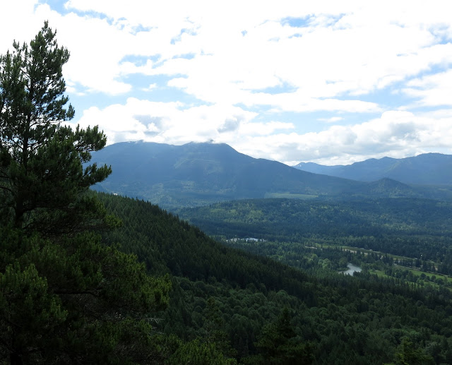
Upper Snoqualmie Valley, looking southeast from summit of Little Si, Middle Fork valley in the foreground.

So when some girlfriends and I decide on a quick hike last weekend, I'm the one who actually suggests Little Si.  Why not?  I always love going places I've never been before, whether it's halfway across the world or a new (for me) hiking trail close to home.

"We should beat the church crowd, " says Julie when we arrive at what we think is fairly early on a Sunday, 9 a.m.  Ha, already we have to park in the overflow lot. "Isn't Seattle one of the least church-going major cities in the U.S.?" I remind Julie. 

It's just a short walk to the trailhead.  Then we start up what is initially a rocky trail through second-growth forest, with a decent uphill stretch for third mile or so.


Then the trail levels out into classic Northwest second-growth lowland forest, with lots of alder, Doug fir, western red cedar, and hemlock. After about a half mile we get peek-a-boo views up to the behemoth next door, Mt. Si. (No decent shot though.)


Maybe three-quarters to a mile on, we enter a patch of forest that feels enchanted.  A thick layer of moss covers downed logs and boulders, and a profusion of lush green sword ferns engulfs the forest floor.

"This seems like Hobbit land," says Nanette.  I feel it, too.


We skirt past an exposed rock wall to our left and spy several rock climbers in various stages of scaling the wall.  Maybe next trip. :)


As we near the summit, the trail wraps around the other side of the peak and the forest thins. At times the trail is a bit rough, but it's not bad overall.


Step carefully!
And before we know it, we top out at the 1,576-foot-high summit, which is littered with clusters of hikers on various rock outcrops.  Then we nibble some snacks and enjoy the views.

Looking southeast to North Bend and Rattlesnake Ridge.


When we get back to the parking lot, the overflow lot is full and cars wait for us to leave for a space.  You can get annoyed by the crowds on some popular trails, but I like it that so many Northwesterners are getting out, enjoying nature, and maybe developing solid environmental values as well.  Maybe that little kid we passed is a future Green Peace activist.

And no hike in the Mountains to Sound Greenway near North Bend and beyond is complete without a stop at local institution Scott's Dairy Freeze.  Today it's my treat.

Small hot fudge sundae at Scott's Dairy Freeze
 
Mt. Si towers over Scott's and North Bend.

When You Go
Here's a link to the excellent Washington Trails Association hiking guide for Little Si, with directions and details.  They say it's a 5-mile roundtrip hike, but it didn't feel that long. Another source says it's 4.4 miles RT.  Regardless, Little Si is a nice little hike.  The elevation gain is a little over 1,200 feet.  If you can, go early or late and go on a weekday.  Little Si is about 30 miles east of Seattle in North Bend just north of Interstate 90.