Wednesday, November 25, 2015

It's About Giving Thanks


Thanksgiving is my favorite holiday. It wasn't always that way. As a child it was all about Christmas, but these days I treasure simply sitting down to have a nice dinner together with family and/or friends. 

And of course on this holiday, it's about giving thanks for...whatever. Anything. Everything.

I think just sharing a meal together around a table with others is something to be grateful for. How often do you do that each week? 


So first and foremost, I'm grateful to dine with members of my extended family this Thanksgiving season. Especially after everyone has put time, energy, and love into preparing a special meal.


Here in the Pacific Northwest, Thanksgiving time is often stormy, damp, and windy, and occasionally sunny and cold.  

For our tempestuous and ever-changing weather, for our drenching rains and stark blue skies afterwards, I am grateful. For foggy days that shroud the landscape in a comforting mist, like a favorite blanket, I am grateful.


This year I've been challenged by deep loss. For the wild and precious lives of my stepmother Bonnie and brother David, who passed away this year, I will be forever grateful.


For our abundant and beautiful mountain trails, those who put time and energy into maintaining them, and my friends who join me on hikes, I am grateful.


For the Salish Sea, on whose beaches I played as a child and whose waters I now cruise in my sea kayak, I am grateful. May we strive to ensure safe and clean water for the formerly abundant marine life and a better, healthier marine ecosystem for the struggling but surviving wild salmon and Southern Resident Killer Whales (orcas).

And extra thanks for Granny, the presumed 104-year-old Southern Resident orca who still is out there, raising and mothering the J pod. Her long life is a tremendous inspiration to thousands.


Back to mountains again, for Mt. Hood (Wy'east), on whose forgiving slopes I learned to ski and whose trails I first backpacked as a teen, I'm especially grateful. 


I could go on and on in this vein, posting hundreds of photos and thanking everything, like...

all my family and friends, 
those who work hard to make this world a better place, 
grocery checkers and other service workers who give me a friendly smile at just the right moment, 
the sun, 
the sky, 
the moon, 
the stars, 
ladybugs, 
my productive garden, 
Columbia Gorge waterfalls, 
Washington State ferries, 
banana slugs, 
sword ferns,
trilliums,
wild rhododendrons,
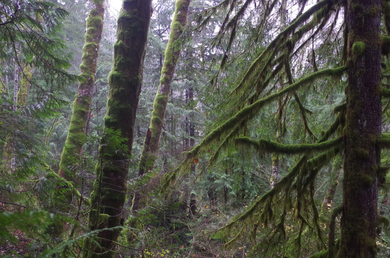
the remaining old growth forest,
western red cedars (Thuja plicata),
ponderosa pines,
Northwest berries,
laughter, especially babies and toddlers laughing,
long and late summer sunsets,
the wind that caresses and jingles my wind chimes, and...and....and it's hard to stop!


So for now I'll take leave, log off, and plan on spending a social media, web-free holiday. I'll try to be fully present with those around me, including any whales I might see on the ferry ride to Bainbridge (wishful thinking).

How about you? What tops your list of gratitude this year? Wishing you and yours a lovely Thanksgiving and holiday season ahead.

Happy trails and thanks for visiting Pacific Northwest Seasons!

In between blog posts, visit Pacific NW Seasons on FaceBook, Twitter, and Instagram for more Northwest photos and outdoors news.


Friday, November 20, 2015

Hiking the Northwest's Greatest Hits: Bridal Veil Falls

On this cool late autumn day in the Cascade foothills, it's not raining but water is everywhere.  As we're hiking up the Lake Serene trail to Bridal Veil Falls off Highway 2 northeast of Seattle, there's ample evidence of yesterday's deluge. 

Everything is slick with moisture, from spongy green moss, shiny leaves, and muddy trail. Streams we cross are swollen with runoff. Little waterfalls and streams course downhill, criss-crossing the trail and causing us to jump carefully from rock to rock, not always  keeping our feet dry.

There's a reason our mountains are called the Cascades.

Surprisingly, while I've been to Bridal Veil Falls in the Columbia River Gorge east of Portland and Bridalveil Fall in Yosemite Valley, this is my first trip here, in my home state. I used to bypass the foothills hikes, seeking the thrill of higher elevations and sweeping, panoramic views.  But in recent years I mix it up. 

With a heavy rain yesterday and another storm heading our way, the number of hikers venturing out is less than normal on a weekend day. We easily snag a space in the usually full parking lot at the trailhead and head up through the lush mossy forest.


For the first mile or so, the trail is pretty mellow through second-growth forest, and then it takes a decidedly steeper turn.


Thankfully stairs have been added in this especially wet (today) section of trail. Some places we have to step outside the stairs, though, because they've become big puddles.

And then there are those multiple little streams flowing over the trail, literally keeping us on our toes with each step.


By the time we reach the Bridal Veil Falls cutoff, with 1/2 mile to the waterfalls viewpoint, a damp mist is beginning to pervade the forest.


After scrambling up the final steps to the viewpoint, I turn around to my hiking buddies and say WOW! Bridal Veil Falls (at least the small portion of 1,000-foot-+ waterfalls we can see from the trail) is raging

As the torrent of water tumbles down, heavy mist roils upward as if from a steaming cauldron. To avoid getting really wet, I zip up my water repellent jacket and hood.


Because we're hiking with intentional silence today, we go off the trail into the woods near the waterfalls and throw down sit pads (to avoid a wet bum). Then we sit for about 10 minutes and listen to the water pummeling the rocks. 

It's magnificent.


Then we're off. I imagine on a warm summer day there's competition for space at the viewpoint, but today it's not bad.


On our way down, the mist seems to be increasing lower down the trail.  Personally, I think it makes the hike even more lovely.


On the last half mile or so, I slow down and take in the beautiful misty, mossy forest. I always find it nourishing to be out here. I hope you do, too.


Happy trails and thanks for visiting Pacific Northwest Seasons! And I'd love to hear in the comments below about your Northwest experiences.

In between blog posts, visit Pacific NW Seasons on FaceBook, Twitter, and Instagram for more Northwest photos and outdoors news.


When You Go
Depending on traffic, it's about a 90-minute drive to the trailhead from Seattle, a little over 21 miles east of Monroe off Highway 2 on the Mt. Index Road (just before the bridge over the Skykomish River). We gained about 1,000 feet in elevation and hiked about 4 miles roundtrip to the waterfalls and back, with the last .5 mile to the falls mostly up steps and boardwalks. This hike is low enough that much of it is hikeable year-round, although beware ice on the trail during the winter. Don't forget to put your Northwest Forest Pass on the dashboard of your rig while parked in the lot.

Friday, November 13, 2015

After the Burn: Fire in the North Cascades

Photo by Dylan Klinesteker
Now that we're getting our typical November storms in the Pacific Northwest (heavy rain, wind, snow in the mountains, flood watches), the  record-breaking 2015 fire season seems a distant blip in the nonstop, 24/7 news cycle.

But those who live or travel in the burned areas won't soon forget. And with climate models that show a warmer and drier Pacific Northwest in the decades ahead, many are concerned about the future.

In late August this year, those of us who love the North Cascades Institute Environmental Learning Center (ELC) were glued to FaceBook, Twitter, and other media for news of its fate. We were desperately hoping that this wonderful place would be spared from the swift-moving Goodell Fire in the Skagit River Gorge

It was definitely touch and go. 

At one point the ELC was under a 30-minute evacuation order as the quick-moving fire raged up the steep mountainsides rimming the gorge toward the campus. ELC staff were told there was a 75 percent chance that the learning center would be affected.


According to Program Manager Katie Roloson, who stayed at the ELC and had a boat loaded and ready for retreat onto Diablo Lake if necessary, they were informed that the fire would likely reach the ELC in less than a day. Fortunately the fire slowed down a bit, and fire crews arrived to do more protective measures (e.g., run hoses all around).


Highway 20 just outside Newhalem. Photo by Dylan Klinesteker.

But then the rains came, over 4.5 inches in a few days. As Timothy Egan characterized our region, "a Good Rain" saved the day. Heavy rain suppressed the fire and saturated the drought-parched moss and understory plants that contributed to the spreading fire.

Understory plants and trees like vine maples left the ELC vulnerable to fire.
I ventured to the North Cascades Institute ELC in early October to see and hear firsthand about the Goodell Fire and some of its effects. Hot spots were still smoldering along the high ridges surrounding historic Newhalem just downriver a few miles from the ELC.

Smoke from Goodell Fire hot spot above Newhalem, October 2015.
NCI staffers/naturalists Dylan Klinesteker and Becky List took some of us visitors to see a few burned areas. Our first stop was in the narrow Skagit River Gorge, where the fire burned through hot and fast.


Dylan, who watched the fire in its early stages near Newhalem before it "blew up" on August 19, tells us the wind acted like billows and sent the fire on a rampage. 


"In 30 minutes the fire blew across the whole mountainside just across the highway from the town of Newhalem, then jumped the highway behind the [Seattle City Light] powerhouse. It jumped from 800 to 2,000 acres in a day," said Dylan, "and ultimately grew to 7,000 acres."

The Skagit River from Newhalem up to Ross Lake is tamed by three dams owned and operated by Seattle City Light. These dams supply Seattle with 20 percent of its total supply of hydropower electricity. During the fire, all the power up here was turned off, and the City lost some power lines.
 
Lake Diablo, Diablo Dam, and power lines. The Goodell Fire burned up the mountains on the right side of photo to the highest peak on the right (in the sun).

"The mosaic burn pattern you see on the mountainsides has a lot to do with the intensity of the fire. Some areas were completely stripped of vegetation.  Embers from the fire flew and ignited other areas. Embers can travel miles," Dylan explained. "And if a fire starts at the top of a steep ridge, a burning log can roll down hill and spread fire below, which is what happened in the Skagit River Gorge."


While it looks bleak up there, Dylan said that Douglas firs can be 40 percent scorched and survive.  (On the east side of the Cascades, ponderosa pines can burn 90 percent and survive.)

Dylan Klinesteker discussing the Goodell Fire.

"People see all this damage and think it’s ugly. Good can come of it," naturalist Becky List told us

"A healthy forest has a diversity of trees. For example, under Douglas fir grow western hemlock, which can take over and choke out firs. Fire clears out hemlocks and lets the firs grow, " Becky explained. "Fire kills pests and bacteria and puts minerals back into the soil. Where the fire hung out longer, recovery may take longer because it also kills good things in soil, like fungus."


Our next stop was at the entrance to the Newhalem Campground, where the fire started on the hillside just across Highway 20.

Where the fire began from lightning strike.
Early burning. Photo by Dylan Klinesteker.
We park just outside the entrance to the closed campground, which was threatened and partially burned by the fire, and walk over a bridge across the Skagit River. Looking down into the river, we see clusters of pink salmon hanging in the sandy shallows. Dylan spots a much bigger Chinook.


"During the fire, Seattle City Light was required to keep water flowing through dams in the river for salmon, so water was running even though the power was turned off, " Dylan told us. 

Amidst all the burned hillsides, it's nice to see the wild lifecycle continue. 

Happy trails and thanks for visiting Pacific Northwest Seasons! And I'd love to hear in the comments below about your Northwest experiences.

In between blog posts, visit Pacific NW Seasons on FaceBook, Twitter, and Instagram for more Northwest photos and outdoors news.


When You Go
As of November 16, 2015, the North Cascades Highway (Highway 20) is now closed for the winter due to heavy snow and avalanche danger. But for the next year or so, driving through the scorched Skagit River Gorge could be somewhat hazardous. It rained hard the night before we arrived in October, and the following afternoon a big tree came down across the highway and smashed through the guardrail. Proceed with caution.