.jpg) |
| View of Enchantment Peaks in Stuart Range from Iron Peak summit |
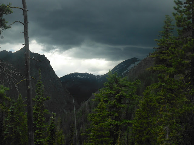
While it's a record-breaking heat down in the lowlands east and west of the Cascades today, here above the Teanaway Valley in Washington's central Cascades, thunder clouds are all around us. This isn't the first time I've skirted thunderstorms while hiking in the Teanaway area.
"Okay, it's time to head down," says Rich. When easygoing and calm Rich says it's time to go, everyone goes.
Our group of about eight hikers starts to meander down this rocky and open summit ridge. There's no need to rush, really. I'm just a bit of a worrywort.
 |
| On the summit ridge, Iron Peak. |
Reverberating thunder and a smattering of rain woke me up early this morning in my tent, but it dissipated by the time we hit the trail around 9:30. The weather is still somewhat unstable, but not enough to keep us off the trail.
Here on the eastern crest of the Cascades, the vegetation is more sparse than the west side, with less underbrush. Although the first quarter mile or so of the trail skirts a stream, with lush green riparian vegetation, we shortly emerge into more open, scrubby forest with expansive views.
 |
| Easy hiking up through subalpine forest. |
 |
| At the saddle between Iron Peak (to the right) and Mt. Teanaway. |
 |
| Iron Peak summit ridge. |
Then it's about a half mile scramble up and along the ridge to a pile of rocks with a summit register that marks the top of Iron Peak. With the hanging clouds, the Mt. Stuart summit never quite reveals herself to us today. But the granitic Stuart Range about 5 miles due north still provides a dramatic skyline.
 |
| Mt. Stuart in the distance. |
About 14 miles north beyond Stuart lies glacier-clad Mt. Daniel and Mt. Hinman, still impressively snow-covered for a summer day. Some of us mistake it for Glacier Peak (oops).
 |
| Glacier-covered Mt. Daniel and Mt. Hinman |
 |
| Alpine anenome near the Iron Peak summit. |
 |
| Iron in the rock on Iron Peak. |
With a very bruised-looking sky looming just north of Mt. Stuart, I scoot down right behind the strongest guys in the group, with barely a stop on the 4-mile descent. At one point thunder echoes overhead, but by the time we get down to the trailhead, it's gone.
 |
| Rich leads the charge back down off Iron Peak. |
 |
| Thunder clouds threaten, but pass by without getting closer. Whew! |
 | ||
| Columbine. |
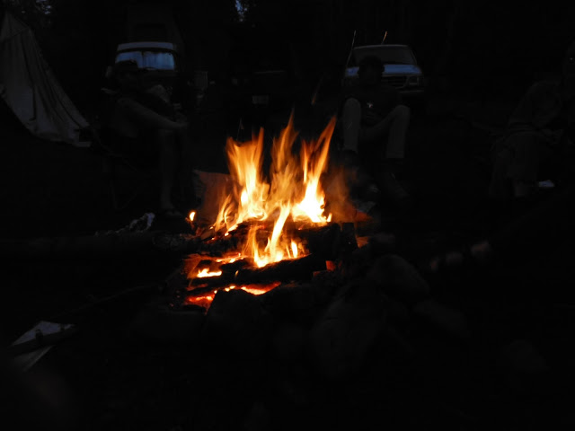
Then we enjoy an evening around the campfire out of cell and WiFi range. It's liberating.
Instead we sit in the waning light and talk, laugh, and toast marshmallows for Wendy's special s'mores: marshmallows stuck between two Pepperidge Farms Geneva cookies.
 |
| It's primal. |
I hope you get to enjoy such a pleasant hike (despite the thunder) and off-the-grid camping trip this summer too.
When You Go
This topo map shows the trail and Iron Peak. Access the Beverly Campground and Iron Peak trailhead via the North Fork Teanaway Road, a turnoff from Highway 97 about 10 miles northeast of Cle Elum. According to my Green Trails map, we hiked about 8 miles roundtrip and gained a little over 2,600 feet in elevation. But other hiking books put this hike at 7 to 7.5 miles. I'm inclined to believe the map.
Although there's not a sign at the trailhead, display your Northwest Forest Pass on your dashboard just in case. This pass is required at the campgrounds along this stretch of dirt road. Also be sure to bring plenty of water! And bug spray...I got bites on my legs at the saddle, and Rich found a tick on my shirt before it had a chance to burrow into my skin.


2 comments:
Wow Jill you all are my heros! What an amazing looking hike. Gotta love WA, I think August has a camping trip calling to me!
Iron is one of my favorites! Every year, if possible, we celebrate by hiking Iron and then camping by the river. It just makes for a perfect weekend.
(But ugh, ticks! I've never seen any there, but now I'm going to be on high alert.)
Post a Comment