

Due to the extensive fire that raged through the Gorge in September 2017, the Angel's Rest Trail is still closed as of April 2018. Trailkeepers of Oregon are organizing work parties to begin to work on this trail, next one will be 4/14/18. Check out their page to sign up.
Walking and hiking in the western Columbia River Gorge always makes me feel euphoric. All that lush, intensely green vegetation, trees, and wildflowers! That sweet, moist fresh air!
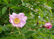
Abundant with coursing streams and waterfalls, the Gorge boasts a crazy profusion of plants and trees, some not found anywhere else in the world.
And then there are the views.
Since scrambling around the Gorge as a teenager, I've hiked all over the globe. But I still get excited any time I hit a trail in the Gorge. When I went up to Angel's Rest last weekend, I had to wonder a few times if I'd ended up in Heaven—at least my version of Heaven.
Surprisingly, it's my first hike up to Angel's Rest, about 4 miles west of Multnomah Falls. Or maybe this hike has blended together in my memory with many hikes I did as a teenager.
 |
| Dead tree snag leftover from 1991 fire. |
Regardless, Angel's Rest is an extremely popular and splendid hike, just 45 minutes from downtown Portland. I get to the trailhead around noon on a cloudy Saturday and find a parking place close by. Perhaps the threat of rain is keeping the crowds down.
For the first half of the 2.4-mile hike up, the trail meanders, then switchbacks upwards through forest dense with underbrush, crossing Coopey Creek and providing peek-a-boo views of Coopey Falls and then the Columbia River.
 |
| Can you say green? |
After gaining more elevation, the trail crosses an old rockfall and later emerges into the burned area, with even better views.
 |
| Columbia River Basalt cliffs across the Columbia River in Washington. |

And before I know it, I've reached Angel's Rest, where columns of aging basalt look like teetering stacks of pancakes along the spine and edges of the bluff.
 |
| Northwest view |
 |
| View north |
Other hikers have plopped down atop various rocks, but I'm spinning around, taking in the view. The edge of the 1991 fire is still very visible, separating more mature forest and thriving new growth.
 |
| View south |
 |
| View westward, downriver |
 |
| View eastward, upriver |
 |
| View DOWN |
 |
| Rain approaching |

Although the top of the bluff is thick with shrubs like serviceberry, I still step carefully. It's a long way to fall. I would not want to be up here on these weathered old rock formations during an earthquake.
On the way down I pass plenty of hikers headed uphill, in everything from light sneaks and tank tops to heavy-duty hiking boots and REI-wear. This being close to Portland, I even pass a hipster hiker wearing leggings and a skirt. Be forewarned, even in dry weather the trail can be rocky and muddy in places.

While my goal was to be up and down in three hours, it stretched to four. This hike is just too beautiful, there were too many photos to take, and too much exuberant foliage and waterfalls to be savored.
Have you hiked to Angel's Rest? Any special memories there? What is your favorite hike in the Gorge? Would love to hear in the comments below. Happy trails and thanks for visiting Pacific Northwest Seasons.
When You Go
The hike to Angel's Rest is just under 5 miles round trip and considered moderate. It's not that steep but a steady grade of uphill for about 1,400 feet. Eastbound on I-84, take Bridal Veil Exit #28. The trailhead is on the south side of the historic Columbia River Highway, opposite the junction with the interstate access road in Bridal veil. From westbound I-84, take Ainsworth State Park Exit #35 and follow the historic Columbia River Highway for 7.1 miles (11.4 km). An alternate, more scenic eastbound route is to come down from the Corbett area via the historic Columbia River Highway, with stops along the way at Chanticleer Point and Crown Point/Vista House.


5 comments:
Wow Jill, Great shots! Makes me want to go too!
Andy
Wow! Those are some beautiful photos! I definitely need to add this one to my ever-growing hiking list.
What a great post – it makes me want to go NOW. I particularly love the photo entitled, “Rain approaching.” That stack of rocks on the left makes for a really striking left-hand “frame.” Well done!
Thanks Andy, Rachel, and Cameron! I've upgraded and took most of these shots with a fancier Pentax camera, still learning.
our family loves that hike. You have taken beautiful photo's and done it justice Jill!
Post a Comment