Thursday, August 29, 2013

Hiking the Northwest's Greatest Hits: Wallace Falls


This summer I've been knocking off some of what I call the "greatest hits" hikes here in the Pacific Northwest:  ΓΌber popular hikes that draw the crowds and, for that reason, have kept me away.

But this summer I've relented.  Never say never, right?  And of course there are reasons these hikes appeal to so many, like the gorgeous waterfalls at scenic Wallace Falls State Park just outside Gold Bar, Washington, a short skip off US Highway 2 north of Seattle.

So I grab a friend and head to the hills. The Cascade foothills, that is, where Wallace Falls is situated.  The drive is less than an hour from north Seattle where I live, and we get there early enough on a weekend morning to beat the thickest crowds and get a parking space in the big, paved lot.

You know a trail is popular when there are flush toilets and a gift shop at the trailhead selling coffee mugs and T-shirts.  Note to those who don't live here or are new to the region:  This is not normal!

Our hike begins with a  quarter-mile stroll under power lines until the trail turns into lush woods, where we're greeted by some words to ponder by William Wordsworth. I think every good hike should start with some poet's musings.


The verdant forest setting continues along this well-maintained and relatively easy trail all the way to the Upper falls. Think many shades of green and lots of rushing water.


This trail features a well-tended trail, picnic shelters, wooden bridges and walkways, and protected viewpoints along the way up to the Middle and Upper falls.


For the first portion of the hike, the trail meanders along the Wallace River, then climbs via easy switchbacks to the viewpoints.  While the crowds weren't too evident when we began, one trail runner passed us twice on his multiple loops running up and down the trail. Dude is hardcore.

This guy passed us on his second and third loops up and down the trail.
After about 1.5 miles and some elevation gain, the real drama begins.  We reach a picnic shelter and viewpoint at the Lower falls, with a distant view of the much taller Middle falls. With the increasing crowds, it's hard now to jockey for a position at the viewpoint for a decent shot of the falls.


 Continuing upwards for another half-mile or so over beautifully graded trail (thanks Washington Trails Association volunteers!), we then reach the viewpoint for the biggest and most impressive, the Middle falls.  Needless to say, this hike is at its best in spring and early summer and on rainy days.


Some stop here, but it's definitely worth it to head up to the next viewpoint above the Middle falls and to see the Upper falls. And for more sweat-inducing exercise.


View back down the Wallace River gorge from top of Middle falls.
One young woman was foolishly vying for a Darwin Award by climbing over the viewpoint fence to get closer to the damp rocks above the falls for a better view. Her boyfriend looked on anxiously but didn't say anything.


Kids, don't do this at home...or anywhere!


As we top out near the Upper falls viewpoint, the undergrowth in the forest is much more sparse with the higher elevation (above 1,500 feet).


While this little teepee shelter is cute, it didn't have much room inside.
Although the trail continues higher to a few lakes, most hikers turn around at the Upper falls viewpoint, as we do. Many more hikers are coming up as we head down now since it's past noon.


Dogs are allowed on state park trails on leash.


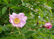
Salal berry blossoms along the trail.
By the time we get down it's early afternoon and the parking lot is full.  But it's sure nice to have a clean bathroom with a sink to wash our hands after the hike, complete with hanging baskets of flowers outside.  We hiked about 5.5 miles and got a decent workout. Sure, the guy who was running up and down the trail five times burned more calories, but I'm fine with our slower but steady pace today.

Interesting factoid:  The name Wallace is not derived from some Euro-American settler.  Rather, the lakes, river, and falls are named after an Anglicization of the local American Indian Coast Salish name "Kwayaylsh." Joe and Sarah Kwayaylsh, members of the Skykomish tribe, were the first homesteaders in the area.


When You Go
If you can, go on a weekday to avoid the weekend glut of people on the trail.  Also, a Washington State Discover Pass is required for parking in the lot at Wallace Falls.  

Driving Directions: From Everett follow US 2 for 28 miles east to the hamlet of Gold Bar. Just before milepost 28, turn left onto 1st Street (signed for Wallace Falls State Park). Proceed for 0.4 mile to a four-way stop. Turn right onto May Creek Road and continue for 1.5 miles to Wallace Falls State Park and the trailhead (elevation 300 feet).

Tuesday, August 20, 2013

Vancouver Island Adventure: Kayaking the Checleset Bay Ecological Reserve


This is the third and last in the "Bunsby Trilogy" about sea kayaking and camping in the remote Checleset Bay Ecological Reserve just north of Kyuquot Sound on the northwest coast of Vancouver Island. You can read the first two posts (1) here and (2) here.

We've been out here kayaking and camping in the Bunsby Islands area for five days now, and it's starting to feel a bit like a small town. 

While we're over 20 miles from the nearest road, there are few enough kayakers out here and it's a small enough area that we all seem to bump in to each other every now and then between days of solitude. Which, if you're a somewhat sociable person like me, adds to the fun of a trip up here.

Today we're heading out from the Bunsbys to the Cuttle Islets off the Acous Peninsula with Bill, a veteran solo kayaker from Calgary who's here for the third summer in a row.  Serina and Lennie, a friendly young couple and guides for West Coast Expeditions we met a few days ago, are taking their group out there too. Of course Serina knows Bill from previous summers here.

With Bill leading us, we cut out to the open ocean past Green Head just off  Checkaklis Island on the outer edge of the Bunsbys.  We're fortunate to have such a sunny mild day, with only mellow ocean swells to navigate during the 1.4-mile crossing to the Cuttles.


"Stay left, there's a boomer!" cries Bill in warning as we approach a standing wave breaking nonstop not too far off Green Head. Besides that teensy bit of excitement, our crossing goes smoothly. It's exhilarating to be kayaking on the open ocean. 

Within 30 minutes or less, we've arrived at our home for tonight, a forest-thatched island with an expansive beach facing a tidal lagoon and views of the truly wild and remote Brooks Peninsula to the northwest. 


We beat the West Coast Expeditions group out here and find a prime spot above high tide line on the beach to pitch our tent, but soon the group arrives and it's party time.  Several of us strip and swim in the chilly but not too cold lagoons fed by the incoming tide. 


Out here close to the open Pacific, the tide pools are spectacular.  I spend the rest of the afternoon blissfully poking around in the tide pools after a dip in the lagoon.


Sea anemone

Tonight after an evening paddle, we witness one of the most breathtaking sunsets and full moonrises I've ever seen.  I can't stop taking pictures. (I should just quit with the words here and post a zillion photos because it's hard whittle them down to just a few.)

Presunset paddle in one of the protected lagoons at Acous Peninsula.

Enjoying evening dusk, peaks of the Brooks Peninsula in the distance.
Rising of the "Thunder Moon."

Lennie and Serina Allison, West Coast Expeditions guides.
Before heading back to the Bunsbys the next morning for our last night off the grid, we stop on the Acous Peninsula to see a decaying-in-place fallen totem pole in thick woods near the beach. (Thanks to Lennie and Serina for the tip.) I tell Matt and Bill that I'm approaching this treasure with quiet respect.


Then we explore the shoreline of historic Battle Bay, once the site of a thriving native village and now tribal reserve land.  While much of the bay is off-limits to camping, we make a quick lunch stop at the outlet of a small river flowing into the bay before heading back across open water to the Bunsby Islands.


One of the things I love about the Bunsbys are the picturesque little coves tucked along the island shorelines at lower tides.  Before exploring the quiet and enchanting inner waterway between Big Bunsby Island and Vancouver Island, we take a short break in a little tidal cove in the shade. 


Far too soon it's our last night in paradise, and we're back at the beach where we were dropped off 6 days ago on Barney's Island. A new kayak group is here, a privately led trip of about a dozen "Bellinghamsters," and it's hard to find a place to squeeze our tent. Perhaps this is a way of getting re-acclimated to life back on the grid tomorrow.


Bill builds a fire on the beach, and as another gorgeous moon rises, we watch the fire hiss and throw off steam like an erupting volcano as it's inundated by the rising tide.


Looks and feels like serenity.

When Leo (Voyager Water Taxi Service) arrives in the morning to haul us and our kayaks the 16+ miles back to Fair Harbour, where we began last week, we're all packed and ready to load.  (BTW, everybody out here knows Leo.) One thing I'm grateful for:  No more mornings struggling to stuff all our gear back into our kayaks in impossibly tight spaces.

As we speed away from the islands, leaving a foamy white trail of wake as we go, it amazes me how quickly we cruise through an area that took us almost 7 hours to kayak. After a week traveling only at the pace of our paddle strokes, the speed is jarring.


I feel nourished by this time off the grid in this special place. That said, I thoroughly appreciated my first hot shower and fresh green salad in a week when we got back to Campbell River. :)

When You Go
The Checleset Bay Ecological Reserve can only be reached by boat or float plane, which makes it an ideal sea kayaking destination. My first two posts about this trip (links at top of this post) describe how we got up here and shows a map of this area. 

While it takes some careful planning and logistics to do a multi-day kayak camping trip in this area, I'm proof that you don't have to be a hard-core "surf ranger" to do it.  West Coast Expeditions, which is the only outfitter based in the Kyuquot area (on Spring Island), leads guided trips up here.  I'd like to go back next year and go farther to explore the Brooks Peninsula.


Thursday, August 8, 2013

Vancouver Island Adventures: Kayaking the Bunsby Islands


This is the second of three posts about a kayak camping trip on the northwest coast of Vancouver Island, B.C. Read the first post here and the third post here.

I've just unzipped the tent and see an azure blue sky above. Call it paradise, heavenly, or just perfect. It all fits. 

Here in the remote Bunsby Islands off the northwest coast of Vancouver Island, we've been blessed with a string of bluebird days and little wind.  Outstanding kayaking weather in a stellar place to sea kayak.

While our kayaking trip began with a long paddle from Fair Harbour to the village of Kyuquot, we cheated the next day and hired a water taxi to haul our kayaks and gear out here to the Bunsbys.  With limited vacation time, we don't want to risk being weathered out on the 8-mile open ocean paddle north to the islands, as some have been.

So on a sunny morning we're dropped off at a gorgeous sandy cove on Barney's Island, on the southern edge of this small archipelago.

Kayak all loaded and ready to launch from Barney's Island in the Bunsby Islands.
We've got four+ days to explore out here and a forecast for high pressure and holding.  It doesn't get much better.

As I wrote in my first blog post about this trip, the Bunsby Islands are way up north on the west coast of Vancouver Island in the Checleset Bay Ecological ReserveThe reserve was established in 1981 to provide high-quality marine habitat for a reintroduced population of sea otters.  I'm happy to say the otters are thriving here now. (I didn't get any decent shots although I saw numerous otters.) The reserve also encompasses tribal lands that are off-limits for camping.

Image from http://www.techworld.ca/lifestyle/buns98.htm

When a large group of kayakers with West Coast Expeditions arrives at the cove, we set off to find a camping spot described by Bill, whom we met and paddled with from Fair Harbour.  Although we can't find the place that Bill showed us on the map (which we later discover was actually the beach where we started from), I'm enchanted as we paddle past charming little coves, turquoise tidal lagoons, rocky outcrops studded with colorful starfish (sea stars), and the mostly forested shorelines.

White sand beach at low tide. Photo by Matt Brewster.
It's hard to resist kayaking into every inlet and small bay we pass, but ultimately we do have to find a place to pitch our tent tonight.  We make our way north between the outer Checkaklis Island and the middle and second-largest of the Bunsby Islands, passing many little islets along the way.


We quickly discover that this archipelago is not that large and could be easily circumnavigated in a day.  But who wants to rush through here?  Not us.

We edge out toward the northwestern side of Checkaklis Island, which is exposed to the open ocean, and just float in our kayaks above some tangled brown kelp forests.  Looking down into these "forests" is far better than any trip to an aquarium.  They teem with marine life, from crabs scurrying across kelp leaves, to schools of small fish darting around, to otherworldly kinds of jellyfish I've never seen in Puget Sound, my home waters.


Some kind of jellyfish. Photo by Matt Brewster.
Rounding the north side of the middle big island (not named on the map), we see the ragged peaks of Vancouver Island and the Brooks Peninsula across the channel in the distance.  We're heading over that direction in a couple days.


Peaks of the Brooks Peninsula in the distance.
Some beautiful coves and beaches beckon us as we continue searching for a camping spot, but forest thick with underbrush largely grows right down to the high tideline. (Note: I should have checked my recreation map that indicates camping site locations.)  

We're both getting tired and ready to settle for the day when we round a bend in Gay Passage and there it is:  a perfect little spot sticking out like a tiny thumb, a teensy peninsula on a small tidal island next to a lagoon.


View from our digs. At high tide the grassy area fills as a tidal lagoon.
And then for the next 26 hours or so we just chill on our little island (which we named Bilgo), reading, napping, exploring the tide pools, and taking pictures.  We see no other kayakers and only two boats cruising past. This solitude, this quiet in nature, is like a balm after several long days of gearing up and traveling to get up here.


Sunset view of Mt. Paxton across Gay Passage from "Bilgo Island."
With the sun lowering in the sky, we hop in our kayaks and paddle back to Barney's Island to see if Bill arrived (he has).  And the moonrise! Tonight we witness the first of several spectacular moonrises.

"Isn't it cool to be in a place where the main 'road' is the sea and our transportation is a kayak?" I say to Matt as we're paddling back to our campsite 20 minutes up the passage.

Heading back to Barney's Island.
A slice of heaven. Photo by Matt Brewster.


Our highlight of the day is hearing the puppy-like whimpering of sea otters echoing across the twilight water as we're midway up Gay Passage.  Sirena, one of the West Coast Expedition guides we've met, tells us it's the sound mama otters and their kits use to find each other.

I fall asleep happy tonight, as I do just about every night throughout this trip.

Next and last post in this series, about a side trip to the Cuttle Islets and Acous Peninsula, will be up in a few days.

When You Go
Although there are designated camping sights indicated on marine recreation maps in the Bunsby Islands, they are not well marked or easy to find.  We passed several without knowing they were there.  In retrospect, I would have looked harder if I knew sites were there.

And of course, we used the "leave no trace" ethic at our campsite (which includes doing your business well below the high tideline).  For my next trip to this area, I'll leave a little extra space in my kayak and bring a garbage pack to pick up old plastic bottles and such that have washed ashore or been left.


Friday, August 2, 2013

Vancouver Island Adventure: Journey to Kyuquot

This is the first of three posts about kayaking and camping on northern Vancouver Island in B.C., just north across the US-Canada border. Read the second post here and the third post here.

Unless you're arriving by float plane, the trip to Kyuquot is a long and varied voyage. As with life in general, my trip there was as much about the journeyan especially scenic and beautiful journeyas the destination.

Where exactly is Kyuquot? It's so remote that you can't drive there. I've been hearing about the place for years now through my cousin's friend Eric, who owns and operates the Kyoquot Inn.

Kyoquot/Checleseht, as the area is called by the First Nations people who have lived there for several millenia, is shown on the map below, tucked way up on the northwestern coast of Vancouver Island. I started my journey in Seattle, shown as a little red dot on the bottom right corner.

Vancouver Island with inset of Kyuquot/Checleseht. Image sourced from Wikimedia Commons.

We leave Seattle about 5:30 a.m. to allow plenty of time at the border crossing into Canada and then on to the Tsawwassen ferry terminal, where we catch the 10:15 ferry to Nanaimo. Okay, we could have left 30 minutes later and easily made the ferry, but better safe than sorry, right?


"It's not always this easy," I warn Matt. He's thrilled to see a wild whale for the first time when a female adult orca emerges from the sea beside the ferry in the Strait of Georgia and seems to wave her dorsal fin at us. This is our only whale sighting of the entire 10-day trip (and technically orcas are dolphins, not whales).

A Salish Sea orca. Photo by Alisa Lemire Brooks.

After a 2.5-hour ferry ride and a 2-hour drive up the east side of Vancouver Island from Nanaimo to Campbell River, we grab a few groceries, gas, and about the best sandwich I've ever had at the Java Shack. Then it's north and west across the island for another hour+ through steeply forested and snow-laced peaks to the  Zeballos and Fair Harbor turnoff (our destination tonight), where we hit dusty dirt logging roads for the rest of our drive. 

Two and a half hours of driving 35 miles per hour past clearcut mountains and saltwater inlets brings us to Fair Harbour, which is indeed situated on a fair harbor. But it's basically just a dirt parking lot with a dock, a few campsites, and a trailer that serves as the store.

As soon as we roll to a stop to get our bearings, a gray-bearded, rustic-looking man sitting beside the harbor leaps up and comes to the car window, as if waiting for us.  In his strong small-town Canadian accent, Bill proceeds to tell us the parking options, the best spots to camp, who and how to pay, where to launch our kayaks, the high and low tide times for the next day, and generally anything else relevant to beginning our kayak trip.

We didn't know how clueless we were until we met Bill.

Bill pointing to our route tomorrow morning.

When we're settled at a lovely waterfront campsite, Bill joins us to enjoy the beautiful sunset and twilight over Fair Harbour. It's blissfully quiet except for the hungry mosquitoes buzzing around with their high-pitched whine.


Fair Harbour sunset
 We're planning an early morning start to kayak the 12+ miles through the labyrinth of inlets and islands of Kyuquot Sound out to the village of Kyuquot. Our goal is up at 5 a.m. and on the water by 7 a.m.


Fair Harbour early morning. Low tide.


Getting ready to launch for our 6-day camping adventure.
I said 7 a.m. launch, right? Ha. Despite our intentions, packing and organizing ourselves (and helping Bill, who will paddle out with us) took a lot longer than anticipated.  Although I wanted to get on the water before the daily inflow winds came barreling up the narrow fjord-like inlets, we don't launch until about 11:30, with the wind steady and persistent.


With Bill serving as our de facto guide, we paddle out of Fair Harbor and make our way into more exposed Markale Passage.  As we're rounding the Markale Peninsula beyond the outer harbor, we stop and chat with three incoming kayakers from Bellingham, Washington, who've just kayaked up from Rugged Point on the outer coast. 

While I'm expecting we'll see lots of other kayakers at the peak of summer based on this early encounter, we only see one other group of kayakers in over 6 hours of paddling today.

Because we're fighting the wind and some lumpy, choppy sea as we make our way down the passage with some open water crossings, I don't take a lot of photos.  Mostly we paddle past forest-covered islands and mountains at water's edge, but evidence of the intensive logging here is still visible in some clearcuts scarring the hillsides.


At around 3:30 Bill points us to a little beach on the northeast side of Union Island, where we pull up and take a lunch break.  Here in Kyuquot Sound there just aren't many spots to land, with most shorelines consisting of rocky outcrops fringed with thick forests of evergreen trees.


A well-deserved break on Union Island, more than halfway to Kyuquot Village
Fortunately, most of our wind battles are over for the day.  We struggle a bit in Crowther Channel, but then we scoot across the narrow channel and round the end of Surprise Island, where we catch our first glimpse of the open ocean and that exhilarating whiff of ocean breeze.  From there into Kyoquot it's easy paddling along the protected shoreline of Vancouver Island amongst scenic little bays and islets.


Pacific Ocean ahead!
While I read it can be confusing finding your way through the little islands and coves to Kyoquot Village and Walter's Island, our destination tonight, it's cake for us.  We just follow the path of the power boats, like cows returning to the barn. Not that many, but enough to show us the way.

Around 5:30 I speed up my pace because at Kyuquot Inn, where we're pitching our tents tonight, the restaurant closes at 6 p.m.  No way am I kayaking 6.5 hours and missing a hot meal at an eatery run by one of the premier kosher caterers in Seattle.

With just minutes to spare, we cruise up to the easy-to-find Kyuquot Inn beach and land.  Proprietor Eric Gorbman is there with an easy smile, waiting for us.  We haul our gear up to the deck and enjoy one of the best dinners I can remember:  exquisitely breaded, flaky fresh halibut and a tangy Greek salad.  Was it the long day of hard paddling that made this dinner so memorable?  Maybe. But I think it would be just that good regardless.

Kyuquot Inn Proprietor Eric Gorbman
 
Kyuquot Sunset


We sleep very well tonight.

Next post in this series:  Kayaking the Bunsby Islands

When You Go
Logistics and planning for a longer kayak camping trip to remote Kyuquot takes time and energy.  For starters, I got the book Sea Kayak Nootka & Kyuquot Sounds  by Heather Harbord, which was informative but almost 10 years old (2004) and a little out-of-date. In researching the trip, I found general information but not a lot of specifics about kayaking from Fair Harbor, which was why connecting with seasoned Kyoquot-area kayaker Bill was a serendipitous coincidence.  A good nautical chart and a clear plastic chart holder for your kayak deck is imperative: get the Canadian Hydrographic Map of Kyoquot Sound. You can order online, but here in Seattle I got mine at Captain's Nautical Supplies in Interbay.

Or you could leave the planning to the experts.  West Coast Expeditions is based on Spring Island and offers guided kayak trips in the area.

While we had perfect sunny weather every day, I'm told it's not the norm, so come prepared for rainy and chilly weather.  FYI, generally the Kyuquot Inn rents cabins and rooms, not campsites for tents. Since Eric is a family friend, we were able to bend the rules a bit.  But anyone is welcome at the restaurant. Most sea kayakers head out to Spring Island in the Mission Group to camp, which is about a mile offshore from Kyuquot village and protected paddling.