 Sunday morning at Anjou Bakery in Cashmere, Washington, and I’m ogling the exquisite fruit pastries while trying to decide which type of baguette sandwich to buy for my hike today. “The ham is my favorite,” says the pretty, fresh-scrubbed cashier, “It’s cured in Leavenworth just up the highway.” Sold.
I’m also probing for information about hikes in the area. Above the fertile orchards here in the Wenatchee Valley, the eastern Cascade Mountains that rim the river and creeks are a jumble of craggy granite peaks and steep ridges. This stunning landscape is full of marvelous places to hike, climb, and scramble.
 When I ask the cashier directions to the Wedge Mountain trailhead—a hike I did years ago—a lean young guy behind the counter (rock climber, I’d wager) suggests hiking up Sauer’s Mountain instead.
“Sauer’s Mountain is beautiful, and you can hike along the ridge over a mile for fantastic views down to Leavenworth and all over the valley,” he continues, and then gives me directions to the trailhead in Peshashtin. I’m sold again. I love getting tips from locals in the know.
The Hike
With a deadline looming and some hiking shorts to review for FitnessTravelGear.com, I need a decent hike—fairly close to the highway with enough mileage and elevation gain to get a good workout. So I turn off Highway 2 at Peshastin, cross the Wenatchee River into the little orchard town, then drive west, and turn right just before the cemetery. The road dead-ends after about a mile below a few houses and orchards, where I park at the clearly marked trailhead.
This is not your typical trailhead. It’s on private property, with rustic signs and an ice chest full of dark cherries beckoning hikers to grab some for the hike ahead. I choose a small bag and stuff money in the jar as a thank you to the Sauers, whose property I assume we are crossing to start the hike. (Maybe in the fall there will be apples or pears instead?)

Here on the eastern crest of the Cascades, it’s another hot, sunny day. I start switchbacking up the narrow trail past Northwest Coast Indian-style carvings plunked in the tall grass (or stuck on tree trunks). These whimsical wood sculptures make me feel welcome.

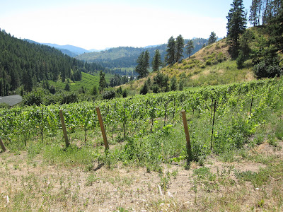
For the first mile the trail skirts a small farm and then some exposed rock faces, with little shade to provide relief from the baking sun. I try to conserve water and quickly realize I should have brought two bottles.


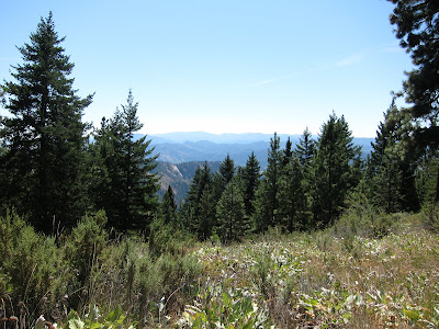
Thankfully the grade evens out and passes through stands of pines as it nears the ridgetop. After the initial switchbacks up the slope above the farm, the rest of the hike is just angling along a ridge through Ponderosa pines, rising higher and higher to the 3,100-foot plus summit. And the views!
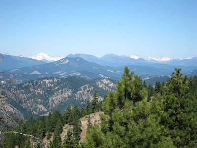
As I crest the ridge and finally get a view to other side, I see Leavenworth and Icicle Creek valley spread below. Far above the valley, the jagged Stuart Range peaks are still iced with snow (in August!).


At 1.5 miles along the trail, a sign marks the view to Glacier Peak on the northwest horizon. (This “elusive” stratovolcano is closer to Seattle than Mount Rainier, but far enough east that it’s not easily viewed.) I initially thought of turning around here and making it a 3-mile round trip, but it’s only another mile to the top and I can’t stop. It’s too splendid, and the panoramic views keep getting better. Onward and upward.

When I scramble the last hundred feet or so up the dusty, rocky trail to the summit, I’m grateful to find a shady spot beneath the pines where I can rest, gaze at the mountains, sip more cold water, and gobble that incredible Leavenworth ham sandwich. (Note, I continued past the summit sign up to a rock cairn a little higher at the true summit.)


Going down is easier but it has gotten a lot hotter. (I hear later that it’s over 90ᵒF.) Despite it being a summer weekend, I pass only one group of four hikers, two solo women hikers, and a dog (with one of the hikers, not solo.)


By the time I return to the car, I’m ready to dive into the beautiful pond just down the road back toward the cemetery. Alas, as far as I can tell, it’s private property. Instead I settle for some juicy fresh cherries, no doubt plucked from some trees I just passed.
When You Go

Here’s a topo map of the hike. Wooden trail signs mark every half mile or so, which I found quite friendly and helpful. It’s 5 miles roundtrip to the summit, with an elevation gain of 1,800 feet. Just below the summit, be sure and cross the old logging road and continue up past the spray-painted blue dot. Earlier in the spring and early summer, the wildflowers apparently put on quite a display along this trail.


5 comments:
Hey Jill!
Nice story. Although this is "in my backyard," I've never done this hike. I'll definitely try it... perhaps in the fall.
L.
What a fabulous outing. I might even be able to handle this one!
Hey Lesley! Yes, this hike seems fairly under the radar, you should check it out!
Barry, yes, nothing too difficult about this hike, just heat and switchbacks, minor scrambling at one short stretch. Worth the view!
If you are in the Leavenworth area looking for other things to do, drop by our site first to see what is happening in and around town. We've built a site with a whimsical tone from a tourist's point of view. We have a blog of our travels and things we've found in Leavenworth that we like. You can find out what events are happening in town, where live music is, eating suggestions, where to shop, and anything else about Leavenworth you every wanted to know.
Visit us at http://www.AccidentalBavarian.com
Thanks Accidental Bavarian! Cool blog! Will keep you in mind next time I head over. I usually stay with longtime residents over there. Used to spend so much time in Leavenworth that even some locals thought I lived there.:)
Post a Comment